Chenaud
| Chenaud | |
|---|---|
 | |
 Chenaud | |
|
Location within Nouvelle-Aquitaine region  Chenaud | |
| Coordinates: 45°13′08″N 0°06′15″E / 45.2189°N 0.1042°ECoordinates: 45°13′08″N 0°06′15″E / 45.2189°N 0.1042°E | |
| Country | France |
| Region | Nouvelle-Aquitaine |
| Department | Dordogne |
| Arrondissement | Périgueux |
| Canton | Saint-Aulaye |
| Intercommunality | Pays de Saint-Aulaye |
| Government | |
| • Mayor (2008–2014) | Annick Ribière |
| Area1 | 12.58 km2 (4.86 sq mi) |
| Population (2008)2 | 317 |
| • Density | 25/km2 (65/sq mi) |
| Time zone | CET (UTC+1) |
| • Summer (DST) | CEST (UTC+2) |
| INSEE/Postal code | 24118 / 24410 |
| Elevation |
26–113 m (85–371 ft) (avg. 40 m or 130 ft) |
|
1 French Land Register data, which excludes lakes, ponds, glaciers > 1 km² (0.386 sq mi or 247 acres) and river estuaries. 2 Population without double counting: residents of multiple communes (e.g., students and military personnel) only counted once. | |
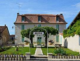
Chenaud is a former commune in the Dordogne department in southwestern France. On 1 January 2016, it was merged into the new commune Parcoul-Chenaud.[1]
Population
| Historical population | ||
|---|---|---|
| Year | Pop. | ±% |
| 1962 | 517 | — |
| 1968 | 456 | −11.8% |
| 1975 | 331 | −27.4% |
| 1982 | 350 | +5.7% |
| 1990 | 313 | −10.6% |
| 1999 | 321 | +2.6% |
| 2008 | 317 | −1.2% |
See also
References
- ↑ Arrêté préfectoral 14 December 2015 (French)
| Wikimedia Commons has media related to Chenaud. |
This article is issued from Wikipedia - version of the 2/4/2016. The text is available under the Creative Commons Attribution/Share Alike but additional terms may apply for the media files.