Regional Municipality of Wood Buffalo
| Wood Buffalo | ||
|---|---|---|
| Specialized municipality | ||
| Regional Municipality of Wood Buffalo | ||
| ||
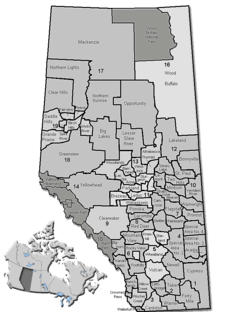 Location of Wood Buffalo in Alberta | ||
| Coordinates: 56°43′36″N 111°22′47″W / 56.72667°N 111.37972°WCoordinates: 56°43′36″N 111°22′47″W / 56.72667°N 111.37972°W | ||
| Country |
| |
| Province |
| |
| Region | Northern Alberta | |
| Census division | No. 16 | |
| - Specialized municipality | April 1, 1995 | |
| Name change | August 14, 1996 | |
| Office location | Fort McMurray | |
| Government[1] | ||
| • Mayor | Melissa Blake | |
| • Governing body |
Wood Buffalo Municipal Council
| |
| • CAO | Marcel Ulliac | |
| Area (2011)[2] | ||
| • Total | 63,637.47 km2 (24,570.56 sq mi) | |
| Population (2011)[2] | ||
| • Total | 65,565 | |
| • Density | 1.0/km2 (3/sq mi) | |
| See Demographics section for population derived from municipal censuses. | ||
| Time zone | MST (UTC−7) | |
| • Summer (DST) | MDT (UTC−6) | |
| Website |
rmwb | |

The Regional Municipality of Wood Buffalo sometimes (RMWB)[3][4] is a specialized municipality located in northeastern Alberta. Formed as a result of the amalgamation of the City of Fort McMurray and Improvement District No. 143 on April 1, 1995,[5] it is the second largest municipality in Alberta by area.[6] It is home to vast oil sand deposits, also known as the Athabasca Oil Sands, helping to make the region one of the fastest growing industrial areas in Canada.
Until the Alberta electoral boundary re-distribution of 2004, the municipality was divided between the provincial electoral districts of Fort McMurray (the community itself) and Athabasca-Wabasca (the surrounding area). The re-distribution amalgamated the municipality into a single electoral district covering the entire municipality. As a result, the new Wood Buffalo electoral district became the most populous such district in Alberta.
Geography
Communities and localities
|
The following urban municipalities are surrounded by the Regional Municipality of Wood Buffalo.[7]
|
The following hamlets are located within the Regional Municipality of Wood Buffalo.[7] |
The following localities are located within the Regional Municipality of Wood Buffalo.[8]
- Localities
|
|
|
|
Hydrology
The Regional Municipality of Wood Buffalo (RMWB) is in the lower basin of the Athabasca River watershed and Fort McMurray is the largest community on the banks of the river.[notes 1] Local rivers include the Hangingstone River, Clearwater River and Christina River, a tributary of the Clearwater River.
The Hangingstone River drains an area of 1,070 km2 (413 sq mi), which is dominated by muskeg, and flows into the Clearwater River just upstream of the Athabasca River at Fort McMurray.[9] The river often experiences high flows in the spring during snow melt, during heavy rainfall events and when ice jams occur during spring ice break. The RMWB warns citizens of the potential for sudden flash floods "especially in populated areas adjacent to the Athabasca River, Clearwater River and Christina River." Water levels have been monitored by the Water Survey of Canada since 1970 (WSC station 07CD004). During the spring months there is increased monitoring of the "Clearwater River to the south of the urban service area to provide warning of an ice break" and the "Athabasca River upper basin, local river levels, precipitation and overall weather patterns."[10]
The Clearwater River,[notes 2][11] designated as part of the Canadian Heritage Rivers System, flows 187 km (116 mi) from its headwaters in Lloyd Lake in northwest Saskatchewan into northeast Alberta before joining the Athabasca River at Fort McMurray.[11][12] "The lack of significant oil sands developments means that the Clearwater River can be used as a baseline river system to provide information on the variability and characteristics of natural systems."[12]
June 2013 floods
By June 12, 2013 after many days of heavy rain, Regional Municipality of Wood Buffalo declared a state of emergency. They organized evacuations from some areas and placed others under boil water advisories as local waterways, such as the Hangingstone River, rose to dangerously high levels 30 kilometres south of Fort McMurray, causing the closure of Highway 63.[13]
2016 wildfire
From May 3, 2016 on, over 80,000 people were affected by evacuations, by May 3 at 6:49 pm, the entirety of Fort McMurray and surrounding areas were placed under a mandatory evacuation.[14][15] making it Alberta's largest evacuation for a wildfire.[14]
Demographics
| Regional Municipality of Wood Buffalo population breakdown, 2015 [16] | |||
| Component | Permanent population |
Shadow population |
Total population |
|---|---|---|---|
| Urban service area (Fort McMurray) | 78,382 | 4,342 | 82,724 |
| Rural service area | 3,566 | 38,742 | 42,308 |
| Total RM of Wood Buffalo | 81,948 | 43,084 | 125,032 |
The Regional Municipality (RM) of Wood Buffalo's 2015 municipal census reported a population of 125,032 in the municipality, which includes permanent and shadow (non-permanent) populations of 82,724 and 42,308 residents respectively.[16]
In the 2011 Census, the Regional Municipality of Wood Buffalo had a population of 65,565 living in 23,077 of its 28,000 total dwellings, a 27.3% change from its 2006 population of 51,496. With a land area of 63,637.47 km2 (24,570.56 sq mi), it had a population density of 1.0/km2 (2.7/sq mi) in 2011.[2]
In 2006, the RM of Wood Buffalo had a population of 51,496 living in 20,505 dwellings, a 24.3% increase from 2001.[17] However, this population has since been revised by Statistics Canada to 51,924.[18] Using the pre-revised Statistics Canada data, Wood Buffalo had a land area of 63,342.89 km2 (24,456.83 sq mi) and a population density of 0.8/km2 (2.1/sq mi) in 2006.[17]
In 2001, the RM of Wood Buffalo had a population of 41,466 in 14,793 dwellings, a 17.8% increase from 1996. On a surface area of 63,400.51 km² it had a density of 0.7/km2 (1.8/sq mi).[19]
Population controversy
The determination of the RM of Wood Buffalo's population has twice been subject to controversy since 2007. First, Statistics Canada's March 2007 release of the population and dwelling counts from the 2006 census reported an overall population that was 18,000 residents fewer than the number of permanent residents the municipality counted in its own census conducted in 2006.[17][20][21]
Second, the RM of Wood Buffalo published a total population of 103,334 as a result of its 2008 municipal census, which included both its permanent and non-permanent (shadow) populations.[22] Alberta Municipal Affairs rejected the census result as the total population was generated through the use of extrapolation instead of door-to-door census enumeration.[23][24]
Visible minorities and Aboriginal population
As of the 2006 census, nearly 11% of residents identified themselves as visible minorities and more than 10% of residents identified as Aboriginal.
| Visible minorities and Aboriginal population | |||
|---|---|---|---|
| Canada 2006 Census | Population | % of Total Population | |
| Visible minority group Source:[25] | South Asian | 1,780 | 3.5% |
| Chinese | 540 | 1.1% | |
| Black | 720 | 1.4% | |
| Filipino | 750 | 1.5% | |
| Latin American | 570 | 1.1% | |
| Arab | 710 | 1.4% | |
| Southeast Asian | 130 | 0.3% | |
| West Asian | 120 | 0.2% | |
| Korean | 115 | 0.2% | |
| Japanese | 40 | 0.1% | |
| Other visible minority | 50 | 0.1% | |
| Mixed visible minority | 90 | 0.2% | |
| Total visible minority population | 5,615 | 10.9% | |
| Aboriginal group Source:[26] | First Nations | 2,425 | 4.7% |
| Métis | 2,535 | 4.9% | |
| Inuit | 210 | 0.4% | |
| Total Aboriginal population | 5,365 | 10.4% | |
| White | 40,425 | 78.6% | |
| Total population | 51,405 | 100% | |
Mother tongue
Nearly 85% of residents identified English, and 3% identified French, as their first language. The next most common languages are Cree, Spanish and Arabic at 1.2% each; Tagalog and Chinese at 0.8% each; Dene/Chipewyan and Urdu at 0.6% each, and German at 0.5%.[27]
Immigration
Wood Buffalo is home to almost 2,000 recent immigrants (arriving between 2001 and 2006) who now make up more than 3% of the population. About 21% of these immigrants came from India, while about 10% came from each of Pakistan and the Philippines, and about 9% came from Venezuela, and about 8% from South Africa, about 6% from China, and about 3% came from Colombia.[28]
Religion
More than 80% of residents identified as Christian at the time of the 2001 census while almost 17% indicated they had no religious affiliation. For specific denominations Statistics Canada counted 15,880 Roman Catholics (37.4%), 4,985 Anglicans (11.7%), 4,225 for the United Church of Canada (9.9%), 1,730 Pentecostals (4.1%), 1,195 Baptists (2.8%), 965 for the Salvation Army (2.3%), 900 Lutherans (2.1%), 690 Muslims (1.6%), 350 Latter-day Saints (0.8%), and 320 Presbyterians (0.8%).[29]
Economy
The Regional Municipality of Wood Buffalo is home to vast oil sand deposits, also known as the Athabasca Oil Sands, helping to make the region one of the fastest growing industrial areas in Canada.
Government
The municipality's current mayor is Melissa Blake, who has served since 2004. Its first mayor upon its creation in 1995 was Guy Boutilier, who had previously been the mayor of Fort McMurray and was subsequently elected as the region's provincial MLA; Doug Faulkner served as mayor from 1997 to 2004.
In the Legislative Assembly of Alberta, the municipality was served by the electoral district of Fort McMurray-Wood Buffalo until 2010, when a second district, Fort McMurray-Conklin, was created due to population growth. Fort McMurray-Wood Buffalo is currently represented by Tany Yao, while Fort McMurray-Conklin is represented by Alberta's Official Opposition Leader Brian Jean. Both were elected as members of the Wildrose Party in the 2015 provincial election.[30][31]
As of 2016, the municipality is located in the federal electoral district of Fort McMurray—Cold Lake, which is currently represented in the Canadian House of Commons by David Yurdiga of the Conservative Party of Canada.
See also
Notes
- ↑ The Athabasca River originates in Jasper National Park. It is fed by the Athabasca Glacier within the Columbia Icefield, at an altitude of approximately 1,600 metres (5,200 ft). The river travels 1,231 km (765 mi) before discharging through the Mackenzie River system into the Arctic Ocean through the Northwest Territories. Its course is marked by rapids, impeding navigation southwest of Fort McMurray.
- ↑ Clearwater river is named because of its "unspoiled, clear-water river in a pristine isolated "wilderness setting of spectacular beauty."
References
- ↑ "Municipal Officials Search". Alberta Municipal Affairs. November 18, 2016. Retrieved November 21, 2016.
- 1 2 3 "Population and dwelling counts, for Canada, provinces and territories, and census subdivisions (municipalities), 2011 and 2006 censuses (Alberta)". Statistics Canada. February 8, 2012. Retrieved February 8, 2012.
- ↑ "Website Abbreviation". Regional Municipality of Wood Buffalo. Retrieved 8 May 2016.
- ↑ "RMWB @RMWoodBuffalo Twitter Profile". Twitter. Regional Municipality of Wood BuffaloRegional Municipality of Wood Buffalo. Retrieved 8 May 2016.
- ↑ "Order in Council (O.C.) 817/94" (PDF). Province of Alberta. December 21, 1994. Retrieved August 1, 2010.
- ↑ "Population and dwelling counts, for Canada and census subdivisions (municipalities), 2006 and 2001 censuses - 100% data". Statistics Canada. January 6, 2010. Retrieved October 3, 2011.
- 1 2 "Specialized and Rural Municipalities and Their Communities" (PDF). Alberta Municipal Affairs. March 1, 2012. Retrieved August 11, 2012.
- ↑ "Standard Geographical Classification (SGC) 2006, Economic Regions: 4816037 - Wood Buffalo, geographical codes and localities, 2006". Statistics Canada. March 5, 2010. Retrieved August 11, 2012.
- ↑ Hangingstone River Hydrological Profile (Report). Hydrology of the Athabasca Oil Sands Region. Regional Aquatics Monitoring Program RAMP. Retrieved June 11, 2013.
- ↑ "Floods? Are You Ready?" (PDF). Wood Buffalo. Retrieved June 11, 2013.
- 1 2 "Clearwater River". Canadian Heritage Rivers System. Retrieved June 11, 2013.
- 1 2 "Clearwater River Hydrological Profile". Hydrology of the Athabasca Oil Sands Region. Regional Aquatics Monitoring Program (RAMP. Retrieved June 11, 2013.
- ↑ "Fort McMurray floodwaters wash out roads, power. Some residents are moved out, others ready for evacuation order". CBC News. June 12, 2013.
- 1 2 Parsons, Paige (May 3, 2016). "Thousands flee from Fort McMurray wildfire in the largest fire evacuation in Alberta's history". Postmedia Network. Edmonton Journal. Retrieved May 3, 2016.
- ↑ "Wildfire destroys Fort McMurray homes, most of city evacuated". CBC News Edmonton. May 3, 2016. Retrieved May 3, 2016.
- 1 2 "2015 Municipal Affairs Population List" (PDF). Alberta Municipal Affairs. ISBN 978-1-4601-2630-1. Retrieved February 23, 2016.
- 1 2 3 "Wood Buffalo Alberta (Regional municipality)". Statistics Canada. Retrieved November 9, 2009.
- ↑ Statistics Canada (February 9, 2009). "2006 Census corrections and updates". Retrieved November 28, 2010.
- ↑ "2001 Community Profiles – Wood Buffalo, Alberta (Regional Municipality)". Statistics Canada. February 1, 2007. Retrieved September 29, 2010.
- ↑ "Municipal Census 2006" (PDF). RM of Wood Buffalo. 2006. Retrieved December 1, 2010.
- ↑ "Wood Buffalo to challenge federal census". Fort McMurray Today. March 21, 2010. Retrieved December 1, 2010.
- ↑ "Municipal Census 2008" (PDF). RM of Wood Buffalo. June 1, 2009. Retrieved December 1, 2010.
- ↑ "Wood Buffalo hits 100,000, but province not paying up". Fort McMurray Today. July 16, 2009. Retrieved December 1, 2010.
- ↑ "Wood Buffalo's population passes 100,000, reports 2008 Municipal Census". RM of Wood Buffalo. July 15, 2009. Retrieved December 1, 2010.
- ↑ , Community Profiles from the 2006 Census, Statistics Canada - Census Subdivision
- ↑ , Aboriginal Peoples - Data table
- ↑ "Wood Buffalo". Detailed Mother Tongue (186), Knowledge of Official Languages (5), Age Groups (17A) and Sex (3) for the Population of Canada, Provinces, Territories, Census Metropolitan Areas and Census Agglomerations, 2001 and 2006 Censuses - 20% Sample Data. Statistics Canada. November 20, 2007. Retrieved February 6, 2008.
- ↑ "Wood Buffalo". Immigrant Status and Period of Immigration (8) and Place of Birth (261) for the Immigrants and Non-permanent Residents of Canada, Provinces, Territories, Census Metropolitan Areas and Census Agglomerations, 2006 Census - 20% Sample Data. Statistics Canada. December 4, 2007. Retrieved February 6, 2008.
- ↑ "Wood Buffalo". Religion (95A), Age Groups (7A) and Sex (3) for Population, for Canada, Provinces, Territories, Census Metropolitan Areas and Census Agglomerations, 1991 and 2001 Censuses - 20% Sample Data. Statistics Canada. March 1, 2007. Retrieved February 6, 2008.
- ↑ http://resultsnew.elections.ab.ca/orResultsED.cfm?ED=58&EventId=31
- ↑ http://resultsnew.elections.ab.ca/orResultsED.cfm?ED=59&EventId=31
External links

| Subdivisions | |||||||||||
|---|---|---|---|---|---|---|---|---|---|---|---|
| Communities | |||||||||||
| Cities and urban service areas | |||||||||||
| Rural municipalities |
| ||||||||||
| Specialized municipalities | |||||||||||
| |||||||||||