Charalá
| Charalá | |||
|---|---|---|---|
| Municipality and town | |||
|
Central square and park Charalá | |||
| |||
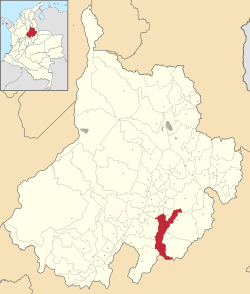 Location of the municipality and town of Charalá in the Santander Department of Colombia | |||
| Country |
| ||
| Department | Santander Department | ||
| Province | Guanentá Province | ||
| Founded | 23 July 1540 | ||
| Founded by | Martín Galeano | ||
| Government | |||
| • Mayor |
Gil Antonio Méndez Méndez (2016-2019) | ||
| Area | |||
| • Municipality and town | 411 km2 (159 sq mi) | ||
| • Urban | 0.7 km2 (0.3 sq mi) | ||
| Elevation | 1,290 m (4,230 ft) | ||
| Population (2015) | |||
| • Municipality and town | 10,540 | ||
| • Density | 26/km2 (66/sq mi) | ||
| • Urban | 5,791 | ||
| [1] | |||
| Time zone | Colombia Standard Time (UTC-5) | ||
| Website | Official website | ||


Charalá is a town and municipality in the south of the department of Santander in northeastern Colombia. Its antipode is located within the capital of Indonesia, Jakarta.[2]
The municipality borders the municipalities Encino and Coromoro in the east, Oiba, Confines and Suaita in the west, Páramo, Ocamonte and Mogotes in the north and in the south Gámbita and Duitama, the latter in the department of Boyacá.[3]
Climate
| | ||||||||||||||||||||||||||||||||||||||||||||||||||||||||||||
|---|---|---|---|---|---|---|---|---|---|---|---|---|---|---|---|---|---|---|---|---|---|---|---|---|---|---|---|---|---|---|---|---|---|---|---|---|---|---|---|---|---|---|---|---|---|---|---|---|---|---|---|---|---|---|---|---|---|---|---|---|
| Climate chart (explanation) | ||||||||||||||||||||||||||||||||||||||||||||||||||||||||||||
| ||||||||||||||||||||||||||||||||||||||||||||||||||||||||||||
| ||||||||||||||||||||||||||||||||||||||||||||||||||||||||||||
Etymology
The name Charalá is Chibcha, the language of the Muisca and was given to honour the Guane cacique of the village; "Chalala".[3]
History
Before the arrival of the Spanish in the area, the Santander department was inhabited by the Guane. Charalá was located at the border of Guane territory and the Muisca Confederation of which it formed an independent unity.
Modern Charalá was founded by one of the conquistadors who was part in the Spanish conquest of the Muisca; Martín Galeano, on July 23, 1540.[3]
Economy
Main economical activities in the municipality are agriculture (coffee, sugar cane and maize) and marble mining.[3]
Born in Charalá
- José Acevedo y Gómez, independence hero of Colombia
Gallery
 Casa de la Cultura
 Colonial house
 Iglesia Nuestra Señora de Monguí
 Statue José António Galán
 Statue Simón Bolívar
 Weaving activity
References
- ↑ (Spanish) 2015 DANE population Charalá
- ↑ "Antipodes Map - Antipodal location for any map point". Solution Realm Software Inc. 2006. Retrieved 3 November 2012.
- 1 2 3 4 (Spanish) Official website Charalá
| Wikimedia Commons has media related to Charalá. |
Coordinates: 6°15′N 73°05′W / 6.250°N 73.083°W