Chappes, Puy-de-Dôme
| Chappes | ||
|---|---|---|
|
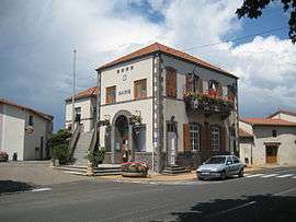
Town hall | ||
| ||
 Chappes | ||
|
Location within Auvergne-Rhône-Alpes region  Chappes | ||
| Coordinates: 45°52′10″N 3°13′18″E / 45.8694°N 3.2217°ECoordinates: 45°52′10″N 3°13′18″E / 45.8694°N 3.2217°E | ||
| Country | France | |
| Region | Auvergne-Rhône-Alpes | |
| Department | Puy-de-Dôme | |
| Arrondissement | Riom | |
| Canton | Aigueperse[1] | |
| Intercommunality | Limagne d'Ennezat | |
| Government | ||
| • Mayor (2014–2020) | Claude Boilon[2] (PS) | |
| Area1 | 10.21 km2 (3.94 sq mi) | |
| Population (2013)2 | 1,595 | |
| • Density | 160/km2 (400/sq mi) | |
| Time zone | CET (UTC+1) | |
| • Summer (DST) | CEST (UTC+2) | |
| INSEE/Postal code | 63089 / 63720 | |
| Elevation |
307–333 m (1,007–1,093 ft) (avg. 314 m or 1,030 ft) | |
|
1 French Land Register data, which excludes lakes, ponds, glaciers > 1 km² (0.386 sq mi or 247 acres) and river estuaries. 2 Population without double counting: residents of multiple communes (e.g., students and military personnel) only counted once. | ||
.svg.png)
Chappes, Puy-de-Dôme is a commune in the Puy-de-Dôme department in Auvergne-Rhône-Alpes in central France.
See also
References
- ↑ "Décret 2014-210 du 21 février 2014 portant délimitation des cantons dans le département du Puy-de-Dôme" [2014-210 decree delimiting cantons of Puy-de-Dôme department]. Légifrance (in French). 21 February 2014. Retrieved 24 October 2016.
- ↑ "List of Mayors of Puy-de-Dôme" (PDF). Prefecture of Puy-de-Dôme. 9 April 2014. Archived from the original (PDF) on 6 October 2014. Retrieved 24 October 2016.
| Wikimedia Commons has media related to Chappes (Puy-de-Dôme). |
This article is issued from Wikipedia - version of the 11/19/2016. The text is available under the Creative Commons Attribution/Share Alike but additional terms may apply for the media files.