Cetronia, Pennsylvania
| Cetronia | |
| Census-designated place | |
| Country | United States |
|---|---|
| State | Pennsylvania |
| County | Lehigh |
| Township | South Whitehall |
| Coordinates | 40°35′12″N 75°31′47″W / 40.58667°N 75.52972°WCoordinates: 40°35′12″N 75°31′47″W / 40.58667°N 75.52972°W |
| Population | 2,115 (2010) |
| Timezone | EST (UTC-5) |
| - summer (DST) | EDT (UTC-4) |
| ZIP code | 18104 |
| Area code | 610 & 484 |
 Location of Cetronia in Lehigh County
| |
 Location of Pennsylvania in the United States
| |
Cetronia is a census-designated place in South Whitehall Township, Lehigh County, Pennsylvania, United States, near the city of Allentown. State Route 1002 (Tilghman Street) and Pennsylvania Route 309 run through Cetronia while Cedar Crest Boulevard runs east of it. As of the 2010 census the population was 2,115.
Interstate 78 runs southwest of Cetronia prior to its merge with PA Route 309. Interstate 476, the Northeast Extension of the Pennsylvania Turnpike, forms the informal boundary between this area and the Kuhnsville area just to the west. US 22, the Lehigh Valley Thruway, runs north of Cetronia, forming an informal boundary with the Crackersport and Walbert area to the north. I-476 has an interchange with US 22 at the western edge of Cetronia, which uses the Allentown zip code of 18104.
Tilghman Square Shopping Center and a number of restaurants, medical offices, and car dealerships are located in the Cetronia area. The Census Bureau uses 309 and Tilghman Street as the western and northern boundaries of the CDP respectively, however, and therefore most of these businesses are excluded from the CDP definition and totals. The unincorporated community of Sterlingworth is included in the CDP.
External links
 |
Orefield | Orefield, Walbert | Parkway Manor | |
| Kuhnsville | |
Allentown | ||
| ||||
| | ||||
| Krocksville | Dorneyville, Wescosville | Sterlingworth, Allentown |
Municipalities and communities of Lehigh County, Pennsylvania, United States | ||
|---|---|---|
| Cities | 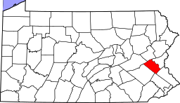 | |
| Boroughs | ||
| Townships | ||
| CDPs | ||
| Unincorporated communities |
| |
| Footnotes | ‡This populated place also has portions in an adjacent county or counties | |