Celestún Municipality
| Celestún | |
|---|---|
| Municipality | |
|
Principal Church of Celestún, Yucatán | |
 Region 1 Poniente #011 | |
|
Celestún Location of the Municipality in Mexico | |
| Coordinates: 20°51′33″N 90°24′00″W / 20.85917°N 90.40000°WCoordinates: 20°51′33″N 90°24′00″W / 20.85917°N 90.40000°W | |
| Country |
|
| State |
|
| Mexico Ind. | 1821 |
| Yucatán Est. | 1824 |
| Government | |
| • Type |
|
| • Municipal President | Rosa Alba Acosta Narváez[2] |
| Area | |
| • Total | 868.63 km2 (335.38 sq mi) |
| [2] | |
| Elevation | 3 m (10 ft) |
| Population (2010[3]) | |
| • Total | 6,831 |
| • Density | 7.9/km2 (20/sq mi) |
| • Demonym | Umanense |
| Time zone | Central Standard Time (UTC-6) |
| • Summer (DST) | Central Daylight Time (UTC-5) |
| INEGI Code | 011 |
| Major Airport | Merida (Manuel Crescencio Rejón) International Airport |
| IATA Code | MID |
| ICAO Code | MMMD |
| Website | Official Website |
| Municipalities of Yucatán | |
.JPG)
Celestún Municipality (Yucatec Maya: "terror of stone") is one of the 106 municipalities in the Mexican state of Yucatán containing (868.63 km2) of land and is located roughly 105 kilometres (65 mi) west of the city of Mérida.[2]
History
There is no accurate data on when the town was founded, but it was a settlement before the conquest and was located in the chieftainship of Ah-Canul. After colonization, the area was one of the few that did not become part of the encomienda system, and was established in 1718, as a town under the jurisdiction of Sisal, where it served as an important source of salt.[2]
Yucatán declared its independence from the Spanish Crown in 1821[4] and the area was transferred from Sisal to the Maxcanú Municipality in 1872. In 1918 the area became its own municipality.[2]
Governance
The municipal president is elected for a three-year term. The town council has four councilpersons, who serve as Secretary and councilors of heritage and public monuments; public security; public works, nomenclature and recruitment; and public buildings and ecology.[5]
Communities
The head of the municipality is Celestún, Yucatán. Among the other populated places of the municipality are Calan, Chamúl, Chín, Hoyuelos, Man, Stal and Tzate. The significant populations are shown below:[2]
| Community | Population |
|---|---|
| Entire Municipality (2010) | 6,831[3] |
| Celestún | 6243 in 2005[6] |
Local festivals

Every year from 1 to 12 December the town celebrates the feast of the Immaculate Conception. There is also an annual celebration on 1 June for Navy Day.[2]
Tourist attractions
- Church of the Immaculate Conception
- Birding
References
- ↑ "Presidentes Municipales" (in Spanish). Mérida, Mexico: PRI yucatan. 23 January 2014. Retrieved 16 August 2015.
- 1 2 3 4 5 6 7 "Municipios de Yucatán »Celestún" (in Spanish). Retrieved 15 August 2015.
- 1 2 "Mexico In Figures:Celestún, Yucatán". INEGI (in Spanish and English). Aguascalientes, México: Instituto Nacional de Estadística y Geografía (INEGI). Retrieved 16 August 2015.
- ↑ "Estado de Yucatán. División Territorial de 1810 a 1995" (PDF). inegi (in Spanish). Aguascalientes, Mexico: Instituto Nacional de Estadística, Geografía e Informática. 1996. p. 15. Archived from the original (PDF) on 23 December 2015. Retrieved 16 August 2015.
- ↑ "Celestún". inafed (in Spanish). Mérida, Mexico: Enciclopedia de Los Municipios y Delegaciones de México. Retrieved 16 August 2015.
- ↑ "Celestún" (in Spanish). PueblosAmerica. 2005. Retrieved 16 August 2015.
Mérida (capital) | |||||||||||||||||||||||||||
| Topics | 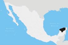 | ||||||||||||||||||||||||||
| Metros | |||||||||||||||||||||||||||
| Larger cities | |||||||||||||||||||||||||||
| Smaller cities |
| ||||||||||||||||||||||||||
| Municipalities |
| ||||||||||||||||||||||||||