Carse of Gowrie
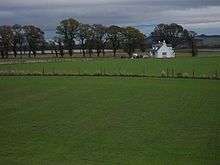
The flat, drained field of the Carse
The Carse of Gowrie is a stretch of low-lying country in the southern part of Gowrie, Perth and Kinross, Scotland.[1][2] It stretches for about 20 miles (32 km) along the north shore of the Firth of Tay between Perth and Dundee. The area offers high-quality agricultural land and is well known as a major area for strawberry, raspberry and general fruit growing. Fruit is easy to cultivate in the area because of its southerly aspect and low rainfall.
Its main villages are:
References
- ↑ Ordnance Survey: Landranger map sheet 53 Blairgowrie & Forest of Alyth (Map). Ordnance Survey. 2012. ISBN 9780319231210.
- ↑ "Ordnance Survey: 1:50,000 Scale Gazetteer" (csv (download)). www.ordnancesurvey.co.uk. Ordnance Survey. 1 January 2016. Retrieved 30 January 2016.
External links
Coordinates: 56°24′42″N 3°10′06″W / 56.41172°N 3.16847°W
This article is issued from Wikipedia - version of the 2/3/2016. The text is available under the Creative Commons Attribution/Share Alike but additional terms may apply for the media files.