Carrollton, Ohio
| Carrollton, Ohio | |
|---|---|
| Village | |
|
The Carroll County Courthouse is located in downtown Carrollton | |
 Location of Carrollton, Ohio | |
 Location of Carrollton in Carroll County | |
| Coordinates: 40°34′43″N 81°5′12″W / 40.57861°N 81.08667°WCoordinates: 40°34′43″N 81°5′12″W / 40.57861°N 81.08667°W | |
| Country | United States |
| State | Ohio |
| County | Carroll |
| Township | Center |
| Government | |
| • Mayor | Frank Leghart |
| Area[1] | |
| • Total | 2.45 sq mi (6.35 km2) |
| • Land | 2.45 sq mi (6.35 km2) |
| • Water | 0 sq mi (0 km2) |
| Elevation[2] | 1,119 ft (341 m) |
| Population (2010)[3] | |
| • Total | 3,241 |
| • Estimate (2012[4]) | 3,221 |
| • Density | 1,322.9/sq mi (510.8/km2) |
| Time zone | Eastern (EST) (UTC-5) |
| • Summer (DST) | EDT (UTC-4) |
| ZIP code | 44615 |
| Area code(s) | 330 |
| FIPS code | 39-12280[5] |
| GNIS feature ID | 1056769[2] |
| Website | villageofcarrollton.com |

Carrollton is a village in Carroll County, Ohio, United States. The population was 3,241 at the 2010 census. It is the county seat of Carroll County.[6]
Carrollton is part of the Canton-Massillon, OH Metropolitan Statistical Area.
History
The village was established as "Centreville" on October 4, 1815 at the crossroads of the Steubenville to Canton and New Lisbon to New Philadelphia roads by Peter Bohart. After the village became the county seat of newly formed Carroll County, the village name was changed on February 24, 1834.[7] The village derives its name from Charles Carroll of Carrollton, the last surviving signer of the Declaration of Independence.[8]
Many of the Fighting McCooks of Civil War fame lived in Carrollton. The Daniel McCook House is listed as a National Historic Place.
Geography
According to the United States Census Bureau, the village has a total area of 2.45 square miles (6.35 km2), all land.[1]
Carrollton is at the junction of State Routes 39 and 43. State Routes 9 and 332 also pass through the village.
A branch of the Wheeling and Lake Erie Railway passes through and ends at the Carroll County Industrial Park.
Demographics
.JPG)
2010 census
As of the census[3] of 2010, there were 3,241 people, 1,347 households, and 829 families residing in the village. The population density was 1,322.9 inhabitants per square mile (510.8/km2). There were 1,502 housing units at an average density of 613.1 per square mile (236.7/km2). The racial makeup of the village was 98.2% White, 0.4% African American, 0.4% Asian, 0.2% from other races, and 0.9% from two or more races. Hispanic or Latino of any race were 0.9% of the population.
There were 1,347 households of which 29.0% had children under the age of 18 living with them, 44.5% were married couples living together, 13.0% had a female householder with no husband present, 4.0% had a male householder with no wife present, and 38.5% were non-families. 33.9% of all households were made up of individuals and 17.6% had someone living alone who was 65 years of age or older. The average household size was 2.26 and the average family size was 2.86.
The median age in the village was 42.2 years. 22.3% of residents were under the age of 18; 8.3% were between the ages of 18 and 24; 22.2% were from 25 to 44; 24.9% were from 45 to 64; and 22.2% were 65 years of age or older. The gender makeup of the village was 44.2% male and 55.8% female.
2000 census
As of the census[5] of 2000, there were 3,190 people, 1,428 households, and 846 families residing in the village. The population density was 1,340.9 people per square mile (517.5/km²). There were 1,531 housing units at an average density of 643.6 per square mile (248.4/km²). The racial makeup of the village was 98.59% White, 0.25% African American, 0.19% Native American, 0.06% Asian, 0.06% from other races, and 0.85% from two or more races. Hispanic or Latino of any race were 0.47% of the population.
There were 1,428 households out of which 25.4% had children under the age of 18 living with them, 46.0% were married couples living together, 10.7% had a female householder with no husband present, and 40.7% were non-families. 36.4% of all households were made up of individuals and 20.6% had someone living alone who was 65 years of age or older. The average household size was 2.16 and the average family size was 2.80.
In the village the population was spread out with 21.4% under the age of 18, 8.1% from 18 to 24, 24.0% from 25 to 44, 23.4% from 45 to 64, and 23.0% who were 65 years of age or older. The median age was 42 years. For every 100 females there were 82.2 males. For every 100 females age 18 and over, there were 75.1 males.
The median income for a household in the village was $25,694, and the median income for a family was $38,528. Males had a median income of $31,885 versus $16,441 for females. The per capita income for the village was $14,866. About 11.3% of families and 17.0% of the population were below the poverty line, including 27.4% of those under age 18 and 21.2% of those age 65 or over.
Education
| Historical population | |||
|---|---|---|---|
| Census | Pop. | %± | |
| 1860 | 721 | — | |
| 1870 | 813 | 12.8% | |
| 1880 | 1,136 | 39.7% | |
| 1890 | 1,228 | 8.1% | |
| 1900 | 1,271 | 3.5% | |
| 1910 | 1,730 | 36.1% | |
| 1920 | 2,192 | 26.7% | |
| 1930 | 2,286 | 4.3% | |
| 1940 | 2,548 | 11.5% | |
| 1950 | 2,658 | 4.3% | |
| 1960 | 2,786 | 4.8% | |
| 1970 | 2,817 | 1.1% | |
| 1980 | 3,065 | 8.8% | |
| 1990 | 3,042 | −0.8% | |
| 2000 | 3,190 | 4.9% | |
| 2010 | 3,241 | 1.6% | |
| Est. 2015 | 3,137 | [9] | −3.2% |
| Sources:[10][11] | |||
Students attend the Carrollton Exempted Village School District.[12]
Notable people
- William Crozier - artillerist and inventor
- Ephraim R. Eckley - U.S. Representative, Civil War Union Army brigadier general
- George Hemming - 19th century Major League Baseball player
- Kirk Lowdermilk - former American football offensive lineman for the Ohio State University and the Minnesota Vikings
- Eddie and Sam Maple - brothers who were American thoroughbred horse racing jockeys.
- Benjamin F. Potts, territorial governor of Montana
References
- 1 2 "US Gazetteer files 2010". United States Census Bureau. Archived from the original on 2012-07-14. Retrieved 2013-01-06.
- 1 2 "US Board on Geographic Names". United States Geological Survey. 2007-10-25. Retrieved 2008-01-31.
- 1 2 "American FactFinder". United States Census Bureau. Retrieved 2013-01-06.
- ↑ "Population Estimates". United States Census Bureau. Archived from the original on 2013-06-17. Retrieved 2013-06-17.
- 1 2 "American FactFinder". United States Census Bureau. Archived from the original on 2013-09-11. Retrieved 2008-01-31.
- ↑ "Find a County". National Association of Counties. Archived from the original on 2011-05-31. Retrieved 2011-06-07.
- ↑ Eckley, H.J.; Perry, W.T. (1921). History of Carroll and Harrison Counties. The Lewis Publishing Co. pp. 122–124, 136.
- ↑ Overman, William Daniel (1958). Ohio Town Names. Akron, OH: Atlantic Press. p. 24.
- ↑ "Annual Estimates of the Resident Population for Incorporated Places: April 1, 2010 to July 1, 2015". Retrieved July 2, 2016.
- ↑ "Census of Population and Housing". United States Census Bureau. Retrieved 2014-01-15.
- ↑ census data: 1860 : 1860 page 12, 1870 : 1870 page 24, 1880 : Howe, Henry (1907). Historical Collections of Ohio, The Ohio Centennial Edition. The State of Ohio. p. 361. , 1890,1900 : Hunt, William C. (1901). Population of the United States by states and territories, counties, and minor Civil Divisions, as returned at the Twelfth Census: 1900. United States Census Printing Office. p. 306. , 1910, 1920, 1930 : 1930 page 40 , 1940 : 1940 page 117 , 1950 : 1950 page 14 , 1960 : 1960 page 16 , 1970 : 1970 page=124 ,1990: 1990 , 2000 : 2000
- ↑ PUC Ohio map of School Districts Archived February 20, 2009, at the Wayback Machine.
External links
| Wikivoyage has a travel guide for Carrollton (Ohio). |
Municipalities and communities of Carroll County, Ohio, United States | ||
|---|---|---|
| Villages | 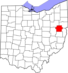 | |
| Townships | ||
| CDP | ||
| Unincorporated communities | ||
| Footnotes | ‡This populated place also has portions in an adjacent county or counties | |