Carp River (Ottawa)
For other places with the same name, see Carp River.
| Carp River | |
| Name origin: From the French carpes à cochon | |
| Country | Canada |
|---|---|
| Province | Ontario |
| Region | Eastern Ontario |
| Municipality | Ottawa |
| Part of | Saint Lawrence River drainage basin |
| Source | |
| - location | Kanata |
| - elevation | 113 m (371 ft) |
| - coordinates | 45°18′07″N 75°52′07″W / 45.30194°N 75.86861°W |
| Mouth | Ottawa River |
| - location | Fitzroy Harbour |
| - elevation | 54 m (177 ft) |
| - coordinates | 45°28′59″N 76°13′37″W / 45.48306°N 76.22694°WCoordinates: 45°28′59″N 76°13′37″W / 45.48306°N 76.22694°W |
| Length | 42 km (26 mi) |
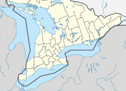 Location of the mouth of the Carp River in Eastern Ontario
| |
The Carp River is a river in the city of Ottawa, Ontario, Canada. It flows north from Kanata, passes through the town of Carp and empties into the Ottawa River at Fitzroy Harbour. The river is 42 kilometres (26 mi) long and takes its name from the sucker fish, called carpes à cochon by the French, found in the river. The watershed is administered by the Mississippi Valley Conservation Authority.
In the spring there is enough run-off water from melting ice that the Carp River becomes a whitewater paddling site. The put-in is beside a bridge (crossing the river) on Carp Road between Kinburn Side Road and Galetta Side Road. The whitewater is class 2 to 3 and excellent for kayaking and canoeing.
See also
References
- "Carp River". Geographical Names Data Base. Natural Resources Canada. Retrieved 2010-06-10.
- "Toporama - Topographic Map Sheets 31F8, 31G5". Atlas of Canada. Natural Resources Canada. Archived from the original on 2010-08-31. Retrieved 2010-06-10.
External links
This article is issued from Wikipedia - version of the 11/16/2016. The text is available under the Creative Commons Attribution/Share Alike but additional terms may apply for the media files.