Carolina Place Historic District
|
Carolina Place Historic District | |
 | |
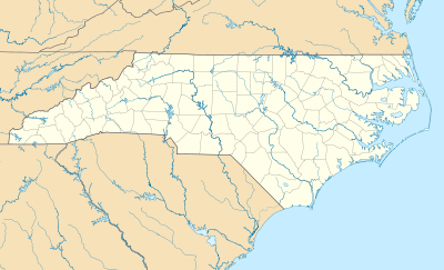  | |
| Location | Bounded by Market St., Wallace Park, Gibson Ave., Wrightsville Ave. and S. Eighteenth St., Wilmington, North Carolina |
|---|---|
| Coordinates | 34°14′06″N 77°55′24″W / 34.23500°N 77.92333°WCoordinates: 34°14′06″N 77°55′24″W / 34.23500°N 77.92333°W |
| Area | 46 acres (19 ha) |
| Built | 1906 |
| Architect | Stephens, Burett |
| Architectural style | Late 19th And 20th Century Revivals, Bungalow/craftsman, Queen Anne |
| NRHP Reference # | 92001086[1] |
| Added to NRHP | August 31, 1992 |
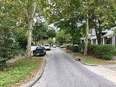
Carolina Place Historic District is a national historic district located at Wilmington, New Hanover County, North Carolina. The district encompasses 337 contributing buildings in a predominantly residential section of Wilmington. The district developed as Wilmington's first planned streetcar suburb between about 1906 and 1941 and includes notable examples of Queen Anne, Classical Revival, Colonial Revival, and Bungalow / American Craftsman style architecture.[2]
It was listed on the National Register of Historic Places in 1992.[1]
References
- 1 2 National Park Service (2010-07-09). "National Register Information System". National Register of Historic Places. National Park Service.
- ↑ Allison H. Black and David R. Black (May 1992). "Carolina Place Historic District" (pdf). National Register of Historic Places - Nomination and Inventory. North Carolina State Historic Preservation Office. Retrieved 2015-02-01.

This article is issued from Wikipedia - version of the 12/1/2016. The text is available under the Creative Commons Attribution/Share Alike but additional terms may apply for the media files.