Carneros Creek (Napa River)
| Carneros Creek | |
| Arroyo De Los Carneros[1] | |
| stream | |
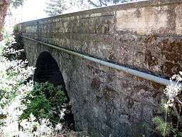 Historic Old Sonoma Road bridge over Carneros Creek in 2010 | |
| Country | United States |
|---|---|
| State | California |
| Region | Napa County, California |
| City | Napa |
| Source | Mayacamas Mountains |
| - elevation | 1,500 ft (457 m) [2] |
| - coordinates | 38°1′58″N 122°24′42″W / 38.03278°N 122.41167°W [3] |
| Mouth | Napa River |
| - elevation | 3 ft (1 m) |
| - coordinates | 38°13′17″N 122°18′43″W / 38.22139°N 122.31194°WCoordinates: 38°13′17″N 122°18′43″W / 38.22139°N 122.31194°W [3] |
| Basin | 170 sq mi (440 km2) |
Carneros Creek is a south by southeastward flowing stream originating in the southernmost Mayacamas Mountains, in Napa County, California. It is the southernmost tributary to the Napa River, entering 2.5 miles (4.0 km) north of San Pablo Bay and 5 miles (8.0 km) south of the town of Napa.[4]
History
A Mexican land grant named Los Carneros, which is Spanish for "sheep", dates to 1836 (Rancho Rincon de los Carneros) in what is now Napa County.[1] Rancho Rincon de los Carneros, extending northeast from Carneros Creek to the Napa River, was granted to Nicolas Higuera around this time. Higuera also received Rancho Entre Napa, contiguous to the north along the creek. Carneros Creek forms the northeast border of the 1841 Mexican land grant Rancho Huichica which includes most of the Carneros region and Huichica Creek which is west of and parallel to Carneros Creek. Rancho Huichica was granted to Jacob P. Leese the first American pioneer to build a house in San Francisco. In the next year, Antonio Ortega, the Administrator of Mission San Francisco Solano, was granted a large rancho from Napa to Yountville. This area, which extended to Carneros Creek, above Higuera’s grant, was later granted to Salvador Vallejo.[5]
Watershed
The Carneros Creek official mainstem is 9.8 miles (15.8 km) long.[2][3] This third order stream has a rectangular drainage basin area of 8.9 square miles (23 km2). The highest elevation in the watershed is 1,660 feet (510 m) above mean sea level, dropping to sea level at its confluence with the Napa River. The lowest 1,640 feet (500 m) of the creek is confined within flood levees.[6]
Ecology
Carneros Creek is an anadromous Steelhead trout (Oncorhynchus mykiss) stream. Because these trout spend two years in freshwater before returning to the sea, only the perennial middle reach of the creek hosts trout year-round (between Old Sonoma Road and extending upstream about 4.2 miles (6.8 km) where the channel goes dry in summer and fall).[7]
See also
References
- 1 2 Erwin Gudde. California Geographic Names. p. 67. Retrieved 2012-09-26.
- 1 2 U.S. Geological Survey. National Hydrography Dataset high-resolution flowline data. The National Map Archived 2012-04-05 at WebCite, accessed September 26, 2012
- 1 2 3 U.S. Geological Survey Geographic Names Information System: Carneros Creek
- ↑ Julia Rubens Beagle (2010). Creating an Anticipatory Management Plan for Carneros Creek, Napa CA (PDF) (Thesis). University of California, Berkeley. p. 27. Archived from the original (PDF) on 2013-09-21. Retrieved 2012-10-08.
- ↑ Grossinger, R., C. Striplen, E. Brewster, and L. McKee (2004). Ecological, Geomorphic, and Land Use History of Carneros Creek Watershed: A component of the watershed management plan for the Carneros Creek watershed, Napa County, California. A Technical Report of the Regional Watershed Program, SFEI Contribution 70 (PDF) (Report). Oakland, California: San Francisco Estuary Institute. p. 48. Retrieved 2012-10-08.
- ↑ Pearce, S., O’Connor, M., McKee, L., and Jones, B. (2003). Channel Geomorphology Assessment: A component of the watershed management plan for the Carneros Creek watershed, Napa County, California. A Technical Report of the Regional Watershed Program, SFEI Contribution 67 (PDF) (Report). Oakland, California: San Francisco Estuary Institute. Retrieved 2012-10-09.
- ↑ Jonathan Koehler (2003-04-01). Fish Habitat Assessment (PDF) (Report). Retrieved 2012-10-09.
External links
- Oakland Museum Creek Map of Napa River Watershed
- Carneros Creek Watershed Assessment and Management Plan