Carúpano
| Carúpano | |||
|---|---|---|---|
| |||
 Carúpano | |||
| Coordinates: 10°40′20″N 63°14′25″W / 10.67222°N 63.24028°WCoordinates: 10°40′20″N 63°14′25″W / 10.67222°N 63.24028°W | |||
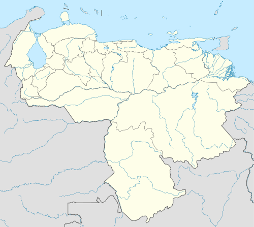
| Country | Venezuela | ||
| State | Sucre | ||
| Municipality | Bermúdez | ||
| Founded | 23 December 1647 | ||
| Government | |||
| • Mayor | Julio Rodriguez (PSUV) | ||
| Area | |||
| • Total | 203 km2 (78 sq mi) | ||
| Elevation | 10 m (30 ft) | ||
| Population (2010) | |||
| • Total | 173.877 hab. | ||
| • Density | 856/km2 (2,220/sq mi) | ||
| • Demonym | Carupanero(a) | ||
| Time zone | VST (UTC-4:30) | ||
| • Summer (DST) | not observed (UTC-4:30) | ||
| Postal code | 6150 | ||
| Area code(s) | (+58) 294 | ||
| Website | bermudez-sucre.gob.ve | ||
| The area and population figures are for the municipality | |||

Carúpano is a city in the eastern Venezuelan state of Sucre. It is located on the Venezuelan Caribbean coast at the opening of two valleys, some 120 km east of the capital of Sucre, Cumaná.[1] This city is the shire town of the Bermúdez Municipality and, according to the 2001 Venezuelan census, the municipality has a population of 122,195.[2]
History
It was somewhere on the Peninsula of Paria, near Carúpano, where Christopher Columbus first set foot on the American continent for the only time, during his third voyage (in all his other trips he only explored the Caribbean islands).
It was in Carúpano where Simón Bolívar, the liberator of Venezuela, issued a decree ending slavery in 1814.[3]
The King Ferdinand VII of Spain on 1815 send a fleet of 18 warships and 42 cargo ships which landed in Carupano and Isla Margarita with the mission to pacify the revolts against the Spanish monarchy in the American colonies.
In May 1962 Carúpano was the scene of a short-lived military rebellion against the government of Rómulo Betancourt, in which rebel military officers took over the city. The incident is known as El Carupanazo.
In July 1997, a violent earthquake struck the city and most of the state. This earthquake was centered in the town of Cariaco, where most of the deaths and damage occurred.[4][5]
Economy
Cacao, coffee, sugar, cotton, timber and rum[6] have been important exports of Carúpano since colonial times. Carupanese rums are highly appreciated nationwide, so the internal consumption usually leaves little surplus rum for export.
As of November 2006, Carúpano is a domestic scheduled destination of Avior Airlines, flying from the local General José Francisco Bermúdez Airport.[7]
Demographics

The Bermúdez Municipality, according to the 2001 Venezuelan census, has a population of 175,877 (up from 100,794 in 1990). This amounts to 15.5% of Sucre's population.[2] The municipality's population density is 1,559 people per square mile (601.95/km²).[1][2]
Government
Carúpano is the administrative centre of Bermúdez Municipality. The mayor of the Bermúdez Municipality is Julio César Rodríguez, elected in 2008.[8]
Sites of interest
House of Cable
The House of Cable was where the first submarine cable between Europe and America arrived, joining the French city of Marseille with Carúpano, back in the late 19th century. This house is today the headquarters of the Tomas Merle foundation and the Paria Project, two organizations that promote tourism and industry.
Religious buildings
- Iglesia Catedral Santa Rosa de Lima
- Iglesia Santa Catalina de Siena
- Iglesia Nuestra Señora de Coromoto
- Iglesia San Martín de Porres
- Iglesia Ntra. Señora del Valle
- Iglesia San Rafael Ancargél
- Capilla Santa Cruz(Guayacan de las Flores)
- Capilla Santa Cruz(Guayacan de los Pescadores)
- Capilla Santa Cruz(Sector el Mangle)
Squares and parks
- Plaza Andrés
- Plaza Bolívar
- Plaza Colón
- Plaza Miranda
- Plaza Santa Rosa
- Plaza Suniaga
- Parque Karupana
Escuelas y Liceos:
- U.E.P " Ramón León Santelli"(Escuela Privada,ubicada en Av. Independencia frente al Hotel Lilma).
- U.E " J.J Martinez Mata "(Escuela Publica,ubicada en Av. Libertad,con calle Paez.
- U.E.P " Rafael Osío Perez "(Liceo Privado,ubicada en Av. Independencia,con calle Paez.
- U.E.P " Dr. José Gregorio Hernandez "(Escuela y Liceo Privado,ubicada en Av. Carabobo.
- U.E.P " San José "(Escuela y Liceo Privado,ubicada en Av. Carabobo,con calle Las Margaritas,y calle Calvario.
- U.E.P " Don Andrés Bello "(Escuela y Liceo Privado,ubicada en Av. Independencia frente a la Plaza Santa Rosa,y calle Dominicci.
- U.E.P " Sagrado Corazón de Jesús "(Escuela Privada,ubicada en Calle Ecuador.
- U.E.P " Inmaculado Corazón de María(Escuela Privada,ubicada en Av. Juncal,cerca del Supermercado Francys.
- U.E " Antonio Jesús Rodriguez Abreu "(Escuela Publica,ubicada en Av. Principal de Canchunchu.
- U.E " Pedro Elías Aristeguieta "(Escuela Publica,ubicada en calle Bolívar al Frente de la Infantería.
- U.E " Manuel María Urbaneja "(Escuela Publica,ubicada en Calle Principal del Sector Curacho.
Notable natives
Famous Carupaneros include Wolfgang Larrazábal, former president of Venezuela; Jictzad Viña, Miss Venezuela 2005; Antonio José de Sucre, one of the paramount leaders of the South American war of independence, was thought to have lived there but hailed from Cumana; Andrés Eloy Blanco, one of the most important Venezuelan poets also came from Cumana; Eladio Lárez, president of Radio Caracas Television, one of Venezuela's largest television networks; and Washington Nationals major league baseball catcher Jesús Flores.
See also
References
 This article incorporates text from a publication now in the public domain: Chisholm, Hugh, ed. (1911). "Carúpano". Encyclopædia Britannica (11th ed.). Cambridge University Press.
- 1 2 Gobernación Del Estado Sucre
- 1 2 3 Primeros Resultados XIII Censo General de Población y Vivienda Archived August 25, 2007, at the Wayback Machine.
- ↑ Carúpano - Venezuela Tuya
- ↑ El Observador Online Archived August 20, 2007, at the Wayback Machine.
- ↑ Crónicas de Desastres - Terremoto de Cariaco, Venezuela (Pan American Health Organization (PAHO) / Organización Panamericana de la Salud (OPS), 1999, 57 p.)
- ↑ Carupano Distillery
- ↑ Avior Airlines...un Viaje de Diferencias Archived September 28, 2007, at the Wayback Machine.
- ↑ "Alcaldía Bolivariana de Bermúdez: Reseña Historica (Bolivarian Mayor Bermudez: Historical Review)". Alcaldía Bolivariana de Bermúdez. Archived from the original on 7 January 2013.