Canyon County, Idaho
| Canyon County, Idaho | ||
|---|---|---|
| ||
 Location in the U.S. state of Idaho | ||
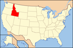 Idaho's location in the U.S. | ||
| Founded | March 7, 1891 | |
| Seat | Caldwell | |
| Largest city | Nampa | |
| Area | ||
| • Total | 604 sq mi (1,564 km2) | |
| • Land | 587 sq mi (1,520 km2) | |
| • Water | 16 sq mi (41 km2), 2.7% | |
| Population | ||
| • (2010) | 188,923 | |
| • Density | 322/sq mi (124/km²) | |
| Congressional district | 1st | |
| Time zone | Mountain: UTC-7/-6 | |
| Website |
www | |

Canyon County is a county located in the U.S. state of Idaho. As of the 2010 census, the population was 188,923,[1] making it the second-most populous county in Idaho. The county seat is Caldwell,[2] and its largest city is Nampa.
Canyon County is part of the Boise, ID Metropolitan Statistical Area.
History
Hudson's Bay Company established Fort Boise in 1834 near what is now Parma, but abandoned it in 1855. Migrants traveled through Canyon County on the Oregon Trail.[3] The Oregon Short Line Railroad was completed in the area in 1883.
The county was established on March 7, 1891, with its county seat at Caldwell. Partitioned from Ada County, Payette County was spun-off in 1917, and the southern portion of Gem County, in 1918 . Some sources attribute the name to the canyon of the Boise River near Caldwell, while western writers John Rees and Vardis Fisher believed it was named for the Snake River canyon, which forms a natural boundary with Owyhee County to the south and west.
Geography
According to the U.S. Census Bureau, the county has a total area of 604 square miles (1,560 km2), of which 587 square miles (1,520 km2) is land and 16 square miles (41 km2) (2.7%) is water.[4]
Adjacent counties
- Payette County - north
- Gem County - northeast
- Ada County - east
- Owyhee County - south
- Malheur County, Oregon - west
National protected areas
- Deer Flat National Wildlife Refuge (part)
- Snake River Birds of Prey National Conservation Area (part)
Major highways
Demographics
| Historical population | |||
|---|---|---|---|
| Census | Pop. | %± | |
| 1900 | 7,497 | — | |
| 1910 | 25,323 | 237.8% | |
| 1920 | 26,932 | 6.4% | |
| 1930 | 30,930 | 14.8% | |
| 1940 | 40,987 | 32.5% | |
| 1950 | 53,597 | 30.8% | |
| 1960 | 57,662 | 7.6% | |
| 1970 | 61,288 | 6.3% | |
| 1980 | 83,756 | 36.7% | |
| 1990 | 90,076 | 7.5% | |
| 2000 | 131,441 | 45.9% | |
| 2010 | 188,923 | 43.7% | |
| Est. 2015 | 207,478 | [5] | 9.8% |
| U.S. Decennial Census[6] 1790-1960[7] 1900-1990[8] 1990-2000[9] 2010-2013[1] | |||
2000 census
At the 2000 census,[10] there were 131,441 people, 45,018 households and 33,943 families residing in the county. The population density was 223/square mile (86/square km). There were 47,965 housing units at an average density of 81/square mile (31/square km). The racial makeup of the county was 83.10% White, 0.32% Black or African American, 0.85% Native American, 0.80% Asian, 0.13% Pacific Islander, 12.17% from other races, and 2.62% from two or more races. Hispanic or Latino of any race were 18.61% of the population. 15.9% were of German, 12.7% English, 10.3% American and 7.6% Irish ancestry according to Census 2000.
There were 45,018 households of which 39.80% had children under the age of 18 living with them, 60.70% were married couples living together, 10.10% had a female householder with no husband present, and 24.60% were non-families. 19.80% of all households were made up of individuals and 8.40% had someone living alone who was 65 years of age or older. The average household size was 2.85 and the average family size was 3.28.
30.90% of the population were under the age of 18, 10.70% from 18 to 24, 28.30% from 25 to 44, 19.10% from 45 to 64, and 11.00% who were 65 years of age or older. The median age was 30 years. For every 100 females there were 98.70 males. For every 100 females age 18 and over, there were 96.30 males.
The median household income was $35,884 and the median family income was $40,377. Males had a median income of $29,418 compared with $22,044 for females. The per capita income for the county was $15,155. About 8.70% of families and 12.00% of the population were below the poverty line, including 14.50% of those under age 18 and 10.70% of those age 65 or over.
2010 census
As of the 2010 United States Census, there were 188,923 people, 63,604 households, and 47,481 families residing in the county.[11] The population density was 321.6 inhabitants per square mile (124.2/km2). There were 69,409 housing units at an average density of 118.2 per square mile (45.6/km2).[12] The racial makeup of the county was 83.0% white, 1.1% American Indian, 0.8% Asian, 0.6% black or African American, 0.2% Pacific islander, 11.4% from other races, and 3.0% from two or more races. Those of Hispanic or Latino origin made up 23.9% of the population.[11] In terms of ancestry, 18.8% were American, 17.4% were German, 13.0% were English, and 8.8% were Irish.[13]
Of the 63,604 households, 42.7% had children under the age of 18 living with them, 56.7% were married couples living together, 12.3% had a female householder with no husband present, 25.3% were non-families, and 20.1% of all households were made up of individuals. The average household size was 2.92 and the average family size was 3.36. The median age was 31.6 years.[11]
The median income for a household in the county was $43,218 and the median income for a family was $48,219. Males had a median income of $38,132 versus $28,356 for females. The per capita income for the county was $18,366. About 12.7% of families and 17.3% of the population were below the poverty line, including 23.8% of those under age 18 and 8.5% of those age 65 or over.[14]
Communities
Cities
Unincorporated communities
See also
References
- 1 2 "State & County QuickFacts". United States Census Bureau. Retrieved June 28, 2014.
- ↑ "Find a County". National Association of Counties. Archived from the original on 2011-05-31. Retrieved 2011-06-07.
- ↑ Idaho.gov - about Idaho - Canyon Co. Archived December 20, 2004, at the Wayback Machine. accessed May 3, 2009
- ↑ "US Gazetteer files: 2010, 2000, and 1990". United States Census Bureau. 2011-02-12. Retrieved 2011-04-23.
- ↑ "County Totals Dataset: Population, Population Change and Estimated Components of Population Change: April 1, 2010 to July 1, 2015". Retrieved July 2, 2016.
- ↑ "U.S. Decennial Census". United States Census Bureau. Archived from the original on May 11, 2015. Retrieved June 28, 2014.
- ↑ "Historical Census Browser". University of Virginia Library. Retrieved June 28, 2014.
- ↑ "Population of Counties by Decennial Census: 1900 to 1990". United States Census Bureau. Retrieved June 28, 2014.
- ↑ "Census 2000 PHC-T-4. Ranking Tables for Counties: 1990 and 2000" (PDF). United States Census Bureau. Retrieved June 28, 2014.
- ↑ "American FactFinder". United States Census Bureau. Archived from the original on 2013-09-11. Retrieved 2008-01-31.
- 1 2 3 "DP-1 Profile of General Population and Housing Characteristics: 2010 Demographic Profile Data". United States Census Bureau. Retrieved 2016-01-09.
- ↑ "Population, Housing Units, Area, and Density: 2010 - County". United States Census Bureau. Retrieved 2016-01-09.
- ↑ "DP02 SELECTED SOCIAL CHARACTERISTICS IN THE UNITED STATES – 2006-2010 American Community Survey 5-Year Estimates". United States Census Bureau. Retrieved 2016-01-09.
- ↑ "DP03 SELECTED ECONOMIC CHARACTERISTICS – 2006-2010 American Community Survey 5-Year Estimates". United States Census Bureau. Retrieved 2016-01-09.
External links
| Wikimedia Commons has media related to Canyon County, Idaho. |
- Official website - Canyon County
- Western Canyon Chronicle - Official newspaper for Parma, Notus, Wilder & Greenleaf, in Canyon County, Idaho
 |
Payette County | Gem County | | |
| Malheur County, Oregon | |
Ada County | ||
| ||||
| | ||||
| Owyhee County |
Municipalities and communities of Canyon County, Idaho, United States | ||
|---|---|---|
| Cities | ||
| Unincorporated communities | ||
Coordinates: 43°38′N 116°43′W / 43.63°N 116.71°W