Canton, New York
| Canton | ||
|---|---|---|
| Town | ||
| ||
 Canton Location of Canton in New York | ||
| Coordinates: 44°35′51″N 75°10′16″W / 44.59750°N 75.17111°WCoordinates: 44°35′51″N 75°10′16″W / 44.59750°N 75.17111°W | ||
| Country | United States | |
| State | New York | |
| County | St. Lawrence | |
| Established | 1805 | |
| Area | ||
| • Total | 105.9 sq mi (274 km2) | |
| Population (Census 2010)[1] | ||
| • Total | 10,995 | |
| • Density | 100/sq mi (40/km2) | |
| Time zone | EST (UTC-5) | |
| • Summer (DST) | EDT (UTC-4) | |
| ZIP code | 13617 | |
| Area code(s) | 315 | |
| Demonym |
Cantonian Cantonite | |
| Website | www.CantonNewYork.us | |

Canton is a town in St. Lawrence County, New York, United States. The population was 10,995 at the 2010 census.[1] The town contains two villages: one also named Canton, the other named Rensselaer Falls. The town is named after the great port of Canton (now named Guangzhou) in China.[2] Canton is the home of St. Lawrence University and SUNY Canton. Canton Central School District is centered in the village of Canton.
History
The first settler arrived in 1800. The town was organized/incorporated on May 14th, 1805 from part of the town of Lisbon. The name Canton was supposedly selected due to contemporary interests in the China trade. Canton was one of the original ten towns of the county. In 1845, the community of Canton was incorporated as a village. The Brick Chapel Church and Cemetery was listed on the National Register of Historic Places in 2005.[3]
Geography
According to the United States Census Bureau, the town has a total area of 105.9 square miles (274.3 km²), of which, 104.8 square miles (271.4 km²) of it is land and 1.1 square miles (2.8 km²) of it (1.03%) is water.
The Grasse River flows northward through the centre of St. Lawrence County, and the Oswegatchie River flows through the northwest corner. U.S. Route 11 is a northeast-southwest highway, which intersects New York State Route 68 and New York State Route 310 at Canton village.
Demographics
| Historical population | |||
|---|---|---|---|
| Census | Pop. | %± | |
| 1820 | 1,337 | — | |
| 1830 | 2,440 | 82.5% | |
| 1840 | 3,465 | 42.0% | |
| 1850 | 4,685 | 35.2% | |
| 1860 | 6,379 | 36.2% | |
| 1870 | 6,014 | −5.7% | |
| 1880 | 6,275 | 4.3% | |
| 1890 | 6,096 | −2.9% | |
| 1900 | 6,387 | 4.8% | |
| 1910 | 6,151 | −3.7% | |
| 1920 | 6,497 | 5.6% | |
| 1930 | 6,795 | 4.6% | |
| 1940 | 6,138 | −9.7% | |
| 1950 | 7,652 | 24.7% | |
| 1960 | 8,935 | 16.8% | |
| 1970 | 10,348 | 15.8% | |
| 1980 | 11,568 | 11.8% | |
| 1990 | 11,120 | −3.9% | |
| 2000 | 10,334 | −7.1% | |
| 2010 | 10,995 | 6.4% | |
| Est. 2014 | 11,214 | [4] | 2.0% |
As of 2000, the census[6] reported that there were 10,334 people, 3,198 households, and 2,011 families residing in the town. The population density was 98.6 people per square mile (38.1/km²). There were 3,515 housing units at an average density of 33.5 per square mile (12.9/km²). 91.81% White, 4.49% Black or African American, 0.54% Native American, 0.99% Asian, 1.02% from other races, and 1.16% from two or more races. Hispanic or Latino of any race were 1.92% of the population. There were 3,198 households out of which 31.8% had children under the age of 18 living with them, 49.3% were married couples living together, 9.8% had a female householder with no husband present, and 37.1% were non-families. 29.8% of all households were made up of individuals and 11.0% had someone living alone who was 65 years of age or older. The average household size was 2.40 and the average family size was 2.99.
In the town the population was spread out with 18.9% under the age of 18, 29.6% from 18 to 24, 21.8% from 25 to 44, 18.4% from 45 to 64, and 11.4% who were 65 years of age or older. The median age was 27 years. For every 100 females there were 99.7 males. For every 100 females age 18 and over, there were 98.6 males.
The median income for a household in the town was $36,875, and the median income for a family was $43,819. Males had a median income of $33,993 versus $25,989 for females. The per capita income for the town was $14,896. About 9.2% of families and 12.4% of the population were below the poverty line, including 13.6% of those under age 18 and 7.5% of those age 65 or over.
Transportation
U.S. Route 11 runs through Canton, and as such, is served by Adirondack Trailways, with stops in Gouverneur, Watertown and Syracuse to the west, and Potsdam, Malone and Rouses Point to the east. To the north on New York State Route 68, Ogdensburg borders Canada at the Johnstown crossing, which in turn is an hour from the capital, Ottawa.
Communities and locations in the town
- Crary Mills – A hamlet southwest of Canton village.
- Brick Chapel – A hamlet south of Canton village on County Road 27.
- Canton – A village centrally located in the town by the Grasse River and US-11.
- Eddy – A hamlet in the southwest corner of the town on US-11.
- Morley – A hamlet on the northern town line by the Grasse River at the intersection of County Roads 14 and 27. The community was originally known as "Long Rapids."
- Pyrites – A hamlet in the southwest corner of the town on US-11.
- Rensselaer Falls – A village in the northwest corner of the town on County Roads 14 and 15.
- St. Lawrence University – A university in Canton village.
- SUNY Canton – A state college northwest of Canton village.
- Upper and Lower Lakes State Wildlife Area
- Woodbridge Corners – A location NY-68 northwest of Canton village.
Notable people
- Irving Bacheller, writer and journalist
- Charles Edward Bennett, Florida congressman, was born in Canton
- Dr. Daniel Campbell, Canton doctor and 1811-1821 the US Postmaster
- Theodore Conkey, Wisconsin politician
- Marnie Reed Crowell, writer, ecologist
- A. Barton Hepburn, financier, philanthropist and U.S. Comptroller of the Currency
- Dave Jennings, professional American football player; played for St. Lawrence University
- David O'Brien Martin, New York politician and attorney
- Frederic Remington, artist
- William Pierce Rogers, United States Secretary of State
- Hobart Stocking (1846–1920), Wisconsin legislator
- Silas Wright, New York State Governor
References
- 1 2 "American FactFinder". United States Census Bureau. Archived from the original on 2013-09-11. Retrieved 2011-05-14.
- ↑ http://www.canton.ny.us/
- ↑ National Park Service (2009-03-13). "National Register Information System". National Register of Historic Places. National Park Service.
- ↑ "Annual Estimates of the Resident Population for Incorporated Places: April 1, 2010 to July 1, 2014". Retrieved June 4, 2015.
- ↑ "Census of Population and Housing". Census.gov. Archived from the original on May 11, 2015. Retrieved June 4, 2015.
- ↑ "American FactFinder". United States Census Bureau. Archived from the original on 2013-09-11. Retrieved 2008-01-31.
External links
| Wikisource has the text of the 1911 Encyclopædia Britannica article Canton (New York). |
- Canton town website
- Canton area information
- Canton information and links
- Canton history
- Canton Historic Map
Municipalities and communities of St. Lawrence County, New York, United States | ||
|---|---|---|
| City | 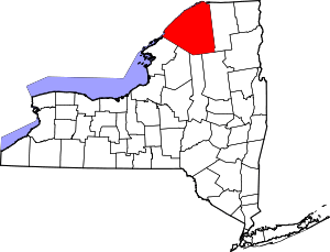 | |
| Towns | ||
| Villages | ||
| CDPs |
| |
| Hamlets | ||