Camden County, Missouri
| Camden County, Missouri | |
|---|---|
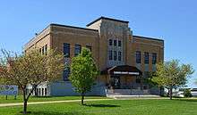 Camden County Courthouse, Camdenton | |
 Location in the U.S. state of Missouri | |
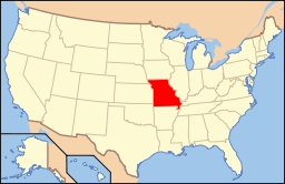 Missouri's location in the U.S. | |
| Founded | January 29, 1841 |
| Named for | Charles Pratt, 1st Earl Camden |
| Seat | Camdenton |
| Largest city | Osage Beach |
| Area | |
| • Total | 709 sq mi (1,836 km2) |
| • Land | 656 sq mi (1,699 km2) |
| • Water | 53 sq mi (137 km2), 7.4 |
| Population (est.) | |
| • (2015) | 44,237 |
| • Density | 67/sq mi (26/km²) |
| Congressional districts | 3rd, 4th |
| Time zone | Central: UTC-6/-5 |
| Website |
www |
Camden County is a county located in the U.S. state of Missouri. As of the 2010 Census, the population was 44,002.[1] Its county seat is Camdenton.[2] The county was organized January 29, 1841 as Kinderhook County and renamed in 1843 for Charles Pratt, 1st Earl Camden, Lord Chancellor of the United Kingdom, and leader of the Whig Party.[3][4]
Geography
According to the U.S. Census Bureau, the county has a total area of 709 square miles (1,840 km2), of which 656 square miles (1,700 km2) is land and 53 square miles (140 km2) (7.4%) is water.[5]
Adjacent counties
- Morgan County (north)
- Miller County (northeast)
- Pulaski County (east)
- Laclede County (southeast)
- Dallas County (southwest)
- Hickory County (west)
- Benton County (northwest)
Major highways
Fire Towers
Fire Towers Include:
- Branch Fire Tower
- Climax Springs Fire Tower
- Hurricane Deck Fire Tower
Demographics
| Historical population | |||
|---|---|---|---|
| Census | Pop. | %± | |
| 1850 | 2,338 | — | |
| 1860 | 4,975 | 112.8% | |
| 1870 | 6,108 | 22.8% | |
| 1880 | 7,266 | 19.0% | |
| 1890 | 10,040 | 38.2% | |
| 1900 | 13,113 | 30.6% | |
| 1910 | 11,582 | −11.7% | |
| 1920 | 10,474 | −9.6% | |
| 1930 | 9,142 | −12.7% | |
| 1940 | 8,971 | −1.9% | |
| 1950 | 7,861 | −12.4% | |
| 1960 | 9,116 | 16.0% | |
| 1970 | 13,315 | 46.1% | |
| 1980 | 20,017 | 50.3% | |
| 1990 | 27,495 | 37.4% | |
| 2000 | 37,051 | 34.8% | |
| 2010 | 44,002 | 18.8% | |
| Est. 2015 | 44,237 | [6] | 0.5% |
| U.S. Decennial Census[7] 1790-1960[8] 1900-1990[9] 1990-2000[10] 2010-2015[1] | |||
As of the census[11] of 2000, there were 37,051 people, 15,779 households, and 11,297 families residing in the county. The population density was 57 people per square mile (22/km²). There were 33,470 housing units at an average density of 51 per square mile (20/km²). The racial makeup of the county was 97.68% White, 0.26% Black or African American, 0.49% Native American, 0.29% Asian, 0.04% Pacific Islander, 0.22% from other races, and 1.03% from two or more races. Approximately 0.93% of the population were Hispanic or Latino of any race.
There were 15,779 households out of which 23.80% had children under the age of 18 living with them, 61.80% were married couples living together, 6.60% had a female householder with no husband present, and 28.40% were non-families. 23.30% of all households were made up of individuals and 9.50% had someone living alone who was 65 years of age or older. The average household size was 2.31 and the average family size was 2.68.
In the county the population was spread out with 20.30% under the age of 18, 6.10% from 18 to 24, 23.30% from 25 to 44, 31.40% from 45 to 64, and 19.00% who were 65 years of age or older. The median age was 45 years. For every 100 females there were 100.00 males. For every 100 females age 18 and over, there were 97.50 males.
The median income for a household in the county was $35,840, and the median income for a family was $40,695. Males had a median income of $28,020 versus $20,825 for females. The per capita income for the county was $20,197. About 8.00% of families and 11.40% of the population were below the poverty line, including 17.00% of those under age 18 and 7.70% of those age 65 or over.
Education
Public schools
- Camdenton R-III School District – Camdenton
- Dogwood Elementary School (PK-02)
- Hawthorne Elementary School (03-04)
- Osage Beach Elementary School (PK-04)
- Hurricane Deck Elementary School (PK-04)
- Oak Ridge Intermediate School (05-06)
- Camdenton Middle School (07-08)
- Camdenton High School (09-12)
- Climax Springs R-IV School District – Climax Springs
- Climax Springs Elementary School (K-06)
- Climax Springs High School (07-12)
- Macks Creek R-V School District – Macks Creek
- Macks Creek Elementary School (PK-06)
- Macks Creek High School (07-12)
- Stoutland R-II School District – Stoutland
- Stoutland Elementary School (PK-06)
- Stoutland High School (07-12)
Private schools
- Camden Christian School – Camdenton (PK-12) – Baptist
Politics
Local
The Republican Party predominantly controls politics at the local level in Camden County. Republicans hold all but one of the elected positions in the county.
| Camden County, Missouri | ||||
|---|---|---|---|---|
| Elected countywide officials | ||||
| Assessor | Kayla Henry | Democratic | ||
| Circuit Clerk | Jo McElwee | Republican | ||
| County Clerk | Rowland Todd | Republican | ||
| Collector | Vicky Burns | Republican | ||
| Commissioner (Presiding) |
Greg Hasty | Republican | ||
| Commissioner (District 1) |
Beverly Thomas | Republican | ||
| Commissioner (District 2) |
Cliff Luber | Republican | ||
| Prosecuting Attorney | Brian Keedy | Republican | ||
| Public Administrator | Nancy A. Douglas | Republican | ||
| Recorder | Donnie Snelling | Republican | ||
| Sheriff | Dwight Franklin | Republican | ||
| Treasurer | Elaine Gilley | Republican | ||
State
| Year | Republican | Democratic | Third Parties |
|---|---|---|---|
| 2008 | 48.79% 10,716 | 49.15% 10,795 | 2.06% 453 |
| 2004 | 61.18% 11,956 | 37.87% 7,401 | 0.95% 184 |
| 2000 | 56.24% 9,555 | 41.55% 7,059 | 2.21% 376 |
| 1996 | 50.25% 7,385 | 46.34% 6,810 | 3.42% 502 |
Camden County is divided into four legislative districts in the Missouri House of Representatives, all of which are held by Republicans.
- District 115 – Rodney Schad (R-Versailles). Consists of the communities of Lake Ozark and Osage Beach.
| Party | Candidate | Votes | % | ± | |
|---|---|---|---|---|---|
| Republican | Rodney Schad | 248 | 76.54 | ||
| Independent | Randy Dinwiddie | 76 | 23.46 | ||
- District 146 – Darrel Pollock (R-Lebanon). Consists of the community of Stoutland.
| Party | Candidate | Votes | % | ± | |
|---|---|---|---|---|---|
| Republican | Darrel Pollock | 477 | 100.00 | ||
| Party | Candidate | Votes | % | ± | |
|---|---|---|---|---|---|
| Republican | David Day | 31 | 100.00 | ||
- District 155 – Diane Franklin (R-Camdenton). Consists of most of the county and includes the communities of Camdenton, Climax Springs, Linn Creek, Macks Creek, Osage Beach, Sunrise Beach, and Village of Four Seasons.
| Party | Candidate | Votes | % | ± | |
|---|---|---|---|---|---|
| Republican | Diane Franklin | 10,303 | 65.63 | ||
| Democratic | John W. Page | 5,396 | 34.37 | ||
All of Camden County is a part of Missouri’s 33rd District in the Missouri Senate and is currently represented by Chuck Purgason (R-Caulfield).
| Party | Candidate | Votes | % | ± | |
|---|---|---|---|---|---|
| Republican | Chuck Purgason | 13,190 | 63.38 | ||
| Democratic | Eric Reeve | 7,621 | 36.62 | ||
Federal
Most of Camden County is included in Missouri’s 4th Congressional District and is currently represented by Vicky Hartzler (R-Harrisonville) in the U.S. House of Representatives.
| Party | Candidate | Votes | % | ± | |
|---|---|---|---|---|---|
| Republican | Vicky Hartzler | 9,266 | 58.71 | ||
| Democratic | Ike Skelton* | 5,732 | 36.32 | ||
| Libertarian | Jason Michael Braun | 514 | 3.26 | ||
| Constitution | Greg Cowan | 272 | 1.72 | ||
A small part of the county is included in Missouri’s 9th Congressional District and is currently represented by Blaine Luetkemeyer (R-St. Elizabeth) in the U.S. House of Representatives.
| Party | Candidate | Votes | % | ± | |
|---|---|---|---|---|---|
| Republican | Blaine Luetkemeyer | 750 | 82.51 | ||
| Libertarian | Christopher W. Dwyer | 159 | 17.49 | ||
Political Culture
| Year | Republican | Democratic | Third Parties |
|---|---|---|---|
| 2008 | 63.40% 14,074 | 35.02% 7,773 | 1.58% 350 |
| 2004 | 67.23% 13,122 | 32.26% 6,296 | 0.52% 101 |
| 2000 | 60.58% 10,358 | 36.98% 6,323 | 2.44% 418 |
| 1996 | 48.93% 7,190 | 37.88% 5,566 | 13.19% 1,938 |
Missouri Presidential Preference Primary (2008)
- Former U.S. Senator Hillary Clinton (D-New York) received more votes, a total of 2,794, than any candidate from either party in Camden County during the 2008 presidential primary.
| Camden County, Missouri | ||
|---|---|---|
| 2008 Republican primary in Missouri | ||
| John McCain | 2,196 (33.92%) | |
| Mike Huckabee | 2,133 (32.94%) | |
| Mitt Romney | 1,843 (28.46%) | |
| Ron Paul | 194 (3.00%) | |
| Camden County, Missouri | ||
|---|---|---|
| 2008 Democratic primary in Missouri | ||
| Hillary Clinton | 2,794 (57.99%) | |
| Barack Obama | 1,867 (38.75%) | |
| John Edwards (withdrawn) | 129 (2.68%) | |
Communities
- Branch
- Camdenton (county seat)
- Climax Springs
- Hurricane Deck
- Kaiser
- Lake Ozark (mostly in Miller County)
- Linn Creek
- Macks Creek
- Montreal
- Osage Beach
- Richland (mostly in Pulaski County)
- Stoutland
- Sunrise Beach
- Village of Four Seasons
See also
References
- 1 2 "State & County QuickFacts". United States Census Bureau. Retrieved September 7, 2013.
- ↑ "Find a County". National Association of Counties. Archived from the original on 2011-05-31. Retrieved 2011-06-07.
- ↑ Eaton, David Wolfe (1916). How Missouri Counties, Towns and Streams Were Named. The State Historical Society of Missouri. p. 268.
- ↑ "Disappearing Missouri Names". The Kansas City Star. March 19, 1911. p. 15. Retrieved August 15, 2014 – via Newspapers.com.

- ↑ "2010 Census Gazetteer Files". United States Census Bureau. August 22, 2012. Retrieved November 14, 2014.
- ↑ "County Totals Dataset: Population, Population Change and Estimated Components of Population Change: April 1, 2010 to July 1, 2015". Retrieved July 2, 2016.
- ↑ "U.S. Decennial Census". United States Census Bureau. Archived from the original on May 11, 2015. Retrieved November 14, 2014.
- ↑ "Historical Census Browser". University of Virginia Library. Retrieved November 14, 2014.
- ↑ "Population of Counties by Decennial Census: 1900 to 1990". United States Census Bureau. Retrieved November 14, 2014.
- ↑ "Census 2000 PHC-T-4. Ranking Tables for Counties: 1990 and 2000" (PDF). United States Census Bureau. Retrieved November 14, 2014.
- ↑ "American FactFinder". United States Census Bureau. Archived from the original on 2013-09-11. Retrieved 2011-05-14.
Further reading
- History of Laclede, Camden, Dallas, Webster, Wright, Texas, Pulaski, Phelps, and Dent counties, Missouri (1889) full text
External links
- Digitized 1930 Plat Book of Camden County from University of Missouri Division of Special Collections, Archives, and Rare Books
 |
Benton County | Morgan County | Miller County | |
| Hickory County | |
Pulaski County | ||
| ||||
| | ||||
| Dallas County | Laclede County |
Municipalities and communities of Camden County, Missouri, United States | ||
|---|---|---|
| Cities | | |
| Villages | ||
| Townships | ||
| CDPs | ||
| Other unincorporated communities | ||
| Footnotes | ‡This populated place also has portions in an adjacent county or counties | |
Coordinates: 38°02′N 92°46′W / 38.03°N 92.77°W