Callander
| Callander | |
| Scottish Gaelic: Calasraid | |
 |
|
 Callander |
|
| Population | 2,754 [1] (2001 census) est. 3,130[2] (2006) |
|---|---|
| OS grid reference | NN628079 |
| Council area | Stirling |
| Country | Scotland |
| Sovereign state | United Kingdom |
| Post town | CALLANDER |
| Postcode district | FK17 |
| Dialling code | 01877 33.... |
| Police | Scottish |
| Fire | Scottish |
| Ambulance | Scottish |
| EU Parliament | Scotland |
| UK Parliament | Stirling |
| Scottish Parliament | Stirling |
Coordinates: 56°14′39″N 4°12′52″W / 56.24403°N 4.21446°W
Callander (/ˈkæləndər/; Scottish Gaelic: Calasraid) is a small town in the region of Stirling, Scotland, situated on the River Teith. The town is located in the former county of Perthshire and is a popular tourist stop to and from the Highlands.
The town serves as the eastern gateway to the Loch Lomond and the Trossachs National Park, the first National Park in Scotland. Due to its location it is often referred to as the "Gateway to the Highlands".[3] The former St. Kessog's Church is now The Clanranald Trust for Scotland head office.
Dominating the town to the north are the Callander Crags, a visible part of the Highland Boundary Fault, rising to 343 m at the cairn.[4] Ben Ledi (879 m) lies north-west of Callander. Local walks include Bracklinn Falls, The Meadows, Callander Crags and the Wood Walks.[5][5] The town sits on the Trossachs Bird of Prey Trail.[6] The River Teith is formed from the confluence of two smaller rivers, the Garbh Uisge (River Leny) and Eas Gobhain about half a mile west of the bridge at Callander.
McLaren High School founded in 1892 educates pupils aged 11 to 18 from a wide catchment area extending as far as Killin, Tyndrum and Inversnaid.
Callander achieved prominence during the 1960s as the fictional setting "Tannochbrae" in the BBC television series Dr. Finlay's Casebook.[7]
History
There is evidence of a neolithic site situated south of the river, which was excavated in 2001 finding evidence of a building and neolithic pottery.[8] The Auchenlaich Cairn, a neolithic chambered cairn which at 322 m in length is the longest in Britain, is situated near Keltie Bridge just east of Callander.[9]
Saint Kessog, a disciple of Columba of Iona, preached and taught in this area in the early sixth century. A small mound by the River Teith is named in pseudo-Gaelic as "Tom na Chessaig", meaning "the Hill of Kessog".[10]
In 1645, during the campaigns of Montrose, a battle was fought at Callander between the Campbells of Argyll and the Atholl men. The Campbells were harassing the McGregors and the McNabs for their allegiance to Montrose. While besieging Castle Ample the news came of the advance of 700 Atholl men under Inchbrakie. A retreat was made southwards, but, as the Campbells were crossing a ford to the east of the village of Callander, they were overtaken and compelled to give battle. Inchbrakie, advancing part of his force to attack the defenders, quietly marched another detachment towards a ford higher up near the present bridge. A crossing was soon effected, and the Campbells, being unexpectedly attacked on the rear, broke and fled, leaving eighty of their men dead on the field.
As late as 1845 Scottish Gaelic was still spoken in Callander with two schools still teaching it.[11]
Callander was served by rail from 1 July 1858 as the terminus of a branch line from Dunblane.[12] A second Callander railway station was opened about 1⁄2 mile (800 m) to the west, behind the Dreadnought Hotel, on 1 June 1870 when the railway was extended to Killin en route to Oban, and closed on 5 November 1965. Sections of this former Callander and Oban Railway line, between Callander and Strathyre and between Balquhidder and Killin Junction, are now part of the National Cycle Network (route 7)[13] and the Rob Roy Way.[14] Track from the dismantled Callander and Oban Railway was used in the construction of the transit system for the 1968 Summer Olympics in Mexico City.[12]
Annual events
- Callander X 10k (29 April 2012) [15]
- Trossachs Beer Festival (24 August - 3 September 2012) [16]
- Callander Jazz & Blues Festival (28–30 September 2012) [17]
Trivia
- The fictional villain Destro from G.I. Joe, a military-themed line of toys from Hasbro, is said to come from Callander, and his family have lived there since at least the 15th century.
- The second to last person to be tried and imprisoned for the crime of Witchcraft in the UK was Helen Duncan, from Callander, during World War Two.[18]


Postcard gallery
-
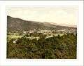
General view Callander
-

Callander Bridge

References
- ↑ "Comparative Population Profile: Callander Locality". Scotland's Census Results Online. 2001-04-29. Retrieved 2008-09-01.
- ↑ "Archived copy". Archived from the original on 2009-09-16. Retrieved 2008-09-02.
- ↑ Gazetteer Link
- ↑ Ordnance Survey - Callander Crags
- 1 2 Callander and Local Area walks
- ↑ Trossachs Bird of Prey Trail
- ↑ "BBC Alba to re-run Dr Finlay's Casebook to mark 50th anniversary". BBC News. 14 August 2012. Retrieved 11 October 2013.
- ↑ Barclay, Gordon; Brophy, Kenneth; MacGregor, Gavin (2002). "A Neolithic building at Claish Farm, near Callander, Stirling Council, Scotland, UK". Antiquity. Antiquity Publications. 76 (291): 23–24. Retrieved 11 October 2013.
- ↑ Batey, Colleen, ed. (1991). Discovery and Excavation in Scotland: an annual survey of Scottish archaeological discoveries, excavation and fieldwork (PDF). Council for Scottish Archaeology. p. 9. ISBN 090135211X. ISSN 0419-411X.
- ↑ "A History of Callander The Trossachs, Scotland". Retrieved 11 October 2013.
- ↑ Newton, Michael.(2010). Bho Chluaidh Gu Calasraid - from the Clyde to Callander: Gaelic Songs, Poetry, Tales and Traditions of the Lennox and Menteith in Gaelic with English Translations, p. 285. The Grimsay Press ISBN 1845300688.
- 1 2 Thomas, John (1990). The Callander & Oban railway. The history of the railways of the Scottish Highlands. 4 (2 ed.). David St John Thomas. ISBN 9780946537464.
- ↑ National Cycle Network
- ↑ Rob Roy Way
- ↑ Callander X 10k
- ↑ Trossachs Beer Festival
- ↑ Callander Jazz & Blues Festival
- ↑ "Britain's 'last witch': Campaign to pardon Helen Duncan". BBC News. Retrieved 11 October 2013.