Buton
 | |
| Geography | |
|---|---|
| Location | South East Asia |
| Coordinates | 5°3′S 122°53′E / 5.050°S 122.883°ECoordinates: 5°3′S 122°53′E / 5.050°S 122.883°E |
| Area | 4,408 km2 (1,702 sq mi) |
| Administration | |
|
Indonesia | |
| Province | South East Sulawesi |
| Largest settlement | Bau-Bau (pop. 137,118) |
| Demographics | |
| Population | 447,408 (2010) |
| Ethnic groups | Butonese people |
- Not to be confused with Buton Island, Riau Islands, off Bintan.
Buton (also Butung, Boeton or Button), is an island in Indonesia located off the southeast peninsula of Sulawesi. It covers roughly 4,408 square kilometers in area, or about the size of Madura; it is the 129th largest island in the world and Indonesia's 19th largest in area.
History
In the precolonial era, the island, then usually known as Butung, was within the sphere of influence of Ternate. Especially in the sixteenth century it served as an important secondary regional center within the Ternaten empire, controlling regional trade and collecting tribute to be sent to Ternate.
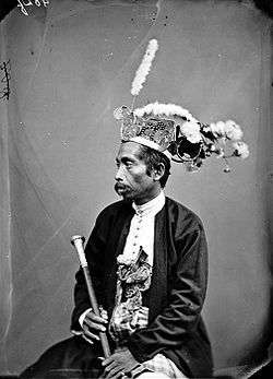
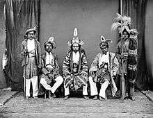
Sultan Murhum, the first Islamic monarch on the island, is remembered in the name of the island's major harbor, Murhum Harbor, in Baubau.
Geography
Its largest town is Bau-Bau, where the Wolio and Cia-Cia languages are spoken. Major nearby islands include Wawonii (to the north), Muna and Kabaena (to the west) and Siumpu (to the southwest). The Tukangbesi Islands lie just to the east where Tukang Besi is spoken, and is separated by the Gulf of Kolowana Watabo (Teluk Kolowana Watabo).
Batuatas Island is to the south. Also the Bouton Passage(as it was known in the pre-Independence era) was an important inter-island navigational location of the northern Flores Sea.[1]
Ecology
The island is largely covered by rainforest and is known for its wildlife. It is one of only two habitats of the anoa, a type of buffalo.
People
The languages spoken on Buton include Wolio, Cia-Cia, various dialects of Muna, Tukang Besi, Kumbewaha, Lasalimu, Kamaru, Pancana, Busoa, Taloki, Kulisusu and Kioko.[2][3] The Indonesian language, the national language of Indonesia, is also widely used and taught in schools.
In 2009, the Cia-Cia tribe in Bau-Bau city began to use the Korean Hangul alphabet for their language, based on textbooks created by the Hunminjeongeum Society, a linguistic society in Seoul.[4]
Economy
The island has a massive reserve of natural asphalt and several other minerals. Asphalt from Buton can be utilized as bitumen modifiers [5] as well as a substitute to petroleum asphalt. As a result, it reduces the dependency on conventional fossil based resources.
Administration
Buton island is administered under three second level administrative divisions (Daerah Tingkat II): Bau-bau City, Buton Regency, and North Buton Regency. However, the eponymous archipelago is administered under an additional three regencies: Muna Regency, Wakatobi Regency, and (part of) Bombana Regency.
Notes
- ↑ Goodall, George (Editor)(1943) Philips' International Atlas London, George Philip and Son map 'East Indies' pp.91-92
- ↑ van den Berg, Rene. "Preliminary Notes on the Cia-Cia language (South Buton)". Excursies in Celebes. p. 305. ISBN 90-6718-032-7.
- ↑ "Ethnologue". Retrieved 2009-10-11.
- ↑ "Cia-Cia adopts Hangul to preserve spoken language". 7 August 2009.
- ↑ "Buton Asphalt Indonesia".