Bustan HaGalil
| Bustan HaGalil בֻּסְתַּן הַגָּלִיל | |
|---|---|
 Bustan HaGalil | |
| Coordinates: 32°57′4.32″N 35°4′58.07″E / 32.9512000°N 35.0827972°ECoordinates: 32°57′4.32″N 35°4′58.07″E / 32.9512000°N 35.0827972°E | |
| District | Northern |
| Council | Mateh Asher |
| Region | Western Galilee |
| Affiliation | Agricultural Union |
| Founded | 1948 |
| Founded by | Romanian Jews |
| Population (2015)[1] | 961 |
| Name meaning | Orchard of the Galilee |

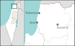
Bustan HaGalil (Hebrew: בֻּסְתַּן הַגָּלִיל or בוסתן הגליל lit. Orchard of the Galilee) is a moshav in the Western Galilee in northern Israel. Located near Acre, it falls under the jurisdiction of Mateh Asher Regional Council. In 2015 its population was 961.
History
It was founded in 1948 by Holocaust survivors from Romania and was located on the land of the depopulated Arab village of Al-Manshiyya, north of the village site.[2] The site had previously been used for the Sydney Smith Barracks, where the Armistice of Saint Jean d'Acre, which ended the Syria-Lebanon campaign of World War II in 1941, was signed.[3] [4] The name is symbolic, taken after the orchards in the area.[3]
After the 1948 Arab–Israeli War, residents of the moshav of Beit Yosef joined them.
References
- ↑ "List of localities, in Alphabetical order" (PDF). Israel Central Bureau of Statistics. Retrieved 16 October 2016.
- ↑ Khalidi, 1992, "All That Remains," p. 23
- 1 2 Mapa's concise gazetteer of Israel (in Hebrew). Yuval El'azari (ed.). Tel-Aviv: Mapa Publishing. 2005. p. 55. ISBN 965-7184-34-7.
- ↑ Time Magazine in partnership with CNN, "Acre Pact", 21 July 1941
External links
- Bustan HaGalil Authority for Development of the Galilee (Hebrew)