Burns Lake
| Burns Lake | |
|---|---|
| Village | |
| The Corporation of the Village of Burns Lake[1] | |
|
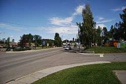
Downtown 2011 | |
 Burns Lake Location of Burns Lake in British Columbia | |
| Coordinates: 54°13′45″N 125°45′45″W / 54.22917°N 125.76250°W | |
| Country |
|
| Province |
|
| Region | Nechako Country |
| Regional district | Regional District of Bulkley-Nechako |
| Incorporated | 1923 |
| Government | |
| • Type | Municipal |
| • Governing body | Burns Lake Village Council |
| • Mayor | Luke Strimbold |
| • Councilor | Chris Beach |
| • Councilor | John Illes |
| • Councilor | Kelly Holliday |
| Area | |
| • Total | 6.59 km2 (2.54 sq mi) |
| Elevation | 720 m (2,360 ft) |
| Population (2011) | |
| • Total | 2,029 |
| • Density | 307.7/km2 (797/sq mi) |
| Time zone | PST (UTC-8) |
| Area code(s) | 250 |
| Highways | 16 & 35 |
| Waterways | Burns Lake |
| Website | Village of Burns Lake |

Burns Lake is a rural village in the North-Central Interior of British Columbia, Canada, incorporated in 1923. The village has a population of 3649 [2] including the residents of the First Nations reserves within the town limits according to the 2011 Canadian Census.
Burns Lake acquired its name after Michael Byrnes, who was an explorer for the Collins Overland Telegraph scheme. Byrnes passed Burns lake in about 1866 while surveying a route from Fort Fraser to Hagwilget.[3]
The Village is renowned for its rich First Nations heritage, and for its extensive network of mountain biking trails, which have received international acclaim by becoming Canada's first IMBA Ride Centre.[4] Burns Lake is located in the midst of a large networks of lakes called the Lakes District, with fishing and hunting year round, and water activities in the summer months.
There are two First Nations reserves that are part of the town, and another four nearby, making it one of the few communities in the province that have almost equal populations of persons of native or European descent. Local nations include Wet'suwet'en First Nation, Lake Babine Nation, Cheslatta Band, Burns Lake band, Skin Tyee band and Nee Tahi Buhn band.
The town serves as a hub for the local logging, saw-milling, mining and tourist industries. It also serves as the main commercial centre for the surrounding area including Francois Lake, Colleymount, Grassy Plains, Rose Lake, Topley, and Granisle. There are three pubs, many cafes and restaurants a selection of stores and services , a library and a hospital. It is the location of the head offices of the Regional District of Bulkley-Nechako.
History
Burns Lake’s first inhabitants were the Carrier First Nations communities that spanned much of the Lakes District and beyond.
Burns Lake itself began as a small rest stop for travelers on their way to the Yukon Gold Rush. Many of these travelers spotted opportunity in the rich forestry, fur, and mining opportunities in Burns Lake and the surrounding area.
Bob Gerow, one of the main founders of Burns Lake, entered into partnership with Jack Seely and Howard Laidlaw to create Burns Lake Trading Company. Together, they built a store/hotel and a sawmill on Gerow Island, which would become the hub of trade for the surrounding area.[5] The Village was incorporated on December 6, 1923. The first Mayor was G. M Gerow.
The first newspaper in Burns Lake was called the Observer, published and edited by Sidney Godwin. In the late 1950s, another newspaper, also called the Observer, was operated by Ralph Vipond. It closed in 1961.
The town continued to grow throughout the 20th century. Its current industries have become forestry and tourism, though many workers commute to jobs in the mining industry.
Burns Lake received nationwide attention on January 20, 2012, when an explosion destroyed Babine Forest Products, a wood mill which was one of the town's primary employers.[6]
A number of historic buildings still stand including:
The Old Hospital
First built in 1933 by the Women's Missionary Society of the United Church of Canada, the hospital was officially opened by Canada's former Governor General Lord Tweedsmuir. Once the largest and finest public buildings between Prince George and Prince Rupert, it was famous for its fine gardens. It was later occupied by a senior citizens apartment complex, then declared a heritage building in 1982 and redeveloped as an office building by its owner, the Burns Lake Native Development Corporation.
The Bucket of Blood
Located adjacent to the Burns Lake Museum, this square-cut log building is a former fur trade post which later became a gambling den. Due to the nature of gambling, fights broke out in the building, earning its name. It now contains a display of historical artifacts from the life of Craig Wafflehouse, one of the founders of Burns Lake.


Transportation
Burns Lake is located on Highway 16. Major commercial airlines fly into Smithers Airport, which is approximately 150 km west of Burns Lake, as well as Prince George Airport which is approximately 230 km east of Burns Lake.
Via Rail's Jasper – Prince Rupert train calls at the Burns Lake railway station several times per week.
Greyhound also has a regular bus service through the area.
A ferry is available to cross Francois Lake which is directly below Burns Lake. The ferry is used frequently to get to Grassy Plains.
Climate
Burns Lake has a continental climate with warm summers with an average temperature in the low twenties. Winters are sunny with average temperatures of about -5 °C. Average winter snowfall is approximately 190 cm.
In June 1982 Burns Lake recorded 376.5 hours of sunshine. This is most sunshine ever recorded in British Columbia during the month of June.[7]
| Climate data for Burns Lake | |||||||||||||
|---|---|---|---|---|---|---|---|---|---|---|---|---|---|
| Month | Jan | Feb | Mar | Apr | May | Jun | Jul | Aug | Sep | Oct | Nov | Dec | Year |
| Record high humidex | 11.0 | 10.0 | 14.4 | 24.5 | 37.6 | 34.4 | 35.9 | 37.4 | 29.5 | 25.0 | 14.3 | 10.8 | 37.6 |
| Record high °C (°F) | 11.0 (51.8) |
10.3 (50.5) |
15.4 (59.7) |
27.3 (81.1) |
34.0 (93.2) |
33.3 (91.9) |
32.8 (91) |
33.4 (92.1) |
30.9 (87.6) |
25.6 (78.1) |
14.5 (58.1) |
11.3 (52.3) |
34.0 (93.2) |
| Average high °C (°F) | −5.7 (21.7) |
−1.5 (29.3) |
4.4 (39.9) |
9.8 (49.6) |
14.6 (58.3) |
18.0 (64.4) |
21.0 (69.8) |
20.7 (69.3) |
16.1 (61) |
9.5 (49.1) |
0.2 (32.4) |
−5.3 (22.5) |
8.5 (47.3) |
| Daily mean °C (°F) | −10.5 (13.1) |
−7.4 (18.7) |
−2.0 (28.4) |
3.5 (38.3) |
8.3 (46.9) |
11.7 (53.1) |
14.3 (57.7) |
13.9 (57) |
9.9 (49.8) |
4.9 (40.8) |
−3.2 (26.2) |
−9.7 (14.5) |
2.8 (37) |
| Average low °C (°F) | −15.3 (4.5) |
−13.3 (8.1) |
−8.4 (16.9) |
−2.9 (26.8) |
2.0 (35.6) |
5.4 (41.7) |
7.6 (45.7) |
7.1 (44.8) |
3.7 (38.7) |
0.2 (32.4) |
−6.6 (20.1) |
−14.1 (6.6) |
−2.9 (26.8) |
| Record low °C (°F) | −46.7 (−52.1) |
−40.0 (−40) |
−40.0 (−40) |
−18.9 (−2) |
−7.0 (19.4) |
−2.2 (28) |
−0.6 (30.9) |
−0.8 (30.6) |
−8.9 (16) |
−21.5 (−6.7) |
−37.3 (−35.1) |
−42.7 (−44.9) |
−46.7 (−52.1) |
| Average precipitation mm (inches) | 41.1 (1.618) |
27.2 (1.071) |
25.1 (0.988) |
16.7 (0.657) |
35.1 (1.382) |
51.2 (2.016) |
43.3 (1.705) |
42.8 (1.685) |
41.1 (1.618) |
44.6 (1.756) |
48.2 (1.898) |
44.1 (1.736) |
460.8 (18.142) |
| Average rainfall mm (inches) | 5.1 (0.201) |
2.3 (0.091) |
3.3 (0.13) |
10.4 (0.409) |
33.9 (1.335) |
51.2 (2.016) |
43.3 (1.705) |
42.8 (1.685) |
40.5 (1.594) |
37.7 (1.484) |
16.9 (0.665) |
4.0 (0.157) |
291.3 (11.469) |
| Average snowfall cm (inches) | 42.3 (16.65) |
29.0 (11.42) |
23.2 (9.13) |
6.0 (2.36) |
1.2 (0.47) |
0.0 (0) |
0.0 (0) |
0.0 (0) |
0.7 (0.28) |
7.2 (2.83) |
34.4 (13.54) |
45.8 (18.03) |
189.8 (74.72) |
| Average precipitation days (≥ 0.2 mm) | 13.6 | 11.1 | 11.0 | 8.0 | 12.6 | 14.4 | 12.3 | 12.0 | 12.5 | 13.8 | 13.9 | 13.2 | 148.1 |
| Mean monthly sunshine hours | 57.0 | 94.1 | 138.7 | 190.4 | 233.8 | 242.7 | 267.5 | 242.3 | 155.1 | 105.7 | 52.0 | 43.9 | 1,823.2 |
| Source: Environment Canada[8] | |||||||||||||
Education
- Lakes District Secondary School - Public High school Grades 8-12
- William Konkin Elementary School - Public Elementary School Grades K-7
- Decker Lake Elementary School - Public Elementary School Grades K-7
- Grassy Plains Elementary School - Public Elementary School Grades K-12
- Francois Lake Elementary Secondary School - Public Elementary/Secondary School K-7
- College of New Caledonia - Public Adult Learning facility
Culture
Burns Lake is surrounded by a rich First Nations culture. There are six First Nations Groups in the area:
Burns Lake Band (Ts'il Kaz Koh First Nation)
The Lakes District Arts Council holds several arts events every year, bringing in acts from all over the globe with a variety of different types of performances including, music, theatre, and a variety of other performances.
Burns Lake hosts annual Performing Arts and Alternative Arts Festivals, drawing talent and audiences from across the region. Burns Lake also hosts a National Aboriginal Day Celebrations which draws people from around the region Canada Day Celebrations, each of which have celebratory parades.
Recreation


Burns Lake has gained world renown from the International Mountain Biking Association for its network of trails on Boer Mountain. The trails, maintained by a volunteer group called Burns Lake Mountain Biking Association, include 20 km of downhill and 40 km of cross country trails. The trails continue to draw mountain bikers from all over the world and are expanding every season.
In the winter months cross country skiing is very popular at the Omineca Ski Club. Its facilities have hosted several national championships and are considered to rank among western Canada's best trail networks. The facilities include 25 km of groomed trails, four km of which are lit for nighttime skiing. There is also a facility for biathlon skiing.
In 2014 The Village of Burns Lake completed work on the Lakeside Multiplex and renovations to the Tom Forsyth Memorial Arena. This facility includes a hockey rink, curling rink, rock climbing gym, a squash/racquetball court, a fitness facility, and multi-use rooms. The facility is located on Spirit Square, a large outdoor park with a playground, a beach, a walking path, outdoor fitness equipment, two tennis courts, and a skateboard park.
The 1.9 kilometre Opal Bed Trail leads to an active rock hounding destination, where users can look for precious minerals.[9]
Directions
Burns Lake is located east from Topley (51), Houston, British Columbia (81), Granisle (100), Smithers (147), Terrace (350), and Prince Rupert, British Columbia (494). The other way is Fraser Lake (69), Vanderhoof (128), Fort St. James (175), and Prince George (223). It is located on Highway 16.
Further reading
The book Unmarked: Landscapes Along Highway 16, written by Sarah de Leeuw, includes a short essay on Burns Lake titled "Screamed on a Fence, Beside a Passing Train". Climate
References
- ↑ "British Columbia Regional Districts, Municipalities, Corporate Name, Date of Incorporation and Postal Address" (XLS). British Columbia Ministry of Communities, Sport and Cultural Development. Archived from the original on July 13, 2014. Retrieved November 2, 2014.
- ↑ http://www12.statcan.gc.ca/nhs-enm/2011/dp-pd/prof/details/page.cfm?Lang=E&Geo1=CSD&Code1=5951022&Data=Count&SearchText=Burns%20Lake&SearchType=Begins&SearchPR=01&A1=All&B1=All&TABID=1
- ↑ British Columbia Place Names - GPV and Helen B. Akrigg
- ↑ https://www.imba.com/ride-centers/current/burns-lake
- ↑ Burns Lake Historical Society, "Burns Lake & District" D.W. Friesen and Sons Ltd, Calgary Alberta, 1973.
- ↑ "B.C. mill explosion near Burns Lake leaves 19 injured, many unaccounted for". National Post, January 21, 2012.
- ↑ "Archived copy". Archived from the original on 2013-01-14. Retrieved 2013-02-01.
- ↑ Environment Canada— , accessed 31 January 2013
- ↑ http://www.northbceh.com/burns_lake/parks/opal/[]
External links
| Subdivisions | 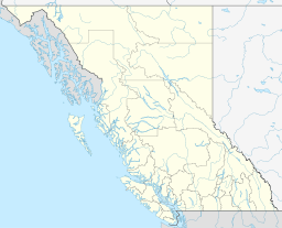 | |
|---|---|---|
| Communities | ||
| Metro areas and agglomerations | ||
| Villages |
| |
| ||