Burgoon, Ohio
| Burgoon, Ohio | |
|---|---|
| Village | |
|
Community grain elevator | |
 Location of Burgoon, Ohio | |
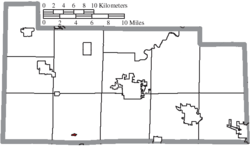 Location of Burgoon in Sandusky County | |
| Coordinates: 41°16′1″N 83°15′0″W / 41.26694°N 83.25000°WCoordinates: 41°16′1″N 83°15′0″W / 41.26694°N 83.25000°W | |
| Country | United States |
| State | Ohio |
| County | Sandusky |
| Township | Sandusky |
| Area[1] | |
| • Total | 0.12 sq mi (0.31 km2) |
| • Land | 0.12 sq mi (0.31 km2) |
| • Water | 0 sq mi (0 km2) |
| Elevation[2] | 705 ft (215 m) |
| Population (2010)[3] | |
| • Total | 172 |
| • Estimate (2012[4]) | 171 |
| • Density | 1,433.3/sq mi (553.4/km2) |
| Time zone | Eastern (EST) (UTC-5) |
| • Summer (DST) | EDT (UTC-4) |
| ZIP code | 43407 |
| Area code(s) | 419 |
| FIPS code | 39-10282[5] |
| GNIS feature ID | 1056740[2] |

Burgoon /ˈbɜːrɡuːn/[6] is a village in Sandusky County, Ohio, United States. The population was 172 at the 2010 census.
Geography
Burgoon is located at 41°16′1″N 83°15′0″W / 41.26694°N 83.25000°W (41.266832, -83.250024).[7]
According to the United States Census Bureau, the village has a total area of 0.12 square miles (0.31 km2), all land.[1]
Demographics
| Historical population | |||
|---|---|---|---|
| Census | Pop. | %± | |
| 1880 | 110 | — | |
| 1920 | 208 | — | |
| 1930 | 246 | 18.3% | |
| 1940 | 267 | 8.5% | |
| 1950 | 223 | −16.5% | |
| 1960 | 243 | 9.0% | |
| 1970 | 221 | −9.1% | |
| 1980 | 244 | 10.4% | |
| 1990 | 224 | −8.2% | |
| 2000 | 199 | −11.2% | |
| 2010 | 172 | −13.6% | |
| Est. 2015 | 170 | [8] | −1.2% |
2010 census
As of the census[3] of 2010, there were 172 people, 67 households, and 47 families residing in the village. The population density was 1,433.3 inhabitants per square mile (553.4/km2). There were 76 housing units at an average density of 633.3 per square mile (244.5/km2). The racial makeup of the village was 95.9% White, 0.6% Native American, 0.6% Asian, and 2.9% from other races. Hispanic or Latino of any race were 7.0% of the population.
There were 67 households of which 35.8% had children under the age of 18 living with them, 47.8% were married couples living together, 13.4% had a female householder with no husband present, 9.0% had a male householder with no wife present, and 29.9% were non-families. 23.9% of all households were made up of individuals and 10.5% had someone living alone who was 65 years of age or older. The average household size was 2.57 and the average family size was 3.04.
The median age in the village was 39.8 years. 25.6% of residents were under the age of 18; 7.6% were between the ages of 18 and 24; 25.1% were from 25 to 44; 26.1% were from 45 to 64; and 15.7% were 65 years of age or older. The gender makeup of the village was 48.8% male and 51.2% female.
2000 census
As of the census[5] of 2000, there were 199 people, 68 households, and 56 families residing in the village. The population density was 2,210.6 people per square mile (853.7/km²). There were 78 housing units at an average density of 866.5 per square mile (334.6/km²). The racial makeup of the village was 94.47% White, 1.51% Asian, 2.51% from other races, and 1.51% from two or more races. Hispanic or Latino of any race were 5.03% of the population.
There were 68 households out of which 38.2% had children under the age of 18 living with them, 66.2% were married couples living together, 11.8% had a female householder with no husband present, and 17.6% were non-families. 16.2% of all households were made up of individuals and 8.8% had someone living alone who was 65 years of age or older. The average household size was 2.93 and the average family size was 3.27.
In the village the population was spread out with 33.7% under the age of 18, 5.0% from 18 to 24, 29.6% from 25 to 44, 20.6% from 45 to 64, and 11.1% who were 65 years of age or older. The median age was 34 years. For every 100 females there were 111.7 males. For every 100 females age 18 and over, there were 106.3 males.
The median income for a household in the village was $54,063, and the median income for a family was $58,125. Males had a median income of $40,625 versus $25,662 for females. The per capita income for the village was $18,934. None of the families and 1.1% of the population were living below the poverty line.
History
A post office called Burgoon has been in operation since 1873.[10] The village is named after Isadore H. Burgoon, a railroad official.[11] An exhibit on I.H. Burgoon can be found at the Rutherford B. Hayes Presidential Center in Fremont.
References
- 1 2 "US Gazetteer files 2010". United States Census Bureau. Archived from the original on 2012-01-24. Retrieved 2013-01-06.
- 1 2 "US Board on Geographic Names". United States Geological Survey. 2007-10-25. Retrieved 2008-01-31.
- 1 2 "American FactFinder". United States Census Bureau. Retrieved 2013-01-06.
- ↑ "Population Estimates". United States Census Bureau. Archived from the original on 2013-06-17. Retrieved 2013-06-17.
- 1 2 "American FactFinder". United States Census Bureau. Archived from the original on 2013-09-11. Retrieved 2008-01-31.
- ↑ http://scrippsjschool.org/pronunciation/
- ↑ "US Gazetteer files: 2010, 2000, and 1990". United States Census Bureau. 2011-02-12. Retrieved 2011-04-23.
- ↑ "Annual Estimates of the Resident Population for Incorporated Places: April 1, 2010 to July 1, 2015". Retrieved July 2, 2016.
- ↑ "Census of Population and Housing". Census.gov. Archived from the original on May 11, 2015. Retrieved June 4, 2015.
- ↑ "Sandusky County". Jim Forte Postal History. Retrieved 28 December 2015.
- ↑ Meek, Basil (1909). Twentieth Century History of Sandusky County, Ohio and Representative Citizens. Whipporwill Publications. p. 323.
Municipalities and communities of Sandusky County, Ohio, United States | ||
|---|---|---|
| Cities |  | |
| Villages | ||
| Townships | ||
| CDPs | ||
| Unincorporated communities | ||
| Footnotes | ‡This populated place also has portions in an adjacent county or counties | |