Bullard, Texas
| Bullard, Texas | |
|---|---|
| Town | |
 Location of Bullard, Texas | |
 | |
| Coordinates: 32°8′27″N 95°19′18″W / 32.14083°N 95.32167°WCoordinates: 32°8′27″N 95°19′18″W / 32.14083°N 95.32167°W | |
| Country |
|
| State |
|
| Counties | Smith, Cherokee |
| Government | |
| • Type | Council-Manager |
| • City Council |
Mayor Pam Frederick David Rhodes Jason Hendrix Shirley Coe Brent Ratekin Shane Neally |
| • City Manager | Jay Abercrombie |
| Area | |
| • Total | 3.37 sq mi (8.74 km2) |
| • Land | 3.36 sq mi (8.71 km2) |
| • Water | 0.01 sq mi (0.03 km2) |
| Elevation | 505 ft (154 m) |
| Population (2010) | |
| • Total | 2,463 |
| • Density | 732/sq mi (282.8/km2) |
| Time zone | Central (CST) (UTC-6) |
| • Summer (DST) | CDT (UTC-5) |
| ZIP code | 75757 |
| Area code(s) | 903 |
| FIPS code | 48-11212[1] |
| GNIS feature ID | 1331622[2] |
| Website |
www |
Bullard is a town in Smith and Cherokee counties in the U.S. state of Texas. It lies at the intersection of U.S. Route 69 and Farm-to-Market Roads 2137, 2493, and 344, about 15 miles (24 km) south of Tyler. The population was 2,463 at the 2010 census,[3] up from 1,150 at the 2000 census.
The Smith County portion of the town is part of the Tyler Metropolitan Statistical Area, while the Cherokee County portion is part of the Jacksonville Micropolitan Statistical Area.
Bullard was earlier known as "Etna" and "Hewsville". The town is named for John H. Bullard, a Confederate soldier, and Emma Eugenia (Erwin) Bullard. In 1881, John Bullard opened the Hewsville post office in his store. In 1883 the Etna post office, near Hewsville, was closed. Then the Hewsville office was renamed "Bullard". Many rural residents in northern Cherokee County are served by the Bullard post office. The bypassing of the railroad brought about the demise of Etna and the rise of Bullard.
History
The Etna post office, just west of Bullard, was granted in 1867, although settlers had been in the vicinity since the early 1850s. John and Emma Bullard arrived about 1870, and a new post office named Hewsville opened in Bullard's store in 1881. This caused the closing of the Etna post office in 1883 and a renaming of the Hewsville post office to Bullard.
When the Kansas and Gulf Short Line Railroad extended their route from Tyler to Lufkin they passed through Bullard and built a depot. In 1890 there were 200 residents and the town had most essential businesses plus a doctor and a telegraph office. The railroad was renamed several times - becoming the St. Louis, Arkansas and Texas Railway and then (1892) the Tyler and Southwestern Railway. In 1903 the two schools (segregated) had five teachers and 186 students between them. By 1914 the population had doubled to 400 and the railroad changed names once again - becoming the St. Louis Southwestern Railroad.
The 1920s saw the opening of a theater and the forming of a community band. The town gained some notoriety for its unique holding tank - a 7-foot-diameter (2.1 m) wooden tub with bars mounted on a wagon frame. When full, the contraption was driven to Tyler for emptying.
The population was still just 450 after World War II, and the community didn't get a city council until 1948.
By the mid 1960s the population had declined to only 300 but rebounded by 1973 when it was back up to 573. The community is now concentrated around the crossroads, and most residents commute to nearby Tyler.[4]
Geography
Bullard is located in southern Smith County, with a small portion extending south into Cherokee County. Four-lane U.S. Route 69 passes through the east side of town, leading north to Tyler and south to Jacksonville.
According to the U.S. Census Bureau, Bullard has a total area of 3.4 square miles (8.7 km2), of which 0.01 square miles (0.03 km2), or 0.36%, is water.[3]
Demographics
| Historical population | |||
|---|---|---|---|
| Census | Pop. | %± | |
| 1950 | 317 | — | |
| 1960 | 364 | 14.8% | |
| 1970 | 573 | 57.4% | |
| 1980 | 681 | 18.8% | |
| 1990 | 890 | 30.7% | |
| 2000 | 1,150 | 29.2% | |
| 2010 | 2,463 | 114.2% | |
| Est. 2015 | 2,832 | [5] | 15.0% |
As of the census[1] of 2000, there were 1,150 people, 429 households, and 326 families residing in the town. The population density was 811.8 people per square mile (312.7/km²). There were 464 housing units at an average density of 327.5 per square mile (126.2/km²). The racial makeup of the town was 95.65% White, 1.48% African American, 0.35% Native American, 0.52% Asian, 1.13% from other races, and 0.87% from two or more races. Hispanic or Latino of any race were 1.30% of the population.
There were 429 households out of which 45.2% had children under the age of 18 living with them, 59.2% were married couples living together, 14.2% had a female householder with no husband present, and 23.8% were non-families. 22.4% of all households were made up of individuals and 11.4% had someone living alone who was 65 years of age or older. The average household size was 2.68 and the average family size was 3.15.
In the town the population was spread out with 30.7% under the age of 18, 7.6% from 18 to 24, 31.2% from 25 to 44, 21.0% from 45 to 64, and 9.5% who were 65 years of age or older. The median age was 33 years. For every 100 females there were 84.3 males. For every 100 females age 18 and over, there were 80.3 males.
The median income for a household in the town was $39,167, and the median income for a family was $47,647. Males had a median income of $33,542 versus $23,587 for females. The per capita income for the town was $16,439. About 5.7% of families and 7.5% of the population were below the poverty line, including 8.1% of those under age 18 and 18.3% of those age 65 or over.
Education
The town of Bullard is served by the Bullard Independent School District. The schools of BISD are Bullard Primary, Bullard Elementary, Bullard Intermediate, Bullard Middle, and Bullard High School. The town of Bullard is also the home of Brook Hill School, a private, Christian school serving Pre K-12th grade students.
External links
References
- 1 2 "American FactFinder". United States Census Bureau. Archived from the original on 2013-09-11. Retrieved 2008-01-31.
- ↑ "US Board on Geographic Names". United States Geological Survey. 2007-10-25. Retrieved 2008-01-31.
- 1 2 "Geographic Identifiers: 2010 Census Summary File 1 (G001): Bullard town, Texas". U.S. Census Bureau, American Factfinder. Retrieved July 27, 2015.
- ↑ Troesser, John. "TexasEscapes.com". Retrieved 2009-05-03.
- ↑ "Annual Estimates of the Resident Population for Incorporated Places: April 1, 2010 to July 1, 2015". Retrieved July 2, 2016.
- ↑ "Census of Population and Housing". Census.gov. Archived from the original on April 22, 2013. Retrieved June 4, 2015.
Municipalities and communities of Cherokee County, Texas, United States | ||
|---|---|---|
| Cities |  | |
| Towns | ||
| CDP | ||
| Other unincorporated communities | ||
| Ghost towns | ||
| Footnotes | ‡This populated place also has portions in an adjacent county or counties | |
Municipalities and communities of Smith County, Texas, United States | ||
|---|---|---|
| Cities | 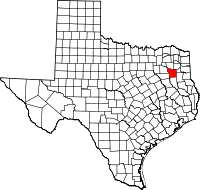 | |
| Towns | ||
| CDP |
| |
| Other unincorporated communities |
| |
| Ghost towns | ||
| Footnotes | ‡This populated place also has portions in an adjacent county or counties | |