Brown Township, Champaign County, Illinois
| Brown Township | |
|---|---|
| Township | |
 Location in Champaign County | |
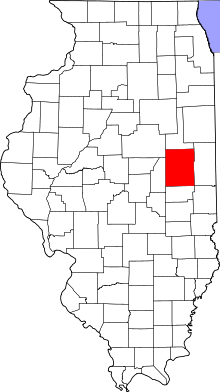 Champaign County's location in Illinois | |
| Coordinates: 40°21′32″N 88°24′43″W / 40.35889°N 88.41194°WCoordinates: 40°21′32″N 88°24′43″W / 40.35889°N 88.41194°W | |
| Country | United States |
| State | Illinois |
| County | Champaign |
| Established | September 1869 |
| Area | |
| • Total | 36.35 sq mi (94.1 km2) |
| • Land | 36.22 sq mi (93.8 km2) |
| • Water | 0.13 sq mi (0.3 km2) 0.36% |
| Elevation | 735 ft (224 m) |
| Population (2010) | |
| • Total | 1,995 |
| • Density | 55.1/sq mi (21.3/km2) |
| Time zone | CST (UTC-6) |
| • Summer (DST) | CDT (UTC-5) |
| GNIS feature ID | 0428720 |
Brown Township is a township in Champaign County, Illinois, USA. As of the 2010 census, its population was 1,995 and it contained 816 housing units.[1]
History
Brown Township was formed from a portion of East Bend Township in September, 1869.
Geography
According to the 2010 census, the township has a total area of 36.35 square miles (94.1 km2), of which 36.22 square miles (93.8 km2) (or 99.64%) is land and 0.13 square miles (0.34 km2) (or 0.36%) is water.[1]

Cities and towns
The city of Fisher lies in the southeast corner of the township; portions of the town extend into neighboring townships, but the majority is in Brown Township. The small town of Foosland is in the western part of the township along the route of the Norfolk Southern railroad.
Unincorporated towns
Lotus is a small settlement in the far southwestern part of the township; the railroad passes through it. Dickerson lies about 2 miles to the east of Lotus.
Transportation

U.S. Route 136 passes through Fisher and runs along the entire southern border of the township. Illinois State Route 47 passes through the township on its route from Mahomet in the south to Gibson City (in neighboring Ford County) in the north. Illinois State Route 54 passes from southwest to northeast through the far northwestern corner of the township on its route from Farmer City (in DeWitt County) to Gibson City.
A Norfolk Southern Railway line passes through the township, connecting Bement with Gibson City.
References
- "Brown Township, Champaign County, Illinois". Geographic Names Information System. United States Geological Survey. Retrieved 2010-01-04.
- United States Census Bureau cartographic boundary files
- 1 2 "Population, Housing Units, Area, and Density: 2010 - County -- County Subdivision and Place -- 2010 Census Summary File 1". United States Census. Retrieved 2013-05-28.
External links
 |
Cheney's Grove Township, McLean County | Drummer Township, Ford County | Dix Township, Ford County | |
| Bellflower Township, McLean County | |
East Bend Township | ||
| ||||
| | ||||
| Newcomb Township | Condit Township |
Municipalities and communities of Champaign County, Illinois, United States | ||
|---|---|---|
| Cities | ||
| Villages | ||
| Townships | ||
| CDPs | ||
| Other unincorporated communities | ||
| Footnotes | ‡This populated place also has portions in an adjacent county or counties | |