Brookville, Pennsylvania
| Brookville, Pennsylvania | |
|---|---|
| Borough | |
|
Downtown Brookville | |
 Brookville, Pennsylvania | |
| Coordinates: 41°09′35″N 79°04′49″W / 41.15972°N 79.08028°WCoordinates: 41°09′35″N 79°04′49″W / 41.15972°N 79.08028°W | |
| Country | United States |
| State | Pennsylvania |
| County | Jefferson |
| Settled | 1796 |
| Incorporated | 1830 |
| Government | |
| • Type | Borough council |
| • Mayor | Richard Beck[1] |
| Area | |
| • Total | 3.2 sq mi (8 km2) |
| Elevation | 1,273 ft (388 m) |
| Population (2000) | |
| • Total | 4,230 |
| • Density | 1,312.5/sq mi (506.8/km2) |
| Time zone | Eastern (EST) (UTC-5) |
| • Summer (DST) | EDT (UTC-4) |
| Zip code | 15825 |
| Area code(s) | 814 Exchanges: 220,849 |

Brookville is a borough in Jefferson County in the U.S. state of Pennsylvania, 100 miles (161 km) northeast of Pittsburgh. 2,472 people lived in Brookville in 1900, and 3,003 people lived there in 1910. The population was 4,230 at the 2000 census. Founded in 1830, it is the county seat of Jefferson County[2]
History
The area was initially settled in the late 1790s upon the arrival of brothers Joseph and Andrew Barnett,[3] as well as their brother-in-law Samuel Scott, who together established the first settlement at the confluence of the Sandy Lick and Mill Creeks in the area now known as Port Barnett. The first non-Native American settler of the land within the eventual town limits was Moses Knapp,[4] who built a log house at the confluence of North Fork Creek and Sandy Lick Creek (which form Redbank Creek) in 1801.[5][6]
Brookville's main source of economic development throughout the 19th century was the lumber industry. Brookville's many creeks and its connection to larger rivers (the Clarion to the north, which, like the Redbank, flows to the Allegheny) allowed for extensive construction of lumber mills along the watersheds and the floating of timber to markets in Pittsburgh. The town enjoyed great economic success during the late 19th and early 20th centuries, serving as home to several factories, breweries, an important railroad stop for local coal and timber, and briefly the Twyford Motor Car Company, which operated from 1905 to 1907 and produced the world's first 4-wheel drive automobile.[7]
The Brookville Historic District, Brookville Presbyterian Church and Manse, Gray-Taylor House, Joseph E. Hall House, and Phillip Taylor House are listed on the National Register of Historic Places.[8]
Geography

Brookville is located at 41°9′35″N 79°4′49″W / 41.15972°N 79.08028°W (41.159654, -79.080276).[9]
It is in the Eastern Standard time zone.
Elevation is 1,273 feet.
According to the United States Census Bureau, the borough has a total area of 3.2 square miles (8.3 km2), all of it land.
Demographics
| Historical population | |||
|---|---|---|---|
| Census | Pop. | %± | |
| 1850 | 763 | — | |
| 1860 | 1,360 | 78.2% | |
| 1870 | 1,942 | 42.8% | |
| 1880 | 2,136 | 10.0% | |
| 1890 | 2,478 | 16.0% | |
| 1900 | 2,472 | −0.2% | |
| 1910 | 3,003 | 21.5% | |
| 1920 | 3,272 | 9.0% | |
| 1930 | 4,387 | 34.1% | |
| 1940 | 4,397 | 0.2% | |
| 1950 | 4,274 | −2.8% | |
| 1960 | 4,620 | 8.1% | |
| 1970 | 4,314 | −6.6% | |
| 1980 | 4,568 | 5.9% | |
| 1990 | 4,184 | −8.4% | |
| 2000 | 4,230 | 1.1% | |
| 2010 | 3,924 | −7.2% | |
| Est. 2015 | 3,868 | [10] | −1.4% |
| Sources:[11][12][13] | |||
As of the census[12] of 2000, there were 4,230 people, 1,849 households, and 1,140 families residing in the borough. The population density was 1,312.6 people per square mile (507.2/km²). There were 1,976 housing units at an average density of 613.2 per square mile (236.9/km²). The racial makeup of the borough was 98.35% White, 0.26% African American, 0.09% Native American, 0.71% Asian, 0.09% from other races, and 0.50% from two or more races. Hispanic or Latino of any race were 0.47% of the population.
There were 1,849 households, out of which 28.0% had children under the age of 18 living with them, 47.0% were married couples living together, 11.5% had a female householder with no husband present, and 38.3% were non-families. 33.9% of all households were made up of individuals, and 18.3% had someone living alone who was 65 years of age or older. The average household size was 2.23 and the average family size was 2.85.
In the borough the population was spread out, with 22.0% under the age of 18, 8.1% from 18 to 24, 26.1% from 25 to 44, 23.4% from 45 to 64, and 20.5% who were 65 years of age or older. The median age was 41 years. For every 100 females there were 83.8 males. For every 100 females age 18 and over, there were 81.2 males.
The median income for a household in the borough was $30,843, and the median income for a family was $38,438. Males had a median income of $29,940 versus $20,395 for females. The per capita income for the borough was $18,437. About 9.1% of families and 13.2% of the population were below the poverty line, including 25.1% of those under age 18 and 8.4% of those age 65 or over.
Education
The Brookville Area School District provides Kindergarten through 12th grade public education for the community. The district operates Brookville Area Jr./Sr. High School (7th-12th), Hickory Grove Elementary School (3rd-6th), Pinecreek Elementary School (1st-2nd), and Northside Elementary School (K). Brookville is also one of four school districts whose students can attend the Jefferson County-DuBois Area Vocational-Technical School (JEFF TECH).
Economy
The town still supports the lumber industry, but coal has given way to natural gas. It now also features several small and medium-sized businesses and some significant manufacturing operations. Interstate 80, which traverses the United States, was constructed just north of the Brookville borough and continues to stimulate the local economy.
Current businesses/employers include:
- Brookville Equipment Corporation
- Brookville Hospital
- Brookville Glove Manufacting Company
- Humphrey Charcoal
- Brookville Wood Products
- BWP Bats
- Laurel Eye Clinic
- Miller Welding & Machine
- Matson Lumber
- Rexam Healthcare
- Beverage Air
Previous businesses include the Pittsburg and Shawmut Railroad.
Tourism is also important. In addition to the Brookville Historic District, as the "Gateway to Cook Forest", many travelers pass through Brookville. It is also home to the annual Western PA Laurel Festival each summer and to the Victorian Christmas Celebration each December. The community's historic preservation efforts have earned Brookville many accolades. Among these are the town's Main Street Project being recognized as having had the longest sustained impact of a Main Street Project in Pennsylvania and in 2012 its selection as a national finalist in the "America's Prettiest Painted Places" competition.[14] There is a small farming community called Hazen which houses a large flea market[15] during the warmer months.
References
- ↑ "Archived copy". Archived from the original on October 22, 2010. Retrieved 2010-10-04.
- ↑ "Find a County". National Association of Counties. Archived from the original on May 31, 2011. Retrieved 2011-06-07.
- ↑ Barnett, Andy. "Joseph Barnett". The Barnett Family Website. Reocities.com. Retrieved August 6, 2010.
- ↑ Knapp, Ernest O. (April 27, 2005). "KNAPP, Moses 1778 - 1847". Jefferson County PA Archives Biographies. USGenWeb Archives. Retrieved August 6, 2010.
- ↑ McKnight, William James (1917). "My First Recollections of Brookville, 1840 to 1843". Jefferson County, Pennsylvania: Her Pioneers and People, 1800-1915. Volume I: Historical. Chicago: J.H. Beers & Company. pp. 359–385. Retrieved August 6, 2010.
- ↑ Scott, Kate M. (1888). "History of Brookville". History of Jefferson county, Pennsylvania, with illustrations and biographical sketches of some of its prominent men and pioneers. Syracuse, New York: D. Mason & Co. pp. 413–475. Retrieved August 6, 2010.
- ↑ "Twyford Four-Wheel-Drive Cars". The Automobile. New York City. 14 (12). March 22, 1906.
- ↑ National Park Service (2010-07-09). "National Register Information System". National Register of Historic Places. National Park Service.
- ↑ "US Gazetteer files: 2010, 2000, and 1990". United States Census Bureau. 2011-02-12. Retrieved 2011-04-23.
- ↑ "Annual Estimates of the Resident Population for Incorporated Places: April 1, 2010 to July 1, 2015". Retrieved July 2, 2016.
- ↑ "Census of Population and Housing". U.S. Census Bureau. Archived from the original on May 11, 2015. Retrieved 11 December 2013.
- 1 2 "American FactFinder". United States Census Bureau. Archived from the original on September 11, 2013. Retrieved 2008-01-31.
- ↑ "Incorporated Places and Minor Civil Divisions Datasets: Subcounty Resident Population Estimates: April 1, 2010 to July 1, 2012". Population Estimates. U.S. Census Bureau. Archived from the original on June 17, 2013. Retrieved 11 December 2013.
- ↑ http://www.usatoday.com/story/dispatches/2012/11/01/prettiest-painted-towns-and-neighborhoods/1661327/
- ↑ http://www.hazenfleamarket.com/
External links
![]() Media related to Brookville, Pennsylvania at Wikimedia Commons
Media related to Brookville, Pennsylvania at Wikimedia Commons
Municipalities and communities of Jefferson County, Pennsylvania, United States | ||
|---|---|---|
| Boroughs | 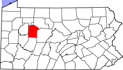 | |
| Townships | ||
| CDP | ||
| Unincorporated communities |
| |
| Footnotes | ‡This populated place also has portions in an adjacent county or counties | |