Brookline Town Green Historic District
|
Brookline Town Green Historic District | |
|
First Parish in Brookline | |
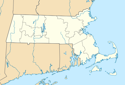  | |
| Location | Chestnut Pl., Fairmont, Dudley, Boyston, Walnut and Warren Sts., Hedge, Codman, and Kennard Rds., Brookline, Massachusetts |
|---|---|
| Coordinates | 42°19′36″N 71°7′53″W / 42.32667°N 71.13139°WCoordinates: 42°19′36″N 71°7′53″W / 42.32667°N 71.13139°W |
| Built | 1775 |
| Architect | Gridley James Fox Bryant,et al |
| Architectural style | Colonial Revival, Greek Revival, Italianate |
| NRHP Reference # | 80000650[1] |
| Added to NRHP | June 22, 1980 |

The Brookline Town Green Historic District encompasses the historic colonial heart of the town of Brookline, Massachusetts. It is bounded on the east by Kennard Street, Chestnut Place, and a portion of Chestnut Street, and on the south by Codman Place, part of Walnut Street, Welch Road, and Warren Street. The western boundary is part of Lee Street between Warren and Dudley Streets, and the northern border skirts the southern edge of Reservoir Park and then runs along Massachusetts Route 9. The area includes the site of the town's first four meeting houses, its first town hall and Old Burying Ground, and a neighborhood of gracious 19th-century residences on large lots. It notably includes the Frederick Law Olmsted National Historic Site.[2]
The district was listed on the National Register of Historic Places in 1980.[1]
See also
- Green Hill Historic District, just south and east
- National Register of Historic Places listings in Brookline, Massachusetts
References
- 1 2 National Park Service (2008-04-15). "National Register Information System". National Register of Historic Places. National Park Service.
- ↑ "MACRIS inventory record for Brookline Town Green Historic District". Commonwealth of Massachusetts. Retrieved 2014-05-13.
| Topics |  | ||||||||||||||||||||||||||||||
|---|---|---|---|---|---|---|---|---|---|---|---|---|---|---|---|---|---|---|---|---|---|---|---|---|---|---|---|---|---|---|---|
| Lists by county | |||||||||||||||||||||||||||||||
| Lists by city |
| ||||||||||||||||||||||||||||||
| Other lists | |||||||||||||||||||||||||||||||
| |||||||||||||||||||||||||||||||