Brookdale, New Jersey
| Brookdale, New Jersey | |
|---|---|
| Census-designated place | |
 Brookdale, New Jersey 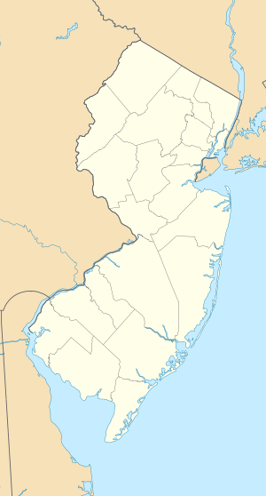 Brookdale, New Jersey  Brookdale, New Jersey Brookdale's location in Essex County. Inset: Location of Essex County in New Jersey. | |
| Coordinates: 40°50′06″N 74°10′47″W / 40.834945°N 74.179777°WCoordinates: 40°50′06″N 74°10′47″W / 40.834945°N 74.179777°W | |
| Country |
|
| State |
|
| County | Essex |
| Township | Bloomfield |
| Area[1] | |
| • Total | 1.607 sq mi (4.163 km2) |
| • Land | 1.603 sq mi (4.152 km2) |
| • Water | 0.004 sq mi (0.011 km2) 0.26% |
| Elevation[2] | 177 ft (54 m) |
| Population (2010 Census)[3] | |
| • Total | 9,239 |
| • Density | 5,763.0/sq mi (2,225.1/km2) |
| Time zone | Eastern (EST) (UTC-5) |
| • Summer (DST) | EDT (UTC-4) |
| ZIP code | 07003 - Bloomfield[4] |
| FIPS code | 3408110[5] |
| GNIS feature ID | 02583975[6] |
Brookdale is an unincorporated community and census-designated place (CDP) in Bloomfield, located within Essex County, New Jersey, United States.[7] It is generally considered to be the part of Bloomfield north of Bay Avenue, As of the 2010 United States Census, the CDP's total population was 9,239.[3]
History
The original English name of Brookdale was Stone House Plains. "Stone House" referred to a rock formation known as the stone house or great rock, supposed to have been suitable as a shelter, just north of the present-day intersection of Bellevue Avenue and Newell Drive.[8] The rock was still present in 1802, but removed not long afterward.[9] "Plains" referred to the plains of the segment of the Yantecaw River which passes through the area.[10]

As early as 1691, settlers, possibly including Abraham Van Giesen, had begun to populate the area along Bellevue Avenue.[9] By about 1750, two brothers, Garrabrant and Teunis Garrabrant, born 1723 and 1726, respectively in Bergen (now Jersey City), sons of Cornelius and Jannetje (Pier) Gerbrandsen, owned sizeable tracts in the vicinity of Brookdale Park, Bellevue Avenue and Broad Street.[11] About 1730 Alexander Cockefair, born about 1696 in Bushwick, purchased a "plantation" roughly bounded by the Yantecaw River and modern-day Broad Street and Watchung Avenue.[12] The Sigler and Coeyman families also had very early farms in Stone House Plains.[13] Descendants of these families operated farms, mills and other businesses in the area for over two centuries.[14]
Dutch was the primary language for many residents through the 18th century. In 1795, the Dutch Reformed Church of Stone House Plains (now Brookdale Reformed Church) was formed, creating a spiritual and social focal point for the community. The original church edifice was built in 1802; it burned and was rebuilt about 1857.[15] The Morris family, which operated mills just south of Brookdale, made a mill pond on the Yantecaw River.[16] In the mid-1800s, residents established the first school. In 1873, on the eve of US mail delivery service, the community voted to change the name to Brookdale.[17]
After World War I, much of the farmland was developed into residential housing. The Clark Thread Company bought the Morris pond (now Clark's Pond) and built an adjoining thread-coloring factory, later occupied by the Scientific Glass Company.[18] Portions of the Cockefair farm were converted to golf course and a junior high school (now Bloomfield Middle School). Essex County acquired and built Brookdale Park. In 1968, petrochemical engineering firm Lummus Company set up in northern Brookdale.[19]
Geography
According to the United States Census Bureau, the CDP had a total area of 1.607 square miles (4.163 km2), including 1.603 square miles (4.152 km2) of land and 0.004 square miles (0.011 km2) of water (0.26%).[1][20]
Demographics
| Historical population | |||
|---|---|---|---|
| Census | Pop. | %± | |
| 2010 | 9,239 | — | |
| Population sources: 2010[3] | |||
Census 2010
At the 2010 United States Census, there were 9,239 people, 3,445 households, and 2,580 families residing in the CDP. The population density was 5,763.0 per square mile (2,225.1/km2). There were 3,583 housing units at an average density of 2,234.9 per square mile (862.9/km2). The racial makeup of the CDP was 76.46% (7,064) White, 4.96% (458) Black or African American, 0.11% (10) Native American, 12.25% (1,132) Asian, 0.02% (2) Pacific Islander, 3.00% (277) from other races, and 3.20% (296) from two or more races. Hispanics or Latinos of any race were 11.74% (1,085) of the population.[3]
There were 3,445 households, of which 32.3% had children under the age of 18 living with them, 62.1% were married couples living together, 10.0% had a female householder with no husband present, and 25.1% were non-families. 20.1% of all households were made up of individuals, and 9.2% had someone living alone who was 65 years of age or older. The average household size was 2.68 and the average family size was 3.13.[3]
In the CDP, 21.9% of the population were under the age of 18, 6.0% from 18 to 24, 27.4% from 25 to 44, 29.5% from 45 to 64, and 15.2% who were 65 years of age or older. The median age was 41.6 years. For every 100 females there were 89.2 males. For every 100 females age 18 and over, there were 87.0 males.[3]
References
- 1 2 Gazetteer of New Jersey Places, United States Census Bureau. Accessed July 21, 2016.
- ↑ U.S. Geological Survey Geographic Names Information System: Brookdale Census Designated Place, Geographic Names Information System. Accessed November 6, 2012.
- 1 2 3 4 5 6 DP-1 - Profile of General Population and Housing Characteristics: 2010 Demographic Profile Data for Brookdale CDP, New Jersey, United States Census Bureau. Accessed November 6, 2012.
- ↑ Look Up a ZIP Code for Brookdale, NJ, United States Postal Service. Accessed November 6, 2012.
- ↑ American FactFinder, United States Census Bureau. Accessed September 4, 2014.
- ↑ US Board on Geographic Names, United States Geological Survey. Accessed September 4, 2014.
- ↑ New Jersey: 2010 - Population and Housing Unit Counts - 2010 Census of Population and Housing (CPH-2-32), United States Census Bureau, August 2012, p. III-3. Accessed November 6, 2012."
- ↑ Lee, Francis Bazley. Genealogical and Memorial History of the State of New Jersey, p. 175. Lewis Historical Publishing Company, 1910. Accessed June 14, 2016.
- 1 2 Folsom, Joseph F. Bloomfield, old and new: an historical symposium, pp. 167-168. Local resident Lewis Cockefair, born 1826, was used extensively as a source, and he evidently did not have first-hand knowledge of it.
- ↑ Google Maps, accessed Jun 13, 2016.
- ↑ Folsom, Joseph F., Bloomfield, old and new: an historical symposium, p 177-178.
- ↑ Folsom, Joseph F., Bloomfield, old and new: an historical symposium, p 171-174.
- ↑ Folsom, Joseph F. Bloomfield, old and new: an historical symposium, p. 177-179.
- ↑ Folsom, Joseph F. Bloomfield, old and new: an historical symposium, p. 165-166.
- ↑ Folsom, Joseph F. Bloomfield, old and new: an historical symposium, p. 122.
- ↑ Sidney, J. C. Map of Essex County, New Jersey: with the names of property holders &c. [Newark N.J.: H.A. Belding, 1850] Map. Accessed from the Library of Congress. (Accessed June 14, 2016.)
- ↑ Folsom, Joseph F. Bloomfield, old and new: an historical symposium, p. 162.
- ↑ "The New Town Crier" newsletter, Historical Society of Bloomfield, May 2013, p. 2.
- ↑ "A Brief History of Bloomfield", Township of Bloomfield, New Jersey, December 8, 2014. Accessed June 14, 2016.
- ↑ US Gazetteer files: 2010, 2000, and 1990, United States Census Bureau. Accessed September 4, 2014.
Municipalities and communities of Essex County, New Jersey, United States | ||
|---|---|---|
| Cities | 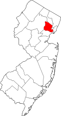 | |
| Boroughs | ||
| Townships | ||
| CDPs and planned communities | ||