Breaux Bridge, Louisiana
| Breaux Bridge, Louisiana (Le Pont-Breaux) | |
| City | |
.jpg) Shops in Breaux Bridge | |
| Nickname: Crawfish Capital of the World | |
| Country | United States |
|---|---|
| State | Louisiana |
| Parish | St. Martin |
| Elevation | 23 ft (7.0 m) |
| Coordinates | 30°16′25.1″N 91°53′57.6″W / 30.273639°N 91.899333°WCoordinates: 30°16′25.1″N 91°53′57.6″W / 30.273639°N 91.899333°W |
| Area | 6.7 sq mi (17.4 km2) |
| - land | 6.6 sq mi (17 km2) |
| - water | 0.1 sq mi (0 km2), 1.49% |
| Population | 8,139 (2010) |
| Density | 1,111.7/sq mi (429.2/km2) |
| Mayor | Ricky J. Calais (R) |
| Timezone | CST (UTC-6) |
| - summer (DST) | CDT (UTC-5) |
| Postal code | 70517 |
| Area code | 337 |
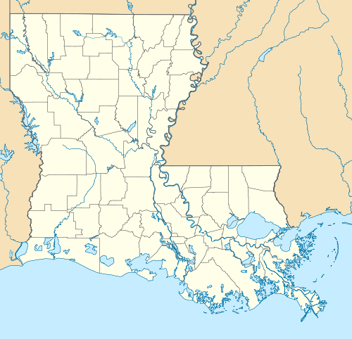 Location of Breaux Bridge in Louisiana
| |
 Location of Louisiana in the United States
| |
| Website: http://www.breauxbridgelive.com | |
Breaux Bridge (French: le Pont-Breaux; pronounced: [ləpɔ̃bʁo]) is a small city in St. Martin Parish, Louisiana, United States. The population is 8,139 as of the 2010 census. It is part of the Lafayette Metropolitan Statistical Area.
This community is called the "Crawfish Capital of the World," a designation obtained by former Speaker of the Louisiana House of Representatives Robert J. "Bob" Angelle. It is also known for its unusual listing of nicknames in its telephone directory.[1]

History
Acadian pioneer Firmin Breaux arrived as a single person with Joseph Broussard dit Beausoleil in early 1765, probably with the family of Michel Trahan. The Acadians suffered many deaths between April and November, 1765, and some left with the priest, Fr. Jean Francois, to go to St. James Parish. A census of Attakapas dated April 25, 1766, lists Firmin at a place named Bayou Tortue. He left after this census and went to St. James where he is listed on the Sept, 14, 1769 Census of The Acadian Coast. In 1774, Firmin, who by then was in Ascension Parish, LA, petitioned Spanish Governor Unzaga to allow him to return to Attakapas. This petition was approved, and Firmin purchased land in the vicinity of the present-day city of Breaux Bridge from Jean François Ledée, a wealthy New Orleans merchant who had acquired the land as a French land grant approved by the Spanish during the waning years of the French administration for the Spanish. By 1774, Breaux's branding iron was registered, and by 1786 he was one of the largest property owners in the Bayou Teche country.
In 1799, Breaux built a footbridge across the Bayou Teche to help ease the passage for his family and neighbors. This first bridge was a suspension footbridge, likely made of rope and small planks. It was stabilized by being tied to small pilings located at each end of the bridge, as well as to a pair of huge live oak trees on both sides of the bayou. When traveling directions were given, residents would often instruct people to "go to Breaux's bridge ...", which eventually was adopted as the city's name.[2]
In 1817, Firmin's son Agricole built the first vehicular bridge, allowing for the passage of wagons and increasing commerce in the area. The town received its official founding in 1829 when Scholastique Picou Breaux, Agricole's widow, drew up a plan called Plan de la Ville Du Pont des Breaux for the city and began developing the property by selling lots to other Acadian settlers. A church parish was created in 1847, and Breaux Bridge was officially incorporated in 1859.[2]
In 1959, the Louisiana legislature officially designated Breaux Bridge as "la capitale mondiale de l'écrevisse" ("The Crawfish Capital of the World").[3]
Geography
Breaux Bridge is located at 30°16′33″N 91°54′4″W / 30.27583°N 91.90111°W (30.275939, -91.901230).[4]
According to the United States Census Bureau, the city has a total area of 6.7 square miles (17 km2), of which, 6.6 square miles (17 km2) of it is land and 0.1 square miles (0.26 km2) of it is water. The total area is 1.65% water.
Demographics
| Historical population | |||
|---|---|---|---|
| Census | Pop. | %± | |
| 1880 | 443 | — | |
| 1890 | 654 | 47.6% | |
| 1900 | 654 | 0.0% | |
| 1910 | 1,339 | 104.7% | |
| 1920 | 1,171 | −12.5% | |
| 1930 | 1,399 | 19.5% | |
| 1940 | 1,668 | 19.2% | |
| 1950 | 2,492 | 49.4% | |
| 1960 | 3,303 | 32.5% | |
| 1970 | 4,942 | 49.6% | |
| 1980 | 5,922 | 19.8% | |
| 1990 | 6,515 | 10.0% | |
| 2000 | 7,281 | 11.8% | |
| 2010 | 8,139 | 11.8% | |
| Est. 2015 | 8,395 | [5] | 3.1% |
As of the 2010 United States Census, there were 8,139 people residing in the city. 50.0% were White, 47.3% African American, 0.4% Native American, 0.6% Asian, 0.4% from some other race and 1.3% from two or more races. 1.3% were Hispanic or Latino of any race.
As of the census[7] of 2000, there were 7,281 people, 2,512 households, and 1,821 families residing in the city. The population density was 1,111.7 people per square mile (429.2/km²). There were 2,740 housing units at an average density of 418.3 per square mile (161.5/km²). The racial makeup of the city was 49.84% White, 48.66% African American, 0.11% Native American, 0.32% Asian, 0.27% from other races, and 0.80% from two or more races. Hispanic or Latino of any race were 0.65% of the population. Of the population over the age of five, 68.3% spoke English at home, 28.3% spoke French, 1.7% spoke Spanish, and 1.6% spoke Louisiana Creole French.[8]
There were 2,512 households out of which 38.3% had children under the age of 18 living with them, 42.9% were married couples living together, 24.9% had a female householder with no husband present, and 27.5% were non-families. 23.5% of all households were made up of individuals and 8.8% had someone living alone who was 65 years of age or older. The average household size was 2.73 and the average family size was 3.23.
In the city the population was spread out with 30.1% under the age of 18, 10.7% from 18 to 24, 28.0% from 25 to 44, 19.0% from 45 to 64, and 12.2% who were 65 years of age or older. The median age was 32 years. For every 100 females there were 92.2 males. For every 100 females age 18 and over, there were 87.6 males.
The median income for a household in the city was $25,102, and the median income for a family was $31,570. Males had a median income of $30,880 versus $17,819 for females. The per capita income for the city was $12,536. About 26.8% of families and 30.7% of the population were below the poverty line, including 43.0% of those under age 18 and 25.8% of those age 65 or over.
Education
Public schools in St. Martin Parish are operated by the St. Martin Parish School Board. The city of Breaux Bridge is zoned to Breaux Bridge Primary School (Grades PK-3), Breaux Bridge Elementary School (Grades 4-6), Breaux Bridge Junior High School (Grades 7-8), and Breaux Bridge High School (Grades 9-12).
Private schools include St. Bernard Elementary (Grades PreK-8), and Louisiana Christian School (Grades PreK-12) .
Notable people
- J. Burton Angelle, member of the Louisiana House of Representatives from 1964 to 1972, director of the Louisiana Department of Wildlife and Fisheries, 1972-1980 and 1984-1988
- Scott Angelle, former interim Lieutenant Governor of Louisiana (2010) and member of the Louisiana Public Service Commission from District 2, son of J. Burton Angelle
- Lottie Beebe, superintendent of St. Martin Parish public schools; member of the Louisiana Board of Elementary and Secondary Education, resides in Breaux Bridge[9][10]
- Paula Davis, member of the Louisiana House of Representatives for District 69 in East Baton Rouge Parish; native of Breaux Bridge
- Jake Delhomme, former quarterback for the NFL's Houston Texans, Cleveland Browns, Carolina Panthers and New Orleans Saints
- Sonny Landreth, musician
- Hunter Hayes, musician
- Chris Hebert, Spinnaker champion
- Sandy Holloway, District 3 member of the Louisiana Board of Elementary and Secondary Education; born in Breaux Bridge, resides in Thibodaux
- Mike "Pete" Huval, state representative; former member of the St. Martin Parish Council, insurance agent
- Jules Jeanmard, Roman Catholic bishop
- Ali Landry, Miss Louisiana Teen USA 1990, Miss Louisiana USA 1996, Miss USA 1996
- Branford Marsalis, jazz musician and former band leader for the The Tonight Show
- Fred H. Mills, Jr., state senator and president of Farmers-Merchants Bank and Trust Co. in Breaux Bridge
- Domanick Williams, former running back for the Houston Texans, 2003 Pepsi NFL Rookie of the Year
- Mark L. Bernard, president of the Breaux Bridge Crawfish Festival
References
- ↑ Gloster, Rob. "Small Town`s Phone Book Caters To Nicknames". United Press International. Retrieved 23 July 2014.
- 1 2 gov.breauxbridgelive.com "History of Breaux Bridge" Archived January 4, 2014, at the Wayback Machine.
- ↑ Louisiana Department of Culture, Recreation and Tourism. "Breaux Bridge Historical Marker".
- ↑ "US Gazetteer files: 2010, 2000, and 1990". United States Census Bureau. 2011-02-12. Retrieved 2011-04-23.
- ↑ "Annual Estimates of the Resident Population for Incorporated Places: April 1, 2010 to July 1, 2015". Retrieved July 2, 2016.
- ↑ "Census of Population and Housing". Census.gov. Archived from the original on May 11, 2015. Retrieved June 4, 2015.
- ↑ "American FactFinder". United States Census Bureau. Archived from the original on 2013-09-11. Retrieved 2008-01-31.
- ↑ "Archived copy". Archived from the original on 2013-08-15. Retrieved 2013-08-23.
- ↑ "Results for Election Date: 10/22/2011". staticresults.sos.la.gov. Retrieved October 22, 2013.
- ↑ "Will Sentell, Beebe, the loyal opposition on BESE, July 29, 2013". Baton Rouge Morning Advocate. Retrieved October 22, 2013.
Further reading
- Castille, Jeanne M. Breaux Bridge Crawfish Festival. Lafayette, La: Attakapas Historical Association, 1976.
- Comeaux, Goldie. The Original Mulate's, Breaux Bridge, Louisiana Cookbook. [Breaux Bridge, La.]: G. Comeaux, 1994. ISBN 0-9643959-0-8
- Delcambre, Kenneth P. The Historical Chronolgy [sic] of Breaux Bridge Businesses, 1769-1954. Volume 1. [Breaux Bridge, La: Champvert, 2003.
- Delcambre, Kenneth P. The Breaux Bridge Author's Directory. Breaux Bridge, La: Champvert Publications, 2001.
- Delcambre, Kenneth P. World War II and Breaux Bridge, Louisiana. City of Breaux Bridge, La: K.P. Delcambre, 1999.
- Rees, Grover. A Narrative History of Breaux Bridge, Once Called "La Pointe". St. Martinville, La: Attakapas Historical Association, 1976.
- Sammons, Thomas C., and Brandee Duhon. Breaux Bridge: Urban Design for a Small Town. [Lafayette, La.]: Univ. of Louisiana at Lafayette, School of Architecture, 1990.
External links
| Wikimedia Commons has media related to Breaux Bridge, Louisiana. |
Municipalities and communities of St. Martin Parish, Louisiana, United States | ||
|---|---|---|
| Cities |  | |
| Towns | ||
| Village | ||
| CDPs | ||
| Other unincorporated communities |
| |
| Ghost town | ||
| Footnotes | ‡This populated place also has portions in an adjacent parish or parishes | |