Boylston, New York
| Boylston, New York | |
|---|---|
| Town | |
 Location in Oswego County and the state of New York. | |
| Coordinates: 43°39′22″N 75°58′44″W / 43.65611°N 75.97889°WCoordinates: 43°39′22″N 75°58′44″W / 43.65611°N 75.97889°W | |
| Country | United States |
| State | New York |
| County | Oswego |
| Area | |
| • Total | 39.1 sq mi (101.4 km2) |
| • Land | 39.1 sq mi (101.4 km2) |
| • Water | 0.0 sq mi (0.0 km2) |
| Elevation | 1,207 ft (368 m) |
| Population (2010) | |
| • Total | 549 |
| Time zone | Eastern (EST) (UTC-5) |
| • Summer (DST) | EDT (UTC-4) |
| ZIP code | 13083 |
| Area code(s) | 315 |
| FIPS code | 36-07674 |
| GNIS feature ID | 0978746 |
Boylston is a town in Oswego County, New York, U.S.. The population was 549 at the 2010 census. The name is that of the first landowner of the tract that became the town.
The Town of Boylston is located on the north boundary of the county.
History
The region was first called "Campania" and was first settled around 1812. Boylston was created from part of the Town of Orwell in 1828. The population of the town was always small.
Geography
According to the United States Census Bureau, the town has a total area of 39.2 square miles (102 km2), of which, 39.1 square miles (101 km2) of it is land and 0.03% is water.
The north town line with part of the west town line is the border of Jefferson County, New York.
Demographics
| Historical population | |||
|---|---|---|---|
| Census | Pop. | %± | |
| 1830 | 388 | — | |
| 1840 | 481 | 24.0% | |
| 1850 | 621 | 29.1% | |
| 1860 | 909 | 46.4% | |
| 1870 | 1,053 | 15.8% | |
| 1880 | 1,283 | 21.8% | |
| 1890 | 1,081 | −15.7% | |
| 1900 | 849 | −21.5% | |
| 1910 | 667 | −21.4% | |
| 1920 | 545 | −18.3% | |
| 1930 | 444 | −18.5% | |
| 1940 | 365 | −17.8% | |
| 1950 | 302 | −17.3% | |
| 1960 | 293 | −3.0% | |
| 1970 | 276 | −5.8% | |
| 1980 | 390 | 41.3% | |
| 1990 | 443 | 13.6% | |
| 2000 | 505 | 14.0% | |
| 2010 | 549 | 8.7% | |
| Est. 2014 | 554 | [1] | 0.9% |
As of the census[3] of 2000, there were 505 people, 193 households, and 137 families residing in the town. The population density was 12.9 people per square mile (5.0/km²). There were 333 housing units at an average density of 8.5 per square mile (3.3/km²). The racial makeup of the town was 98.02% White, 1.19% from other races, and 0.79% from two or more races. Hispanic or Latino of any race were 2.18% of the population.
There were 193 households out of which 31.6% had children under the age of 18 living with them, 58.0% were married couples living together, 7.3% had a female householder with no husband present, and 29.0% were non-families. 22.3% of all households were made up of individuals and 7.3% had someone living alone who was 65 years of age or older. The average household size was 2.62 and the average family size was 3.06.
In the town the population was spread out with 26.5% under the age of 18, 5.7% from 18 to 24, 30.5% from 25 to 44, 24.6% from 45 to 64, and 12.7% who were 65 years of age or older. The median age was 38 years. For every 100 females there were 110.4 males. For every 100 females age 18 and over, there were 107.3 males.
The median income for a household in the town was $39,375, and the median income for a family was $44,792. Males had a median income of $32,083 versus $25,625 for females. The per capita income for the town was $17,360. About 6.0% of families and 8.3% of the population were below the poverty line, including 12.8% of those under age 18 and 7.2% of those age 65 or over.
Communities and locations in Boylston
- Boylston Center – A hamlet located near the center of the town at Routes NY-13 and 50.
- East Boylston – A hamlet in the northeast part of the town on Route 17.
- Hemlock District – A location east of Boylston Center.
- North Boylston – A hamlet in the northwest corner of the town.
- Plantz Corners – A hamlet near the east town line on Routes 13 and 17.
- Smartville – A hamlet south of Boylston Center on Route 50.
- Tamarack Swamp – A bog in the southeast part of the town.
References
- ↑ "Annual Estimates of the Resident Population for Incorporated Places: April 1, 2010 to July 1, 2014". Retrieved June 4, 2015.
- ↑ "Census of Population and Housing". Census.gov. Archived from the original on May 11, 2015. Retrieved June 4, 2015.
- ↑ "American FactFinder". United States Census Bureau. Archived from the original on 2013-09-11. Retrieved 2008-01-31.
External links
Municipalities and communities of Oswego County, New York, United States | ||
|---|---|---|
| Cities | 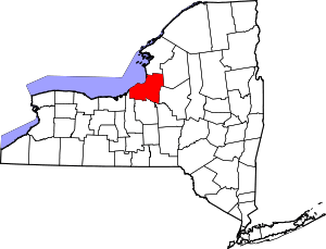 | |
| Towns | ||
| Villages | ||
| CDPs | ||
| Other hamlets |
| |
| Footnotes | ‡This populated place also has portions in an adjacent county or counties | |