Boutte, Louisiana
| Boutte | |
| Census-designated place | |
| Country | United States |
|---|---|
| State | Louisiana |
| Parish | St. Charles |
| Elevation | 3 ft (0.9 m) |
| Coordinates | 29°54′04″N 90°23′11″W / 29.90111°N 90.38639°WCoordinates: 29°54′04″N 90°23′11″W / 29.90111°N 90.38639°W |
| Area | 3.8 sq mi (9.8 km2) |
| - land | 3.7 sq mi (10 km2) |
| - water | 0.1 sq mi (0 km2) |
| Population | 3,075[1] (2010) |
| Density | 582.6/sq mi (224.9/km2) |
| Timezone | CST (UTC-6) |
| - summer (DST) | CDT (UTC-5) |
| Area code | 985 |
 Location of Boutte in Louisiana
| |
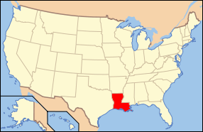 Location of Louisiana in the United States
| |
Boutte is a census-designated place (CDP) in St. Charles Parish, Louisiana, United States. The population was 3,075 at the 2010 census.
Geography
Boutte is located at 29°54′4″N 90°23′11″W / 29.90111°N 90.38639°W (29.901060, -90.386434).[2]
According to the United States Census Bureau, the CDP has a total area of 3.8 square miles (9.8 km2), of which, 3.7 square miles (9.6 km2) of it is land and 0.04 square miles (0.10 km2) of it (0.80%) is water.
Demographics
As of the census[1] of 2000, there were 2,181 people, 740 households, and 560 families residing in the CDP. The population density was 582.6 people per square mile (225.2/km²). There were 810 housing units at an average density of 216.4 per square mile (83.6/km²). The racial makeup of the CDP was 33.93% White, 64.10% African American, 0.50% Native American, 0.14% Asian, 0.05% Pacific Islander, 0.55% from other races, and 0.73% from two or more races. Hispanic or Latino of any race were 1.70% of the population.
There were 740 households out of which 40.7% had children under the age of 18 living with them, 43.1% were married couples living together, 27.0% had a female householder with no husband present, and 24.2% were non-families. 20.1% of all households were made up of individuals and 5.8% had someone living alone who was 65 years of age or older. The average household size was 2.94 and the average family size was 3.40.
In the CDP the population was spread out with 33.0% under the age of 18, 10.3% from 18 to 24, 29.3% from 25 to 44, 19.7% from 45 to 64, and 7.7% who were 65 years of age or older. The median age was 30 years. For every 100 females there were 85.0 males. For every 100 females age 18 and over, there were 77.9 males.
The median income for a household in the CDP was $27,132, and the median income for a family was $36,307. Males had a median income of $29,464 versus $18,913 for females. The per capita income for the CDP was $12,247. About 28.5% of families and 33.7% of the population were below the poverty line, including 41.4% of those under age 18 and 36.5% of those age 65 or over.
Education
St. Charles Parish Public School System operates public schools:
- R. J. Vial Elementary School (grades 3-5) in Paradis - Opened in 1975[3]
- J. B. Martin Middle School (grades 6-8) in Paradis[4]
- Hahnville High School in Boutte[5]
Notable residents
- Alfred Blue - NFL running back
- Garland Robinette - Journalist and news anchor
References
- 1 2 "American FactFinder". United States Census Bureau. Archived from the original on 2013-09-11. Retrieved 2015-06-16.
- ↑ "US Gazetteer files: 2010, 2000, and 1990". United States Census Bureau. 2011-02-12. Retrieved 2011-04-23.
- ↑ Home. R.J. Vial Elementary School. Retrieved on December 3, 2016. "R. J. Vial Elementary School, home of the Jaguars, was established in 1975 and has served the communities of Paradis, Bayou Gauche, Des Allemands, and Boutte for more than 40 years."
- ↑ "About Our School." J. B. Martin Middle School. Retrieved on December 3, 2016. "J. B. Martin Middle School is located on South Street in Paradis and services the west bank areas of Paradis, Des Allemands (Bayou Gauche), Boutte, and Luling (Mimosa/Willowdale)."
- ↑ "Hahnville High School" (Archive). AdvancED. p. 4/9. Retrieved on December 3, 2016. "Hahnville High School services all students on the west bank of the Mississippi River in St. Charles Parish, including the communities of Ama, Boutte, Hahnville, Luling, Paradis, Des Allemands and Killona."
Municipalities and communities of St. Charles Parish, Louisiana, United States | ||
|---|---|---|
| CDPs |  | |
| Other Unincorporated communities | ||
| Footnotes | ‡This populated place also has portions in an adjacent parish or parishes | |