Bous, Luxembourg
| Bous Bus | ||
|---|---|---|
| Commune | ||
 | ||
| ||
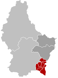
 Map of Luxembourg with Bous highlighted in orange, and the canton in dark red | ||
| Coordinates: 49°33′20″N 6°19′50″E / 49.5556°N 6.3306°ECoordinates: 49°33′20″N 6°19′50″E / 49.5556°N 6.3306°E | ||
| Country |
| |
| Canton | Remich | |
| Government | ||
| • Mayor | Joseph Johanns | |
| Area | ||
| • Total | 15.43 km2 (5.96 sq mi) | |
| Area rank | 75 of 105 | |
| Highest elevation | 294 m (965 ft) | |
| • Rank | 102nd of 105 | |
| Lowest elevation | 150 m (490 ft) | |
| • Rank | 9th of 105 | |
| Population (2014) | ||
| • Total | 1,450 | |
| • Rank | 87th of 105 | |
| • Density | 94/km2 (240/sq mi) | |
| • Density rank | 62nd of 105 | |
| Time zone | CET (UTC+1) | |
| • Summer (DST) | CEST (UTC+2) | |
| LAU 2 | LU00008001 | |
| Website | bous.lu | |

Bous (Luxembourgish: Bus) is a commune and small town in south-eastern Luxembourg. It is part of the canton of Remich, which is part of the district of Grevenmacher.
As of 2005, the town of Bous, which lies in the east of the commune, has a population of 505. Other towns within the commune include Assel, Erpeldange, and Rolling.
External links
-
 Media related to Bous, Luxembourg at Wikimedia Commons
 |
Lenningen, Stadtbredimus | | ||
| Waldbredimus | |
Stadtbredimus Remich | ||
| ||||
| | ||||
| Dalheim | |
Schengen |
 | ||
This article is issued from Wikipedia - version of the 12/1/2016. The text is available under the Creative Commons Attribution/Share Alike but additional terms may apply for the media files.