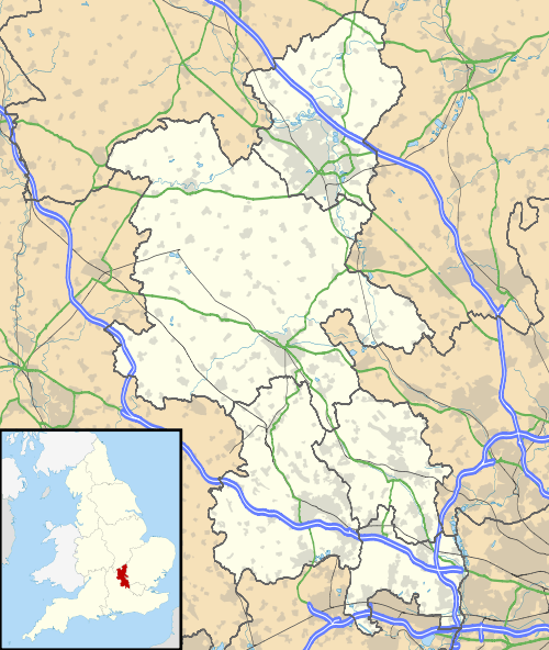
Bourne End, Buckinghamshire
| Bourne End | |
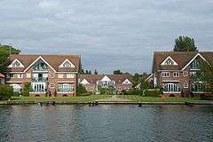
 Older properties by the Thames |
|
 21st century development by the Thames |
|
 Bourne End |
|
| Population | 5,320 |
|---|---|
| OS grid reference | SU895875 |
| Civil parish | Wooburn and Bourne End |
| District | Wycombe |
| Shire county | Buckinghamshire |
| Region | South East |
| Country | England |
| Sovereign state | United Kingdom |
| Post town | BOURNE END |
| Postcode district | SL8 |
| Dialling code | 01628 |
| Police | Thames Valley |
| Fire | Buckinghamshire |
| Ambulance | South Central |
| EU Parliament | South East England |
| UK Parliament | Beaconsfield |
|
|
Coordinates: 51°34′54″N 0°42′48″W / 51.581737°N 0.713382°W
Bourne End is a village mostly in the parish of Wooburn and Bourne End, but also in the parish of Little Marlow, in Buckinghamshire, England. At the 2011 Census the population was listed in the civil parish of Wooburn. The village is near the border with Berkshire, on the north side of the River Thames, close to where the River Wye empties into the Thames.[1]
History
Bourne End's original location is somewhat different from today's established village centre, a half a mile downstream on the River Thames. The name refers to the end of the river (bourne being an Old English term for 'river'), and it would be the mouth of the River Wye that this is derived from. The then hamlet appears on Morden's 1722 map of Buckinghamshire as "Born end".[2] It was noted in the nineteenth century however, that the name had been corrupted to "Bone End", apparently through local mispronunciation, and thence on official maps and documents; in 1858, the vicar of Wooburn successfully reversed this, and the corrected name remains in use today.[3]
The entire length of the River Wye was the provider of water power for many mills in the valley for hundreds of years, and Bourne End was no exception. There were four on the final stretch of the river; Princes Mill, Jacksons (or Gunpowder) Mill, Hedsor Mill and Lower Mill. These mills were historically the predominant employers of the area, along with the local farms and two wharfs on the Thames.
In the early nineteenth century, the settlement known as Bourne End was a hamlet of Wooburn parish, along with others such as Spring Gardens, Eghams Green, Cores End, Heavens Lea and Upper Bourne End. This changed with the emergence of the Wycombe Railway Company in 1846. By 1854, Isambard Kingdom Brunel had designed and constructed a railway linking Maidenhead to High Wycombe. The station was originally known as Marlow Road station, until 1874, a year after the branch line to Marlow was built, and from then on Bourne End station.[4] The railway created more travel opportunities for locals and greatly benefited the mills, and thus Bourne End expanded, on a greater scale than other similar settlements in the surrounding area. See Marlow Branch Line and Marlow Donkey for more information.
The hamlets soon merged into what is now known as Bourne End, as did Well End and Coldmoorholme in the neighbouring parish of Little Marlow. Both a church and school were built at the turn of the century for the residents' convenience. The Parade became established as the focal point of the village for shops and services.
In the 1920s Bourne End became home for two distinguished literary figures; Enid Blyton, a perennially popular children's writer, moved into Old Thatch on Coldmoorholm Lane, and Edgar Wallace, a prolific crime author and dramatist, bought Chalklands off Blind Lane. Another resident at this time was Louis Blériot, the French aviator and aircraft builder, who lived at New York Lodge beside the Thames.[5]
The Royalty Cinema opened in The Parade in 1934. The late 1940s saw extensive development in Bourne End, of the Chalklands estate and the Council Estate north of The Parade. The 1960s saw the building of Community Centre and Library in Wakeman Road after some years of local campaigning.
The Beeching Axe hit the village in 1969, as it was announced that the line between Bourne End and High Wycombe would be shut. The track bed was lifted soon after closure in 1970. A commercial estate was developed adjacent to the station, though most remains as a footpath between the village and Wooburn.
Today
Locale
Bourne End lies between the M4 and M40 motorways, and retains its railway station on the Maidenhead to Marlow branch line. With rail and road accessibility to London, it has become a popular place for commuters to live.
All of the mills along the Wye Valley have now been shut down and demolished, Jacksons Mill in Furlong Road being the last (in Bourne End) in the late 1980s. These have been replaced by houses, offices or industrial estates, which has led to the continuation of the village as an employment centre.
Bourne End remains a distinct settlement, although the continued house-building over the past century means it is threatened by the evident ribbon development, through to High Wycombe. In 1997, when the Local Plan was in preparation, the Residents Associations of Bourne End and Wooburn successfully lobbied to stop Slate Meadow (the field which separates the two settlements) being designated for housing for the time being. Other undeveloped land around the village looks likely to remain so, as it has been specified as Green Belt, an Area of Outstanding Natural Beauty, a Site of Special Scientific Interest, or a combination of the three. In parts, Bourne End is surrounded by farmland. Somewhat further away, Cliveden and Hedsor overlook the village from higher ground to the south east.
Community
Bourne End sustains many businesses and services whilst still retaining a village-like atmosphere. There is a Community Centre in the centre of the village, with a large hall, function rooms and a bar, which is open for member's use. It is, for many, considered the focal point of village activity.
In the early 2000s, a Twinning Association was established, and subsequently Octeville-sur-Mer, a town on the north coast of France, was chosen to be its twin town. Frequent events are held by members of the association to foster and enhance the relationship between the two settlements.
Administration and services
The local government of the village is made up of three tiers. Wooburn and Bourne End Parish Council (formerly Wooburn Parish Council, until 2005), based in Wooburn; Wycombe District Council, based in High Wycombe; and Buckinghamshire County Council, based in Aylesbury. The local police force is Thames Valley Police, who have an office in Boston Drive from which the local constables operate. Local healthcare services are commissioned by Buckinghamshire Primary Care Trust (PCT); GPs operate from The Hawthornden Surgery in Wharf Lane, and The Orchard Surgery in Station Road, and district nurses and health visitors are based at the Bourne End Clinic in Wakeman Road. There are two dentists, the Bourne End Dental Practice, and Advance Dental Services, both in Station Road.
Leisure

The village has two recreation grounds (Furlong Road and Blind Lane), riverside open space at the marina and Spade Oak Reach, a Junior Sports Club and fitness centre and the long-established Upper Thames Sailing Club. For many residents and visitors alike, the river is the central attraction of Bourne End, and many leisure pursuits involve or revolve around it. The Sailing Club traditionally host a week-long regatta every year in June, known as Bourne End Week.
Bourne End hosts a number of restaurants of varying cuisines. There are also a number of Public houses.
Near Bourne End, across the River Thames, is Cock Marsh, an area of common land and floodplain owned by the National Trust. It is a Site of Special Scientific Interest and has a prehistoric burial mound. Cock Marsh is accessible via the footbridge (attached to the railway bridge) over the river, and footpaths continue to Cookham, Cookham Dean and beyond.
The Thames Path National Trail follows the River Thames through Bourne End; upstream on the Buckinghamshire side, crossing the river at the footbridge, and downstream through Berkshire.
Education
Bourne End has three schools:
- Westfield School, on Highfield Road, a special school which was the village First School until 1995.
- Claytons Primary School, on Wendover Road, the village junior school which was formerly a Middle School and was merged with Westfield.
- Bourne End Academy, on New Road, an upper school which has specialist Sports College status. Prior to amalgamation with Pembroke School, Flackwell Heath in 1985, this was known as Deyncourt School, and subsequently Wye Valley School until 2014. From late 2012 to late 2014, the school was suffering from poor results in OFSTED evaluations, and was ultimately placed into Special Measures and given the academy status.
There are also a number of pre-schools and nurseries across the village.
Religion
The village currently has three active churches. The Anglican parish church, in Station Road, is dedicated to St. Mark, and was built in 1889 as a daughter church of St Paul's, Wooburn. The Roman Catholic church of St. Dunstan is in the centre of the village, off Cores End Road. The most well established is the United Reformed Church in Cores End, which was founded as a Congregational Chapel in 1773 (as a non-conformist alternative to St. Paul's in Wooburn).
Bourne End had a Methodist Church in Furlong Road, which closed down in 2002. Well End also once had a Congregational mission hall, in the late nineteenth and early twentieth centuries; this is now a residential house, named The Chapel.
There is also a branch of Ramakrishna Mission in the UK in Bourne End. It is called Vedanta Centre. This is the only centre in the UK which is affiliated to the Ramakrishna Mission. The centre aims to promote Vedanta in the UK.[6]
Shopping
Bourne End continues to support a bustling array of shops, chiefly in The Parade. Community events focused on the village centre, such as 'Fun Night' in December, have attempted to turn residents' attention to upholding local trade and businesses. There is a small parade of shops on Furlong Road, including the main Post Office.
References
- ↑ "Wooburn and Bourne End parish fact file, December 2005" (PDF). Archived from the original (PDF) on 27 September 2006. Retrieved 21 June 2006.
- ↑ "Buckinghamshire 1722, Robert Morden in Camden's Britannia". Retrieved 17 December 2007.
- ↑ Wheals, Brian Brenchley (1983). Theirs Were But Human Hearts. H. S. Publishing. ISBN 0-9509053-0-5.
- ↑ "Maidenhead and Marlow Passengers Association". Retrieved 3 February 2005.
- ↑ Christopher Winn: I Never Knew That about the Thames (London: Ebury Press, 2010), p. 112.
- ↑ Vedanta Centre UK, Accessed 23 December 2012
External links
| Wikimedia Commons has media related to Bourne End, Buckinghamshire. |
| Wikivoyage has a travel guide for Bourne End. |
- Bourne End, Bucks — community website
- The Bourne End (Bucks) Twinning Association website
- The Octeville sur Mer Twinning Association website
| Towns (component areas and hamlets) |  | |
|---|---|---|
| Other civil parishes (component villages and hamlets) |
| |
| Former districts and boroughs | ||
| Former constituencies | ||