Bogoslof Island
| Bogoslof Island | |
|---|---|
 Aerial view, looking south | |
| Highest point | |
| Elevation | 492 ft (150 m) [1] |
| Coordinates | 53°55′38″N 168°02′04″W / 53.92722°N 168.03444°WCoordinates: 53°55′38″N 168°02′04″W / 53.92722°N 168.03444°W [1] |
| Geography | |
 Alaska | |
| Location | Aleutian Islands, Alaska |
| Geology | |
| Mountain type | Submarine volcano[2] |
| Volcanic arc | Aleutian Arc[2] |
| Last eruption | July 1992[1] |
| Designated | 1967 |
Bogoslof Island or Agasagook Island (Aleut: Aĝasaaĝux̂[3]) is the summit of a largely submarine stratovolcano located in the Bering Sea in the U.S. state of Alaska, 31 miles (50 km) behind the main Aleutian volcanic arc. It has a land area of 173 acres (0.70 km2) and is unpopulated. The peak elevation of the island is 490 feet (150 m). It last erupted in 1992. It is 1.76 kilometres (1.09 mi) long and 540 metres (0.34 mi) wide. The stratovolcano rises about 6,000 feet (1,800 m) from the seabed but the summit is the only part that projects above sea level.[1]
The first known emergence of the island above sea level was recorded during an underwater eruption in 1796. Since then, parts of the island have been successively added and eroded.[4] About 2,000 feet (610 m) north west of Bogoslof a small volcanic dome extruded in 1883 from the same stratovolcano emerges from the water as a stack rock known as Fire Island. At the southwest side of Bogoslof another dome erupted in 1796 and is now called Castle Rock. Other eruptions have occurred in 1796-1804, 1806-1823, 1883-1895, 1906, 1907, 1909-1910, 1926-1928 and 1992.[1] The island is uninhabited by humans but is a breeding site for seabirds, seals and sea lions. About 90,000 tufted puffins, guillemots, red-legged kittiwakes and gulls nest here, and there is an expanding rookery for fur seals while a sea lion rookery which once housed 5,000 individuals has reduced in size.[5]
In 1909 President Theodore Roosevelt designated Bogoslof and neighboring Fire Island a sanctuary for sea lions and nesting marine birds. Together, as the Bogoslof Wilderness, they are now part of the Aleutian Islands unit of Alaska Maritime National Wildlife Refuge. In November 1967, the island was designated a National Natural Landmark by the National Park Service. The islands were added to the National Wilderness Preservation System in 1970.
See also
- Bogoslof Wilderness
- List of National Natural Landmarks
- List of volcanoes in the United States of America
 A tufted puffin on Bogoslof Island |
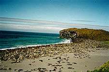 A fur seal colony on Bogoslof Island. |
References
- 1 2 3 4 5 "Bogoslof Description and Statistics". Alaska Volcano Observatory. United States Geological Survey. Retrieved 2009-09-01.
- 1 2 "Bogoslof". Global Volcanism Program. Smithsonian Institution. Retrieved 2009-01-19.
- ↑ Bergsland, K. (1994). Aleut Dictionary. Fairbanks: Alaska Native Language Center.
- ↑ Nunn, Patrick D. (2009). Vanished Islands and Hidden Continents of the Pacific. Honolulu: University of Hawaii Press. p. 140. ISBN 978-0-8248-3219-3.
- ↑ "Bogoslof Wilderness". Wilderness.net. Retrieved 2013-12-13.
External links
| Wikimedia Commons has media related to Bogoslof Island. |
- Volcanoes of the Alaska Peninsula and Aleutian Islands-Selected Photographs
- Bogoslof Island: Block 1069, Census Tract 1, Aleutians West Census Area, Alaska United States Census Bureau