Boalkhali Upazila
| Boalkhali বোয়ালখালী | |
|---|---|
| Upazila | |
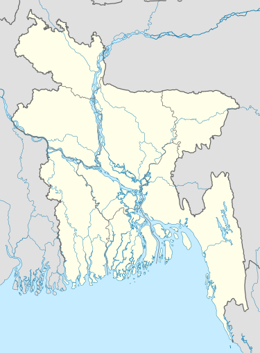 Boalkhali Location in Bangladesh | |
| Coordinates: 22°22.7′N 91°55.2′E / 22.3783°N 91.9200°ECoordinates: 22°22.7′N 91°55.2′E / 22.3783°N 91.9200°E | |
| Country |
|
| Division | Chittagong Division |
| District | Chittagong District |
| Area | |
| • Total | 145.44 km2 (56.15 sq mi) |
| Population (2011) | |
| • Total | 2,23,125[1] |
| Time zone | BST (UTC+6) |
| Website |
boalkhali |
Boalkhali (Bengali: বোয়ালখালী) is an Upazila of Chittagong District in the Division of Chittagong, Bangladesh.[2]
Geography
Boalkhali is located at 22°22′40″N 91°55′15″E / 22.3778°N 91.9208°E . It previously had 33514 households and its total area is 145.44 km².[2]
According to the 2001 Bangladesh Census, there were 36,588 households.
Demographics
As of the 1991 Bangladesh census, Boalkhali has a population of 195607. Males constitute 51.75% of the population, and females 48.25%. This Upazila's eighteen up population is 98116. Boalkhali has an average literacy rate of 48.5% (7+ years), and the national average of 32.4% literate.[3]
As of the 2001 Bangladesh census, the population was 201,590, comprising 104,601 males and 96,989 females. Boalkhali had 9 Unions, 31 Mauza and 30 villages and the literacy rate was 71.8%.[4]
Economy
Agriculture and manufacturing are the two major economic sectors in Boalkhali. The main crops grown here are Paddy, Mustards, Onion, Garlic, Chili and other vegetables. The KorolDenga hills are very fertile for cultivating fruits. The main fruits cultivated here are Jackfruit, Mango, Olive, Papaya, Guava, Kamranga, Banana, KoshshoGula, FyinnaGula, Boththa, Aamra, Pineapple, Lemon and Jambura. The main trees planted in the Koroldenga hills are Agar, Rubber and Teak. The bank of Karnafuli River is also very fertile for cultivation. There are so many fisheries, dairies and poultries in Boalkhali Upazila.
There are a lot of Hats and Bazars in Boalkhali. Hazir Hat, Chowdhury Hat, Munsi Hut, Jomadar Hat etc. are famous Bazar.
The transportation of Boalkhali Upazila is very developed compare to other parts of the country. People can navigate through Karnafuli River, Rail, Bus, Tempoo,CNG(Local Taxi). For Rail there are two stations one in Gomdandi and another one in Bengura.
Administration
Boalkhali has 10 Unions/Wards, 36 Mauzas/Mahallas, and 34 villages.
Boalkhali Municipality is formed by nine ward in 2012 which area is loacate by the whole Former East Gondandi Union, West Gomdandi unit 1 to 6 and Khadurkhil unit 1 to 3 from Union Parishod.
- Kadhurkhil (কধুরখীল)
- West Gomdandi (পশ্চিম গোমদন্ডী)
- Shakpura (শাকপুরা)
- Saroatali (সারোয়াতলী)
- Popadia (পোপাদিয়া)
- Charandwip (চরণদ্বীপ)
- Sreepur Kharandwip (শ্রীপুর-খরণদ্বীপ)
- Amuchia (আমুচিয়া)
- Ahla Karaldenga (আহল্লা করলডেঙ্গা)
Mayor
- Haji Abul Kalam (Abu) Bangladesh National Party
Upazila Chairman:
- Alhaj Md. Ata Ul Haque, Bangladesh Awami League
Vice Chairman:
- Obidul Haque Haqqani, Bangladesh Islami Front
Woman Vice Chairman:
- Shehada Akter Safu, Bangladesh National Party
Upazila Nirbahi Officer (UNO):
- Khandaker Nurul Hoq,[5]
Notable residents
- Binod Bihari Chowdhury (10 January 1911 – 10 April 2013)
- Kalpana Datta (27 July 1913 – 8 February 1995)
- Shefali Ghosh (1941 - December 31, 2006)
- Dr. Bibhuti Bhushan Dutta
See also
References
- ↑ http://www.bbs.gov.bd/WebTestApplication/userfiles/Image/National%20Reports/Union%20Statistics.pdf
- 1 2 Golam Kibria Bhuiyan (2012). "Boalkhali Upazila". In Sirajul Islam and Ahmed A. Jamal. Banglapedia: National Encyclopedia of Bangladesh (Second ed.). Asiatic Society of Bangladesh.
- ↑ "Population Census Wing, BBS, 1991 data". Archived from the original on 2005-03-27. Retrieved November 10, 2006.
- ↑ dead link
- ↑
