Black Rock, New Mexico
| Black Rock, New Mexico | |
|---|---|
| CDP | |
 Location of Black Rock, New Mexico | |
 Black Rock, New Mexico Location in the United States | |
| Coordinates: 35°5′18″N 108°47′28″W / 35.08833°N 108.79111°WCoordinates: 35°5′18″N 108°47′28″W / 35.08833°N 108.79111°W | |
| Country | United States |
| State | New Mexico |
| County | McKinley |
| Area | |
| • Total | 1.7 sq mi (4.5 km2) |
| • Land | 1.7 sq mi (4.4 km2) |
| • Water | 0.1 sq mi (0.2 km2) |
| Elevation | 6,453 ft (1,967 m) |
| Population (2000) | |
| • Total | 1,252 |
| • Density | 740.1/sq mi (285.8/km2) |
| Time zone | Mountain (MST) (UTC-7) |
| • Summer (DST) | MDT (UTC-6) |
| ZIP code | 87327 |
| Area code(s) | 505 |
| FIPS code | 35-07670 |
| GNIS feature ID | 0899539 |
Black Rock (Navajo: Tsézhįįh Deezlį́) is an unincorporated community[1] and a census-designated place (CDP) in McKinley County, New Mexico, United States. The population was 1,252 at the 2000 census.
Geography
Blackrock is located on the Zuñi Reservation on the left bank (south side) of the Zuñi River, approximately four miles east of the town of Zuñi, on the north side of NM Route 53.[2] Immediately to the east of the community is the Black Rock Reservoir,[2][3] which was created in 1908 by damming the Zuni River.[4] The dam has undergone serious rebuilding three times since 1908, the most recent in the mid 1990s.[4] Black Rock has an non-commercial airstrip built just after World War II, but not paved until 1970.[2][5]
According to the United States Census Bureau, the CDP has a total area of 1.8 square miles (4.7 km2), of which, 1.7 square miles (4.4 km2) of it is land and 0.1 square miles (0.26 km2) of it (3.43%) is water.
History
There was a spring at Black Rock and the Zuñi had irrigated fields there since about 3000 BP (950 BCE).[6] The Zuñi had a small, seasonally occupied village on the lava flow, just north of the river, which the Spanish called "Ranchos de Zuñi".[7]
Demographics
As of the census[8] of 2000, there were 1,252 people, 319 households, and 283 families residing in the CDP. The population density was 740.1 people per square mile (286.0/km²). There were 349 housing units at an average density of 206.3 per square mile (79.7/km²). The racial makeup of the CDP was 89.70% Native American, 7.99% White, 0.24% from other races, 0.16% African American, 0.16% Asian, and 1.76% from two or more races. Hispanic or Latino of any race were 2.72% of the population.
There were 319 households out of which 62.1% had children under the age of 18 living with them, 45.1% were married couples living together, 35.4% had a female householder with no husband present, and 11.0% were non-families. 9.7% of all households were made up of individuals and 0.6% had someone living alone who was 65 years of age or older. The average household size was 3.88 and the average family size was 4.06.
In the CDP the population was spread out with 44.3% under the age of 18, 8.1% from 18 to 24, 33.8% from 25 to 44, 10.9% from 45 to 64, and 2.9% who were 65 years of age or older. The median age was 22 years. For every 100 females there were 87.1 males. For every 100 females age 18 and over, there were 81.0 males.
The median income for a household in the CDP was $16,442, and the median income for a family was $14,950. Males had a median income of $17,105 versus $16,563 for females. The per capita income for the CDP was $6,952. About 57.2% of families and 61.8% of the population were below the poverty line, including 73.8% of those under age 18 and 100.0% of those age 65 or over.
References
- ↑ "Geographic Names Information System (GNIS): Feature Detail Report for: Black Rock". United States Geological Survey. 13 November 1980. Archived from the original on 26 June 2014.
- 1 2 3 Zuni Quadrangle, New Mexico–McKinley Co. (35108–A7–TF–024) (Map). 1:24,000. 7.7 miniute series (topographic). United States geological Survey. 1972. Archived from the original on 26 June 2014.
- ↑ "Geographic Names Information System (GNIS): Feature Detail Report for: Black Rock Reservoir". United States Geological Survey. 13 November 1980.
- 1 2 Dodge, William A. (2010). Black Rock: A Zuni Cultural Landscape and the Meaning of Place. Jackson, Mississippi: University Press of Mississippi. p. 181–182. ISBN 978-1-57806-993-4.
- ↑ Dodge 2010, p. 179
- ↑ The findings from these projects suggest that early farmers moved into the Zuni region some 3,000 to 4,000 years ago, bringing with them irrigation agriculture and living in communities laid out along the riverine environments. Damp, Jonathan E. (2008). "The Economic Origins of Zuni" (PDF). Archaeology Southwest. 22 (2): 8. Archived (PDF) from the original on 26 June 2014.; see also Damp, Jonathan E. (2010). "Zuni emergent agriculture: economic strategies and the origins of Zuni". In Gregory, David A.; Wilcox, David R. Zuni Origins: Toward a new synthesis of Southwestern archaeology. Tucson, Arizona: University of Arizona Press. pp. 118–132. ISBN 978-0-8165-2893-6.
- ↑ Dodge 2010, p. 69
- ↑ "American FactFinder". United States Census Bureau. Archived from the original on 2013-09-11. Retrieved 2008-01-31.
Municipalities and communities of McKinley County, New Mexico, United States | ||
|---|---|---|
| City | 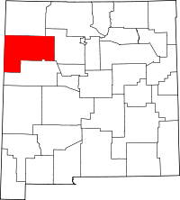 | |
| CDPs | ||
| Unincorporated communities | ||
| Indian reservation | ||
| Footnotes | ‡This populated place also has portions in an adjacent county or counties | |