Bistrica (Novo Naselje)
_and_Satelit_2010.png)
Bistrica (Serbian Cyrillic: Бистрица), also known as Novo Naselje (Serbian Cyrillic: Ново Насеље), is a neighborhood of the city of Novi Sad, the capital of the Serbian province of Vojvodina. The first houses at this locality were built in 1957.
Name
The old name of the settlement was Novo Naselje, but it was officially changed to Bistrica in 1992. However, the inhabitants of the settlement still prefer to use the old name. In Hungarian the place is known as Újtelep.
Borders
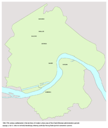
The northern border of Bistrica is Bulevar Vojvode Stepe (Vojvoda Stepa Boulevard), the western border is ulica Somborska rampa (Somborska rampa Street), the southern border is Futoški put (Futog Road), and the eastern border is Subotički bulevar (Subotica Boulevard).
The neighbouring settlements are: Jugovićevo in the north, Veternička Rampa in the west, Telep in the south, and Sajmište and Detelinara in the east.
Parts of the neighborhood
Some of the parts of Bistrica are: Savina, Tozin Sokak (Šonsi), Šarengrad (Jamajka), Satelit (a separate settlement in the past), Mali Satelit (Little Satelit, a part of Satelit), Tozinovac (a part of Satelit), Rasadnik (Radna Zona Zapad), Zapadna Privredna Zona.
Bistrica is administratively divided into two local communities, one of them is named "Bistrica", and the other is named "Gavrilo Princip".
History
According to old maps from the 16th and 17th centuries, a place named Bistrica existed at this location, before Novi Sad was founded in 1694. Name Bistrica is of Slavic origin (notably Serbian). It is not known what happened with this old settlement, since it did not exist any more in the 18th century.
According to Ammianus Marcellinus, a fourth-century Roman historian, there existed a Roman villa called Pistrensis Villa, on the left bank of the Danube. Here the future Roman Empress Constantia, wife of Emperor Gratain, was almost captured by Sarmatians. She barely escaped to Sirmium. According to some opinions, Slavic Bistrica from later time period might be a corruption of Pistrensis. Jacob Hofmann in his Lexicon of Universal History, 1698, mentions the place. This would actually date the origin of name of the area to at least 374 ad.[1]
The real estate development of Novo Naselje had begun in 1957, with construction of first buildings in the area today known as Tozinovac (part of modern Satelit). Concerted mass construction reached its peak between 1976 and 1980. This was also a period when the settlement received its present constitution. Construction has continued into the following period, but with lesser intensity.
Between 1980 and 1989, the seat of the Podunavlje municipality, one of the former seven municipalities of Novi Sad City, was located in Novo Naselje.
-
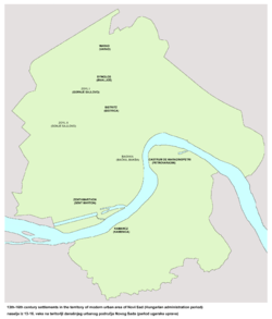
Old settlement of Bistrica in the location of modern Novo Naselje (early 16th century)
-
Old settlement of Bistrica in the location of modern Novo Naselje (Ottoman administration period, 16th-17th century)
-
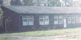
Seat of the Podunavlje municipality from 1980 to 1989
Population
According to 1991 census the population of Bistrica numbered 24,595 people, including: [2]
- Serbs (70%)
- Hungarians (10%)
- Montenegrins (5%)
- Slovaks (5%)
- Croats (5%)
- Others (5%)
Today, Bistrica (together with Satelit) has about 36,000 residents. [3]
Economy
There are several factories in the settlement:
- "Jugoalat", a factory for production of cutting tools;
- "Jugodent", a factory for production of dentist equipment;
- "Autokop", a factory for production of idle parts for cars;
- "Dunav", a factory for production of orthopedic equipment.
In the western part of Bistrica is a seat of "Javno Gradsko Saobraćajno Preduzeće" (a city public transportation company).
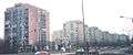
-

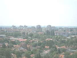
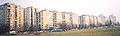
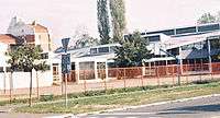
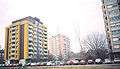
Panoramic view of Novo Naselje
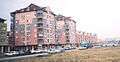
-
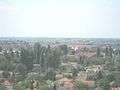
Panoramic view of Novo Naselje
-
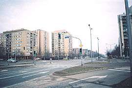
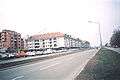
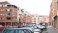
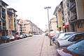
Novo Naselje, Bate Brkića Street
-
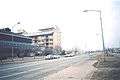
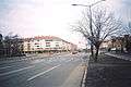
Novo Naselje, Knez Miloš Boulevard
-
Novo Naselje, Bate Brkića Street
-
Novo Naselje, Slobodan Jovanović Boulevard
-
Novo Naselje, Bate Brkića Street
-
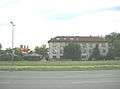
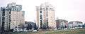
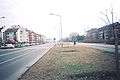
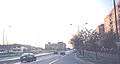
Novo Naselje, Subotica Boulevard (Boulevard of Europe)
Culture, health and sport
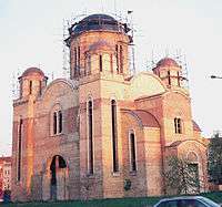
Bistrica have two elementary schools: "Prva vojvođanska brigada" (built in 1980) and "Miloš Crnjanski" (built in 1962). An offset of the Novi Sad City Library is also located in Bistrica. In the western part of the settlement is a stadium of "Mladost" football club. There is also an ambulance in the settlement. An orthodox church is also under construction.
See also
References
- ↑ "Joh. Jacobi Hofmanni SS. Th. Doct.,... Lexicon universale, historiam sacram ... - Johann Jakob Hofmann, Mulder - Google Books". Books.google.com. Retrieved 2012-11-02.
- ↑ "No name | Дневник". Dnevnik.rs. Retrieved 2012-11-02.
- ↑ "Archived copy". Archived from the original on 2010-05-20. Retrieved 2010-05-14.
- Jovan Mirosavljević, Brevijar ulica Novog Sada 1745–2001, Novi Sad, 2002.
- Milorad Grujić, Vodič kroz Novi Sad i okolinu, Novi Sad, 2004.
External links
| Wikimedia Commons has media related to Bistrica (Novo Naselje). |
- About Novo Naselje (in Serbian)
- About Novo Naselje (in Serbian)
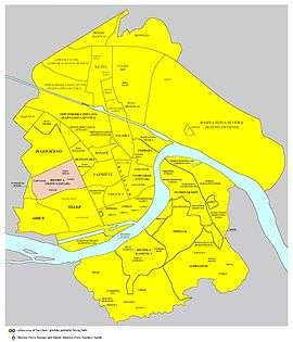
- Detailed map of Novi Sad and Bistrica (Novo Naselje)
-
Novo Naselje, Jovan Dučić Boulevard
-
Novo Naselje, Vladike Ćirića Street
-
Novo Naselje, Branislava Borote Street
-
Novo Naselje, Jovan Dučić Boulevard
-
Novo Naselje, Partizanskih baza Street
-
Novo Naselje, Mileve Marić Street
-
Novo Naselje, Bate Brkića Street
-
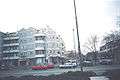
Novo Naselje, Slobodan Jovanović Boulevard
| Neighborhoods in “Novi Sad Proper” |
|  |
|---|---|---|
| Neighborhoods in Petrovaradin |
| |
| Neighborhoods in Sremska Kamenica |
| |
| Suburbs | ||
Coordinates: 45°14′35″N 19°47′58″E / 45.2430°N 19.7994°E