Birkbeck station
| Birkbeck | |
|---|---|
|
Station in 2008 | |
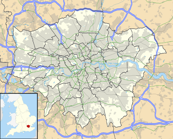 Birkbeck Location of Birkbeck in Greater London | |
| Location | Anerley |
| Local authority | London Borough of Bromley |
| Managed by | Southern |
| Station code | BIK |
| DfT category | F2 |
| Number of platforms |
1 (main line) 1 (Tramlink) |
| Fare zone | 4 |
| Tramlink annual boardings and alightings | |
| 2009–10 | 0.186 million[1] |
| 2010–11 | 0.186 million[2] |
| National Rail annual entry and exit | |
| 2010–11 |
|
| 2011–12 |
|
| 2012–13 |
|
| 2013–14 |
|
| 2014–15 |
|
| Railway companies | |
| Original company | Southern Railway |
| Post-grouping | Southern Railway |
| Key dates | |
| 1858 | Line opens |
| 1915 | Line closes |
| 3 March 1929 | line reopens |
| 2 March 1930 | Opening of station |
| 1983 | station reduced to single platform |
| 2000 | Tramlink starts |
| Other information | |
| Lists of stations | |
| External links | |
| WGS84 | 51°24′14″N 0°03′24″W / 51.4039°N 0.0568°WCoordinates: 51°24′14″N 0°03′24″W / 51.4039°N 0.0568°W |
|
| |

Birkbeck station is a railway station and light rail stop in the London Borough of Bromley in the southern suburbs of London. It is located on Elmers End Road (A214) and alongside Beckenham Crematorium.
Services
National Rail
The line through Birkbeck was opened as a double-track branch of the West End of London and Crystal Palace Railway in 1858, but was closed from 1860 to 1863 and again in 1915 until reopened in 1929 as part of the Southern Railway electrification scheme. A year later, on 2 March 1930, a new station was opened,[4] to serve a growing suburban area, and named after the Birkbeck Freehold Lane Society, whose name derived from the Yorkshire philanthropist Dr Birkbeck.[5][6] In 1983 the line between Beckenham Junction and Bromley Junction was reduced to single track and the former up line and up platform was abandoned. The track was subsequently removed and the station building demolished.
The tracks in the station are located well above street level; the National Rail buildings were damaged by fire in 1983.
When the Croydon Tramlink was constructed a single line through the station was laid using the trackbed of the former BR up line and the former BR up platform was rebuilt. The National Rail line is served by a high level platform to the north of the track, whilst the Croydon Tramlink rail line is served by a low level platform to the south of the track. Each platform has its own access from the street, and the only access between the two platforms is via the street, with a fence between the two tracks to deter any attempt to cross the lines.

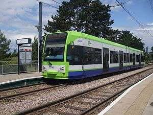
Tramlink
The one-platform Tramlink stop opened in 2000, with the rest of route 2 to the Croydon loop. A proposed line alternative through Birkbeck station from Crystal Palace railway station to Beckenham Junction was considered for conversion to a Tramlink route but Transport for London has dropped the plan on the grounds that the existing rail service is adequate.[7]
| Preceding station | |
Following station | ||
|---|---|---|---|---|
| Crystal Palace | Southern London Bridge to Beckenham Junction (via Crystal Palace) (Mondays-Saturdays only) |
Beckenham Junction | ||
| |
||||
towards Wellesley Road | Route 2 | towards Beckenham Junction |
||
Gallery
-

Main line looking west
-

Tramlink looking east
-

Main line platform sign
-

Tramlink platform sign
References
- ↑ "Tram Stop Usage 2009-10 (FOI)" (XLS). Tramlink annual passenger performance 2009-2010. Transport for London. 18 August 2011. Retrieved 28 November 2012.
- ↑ "Tramlink numbers 2010-2011" (PDF). Tramlink annual passenger performance 2010-2011. Transport for London. 28 March 2012. Retrieved 28 November 2012.
- 1 2 3 4 5 "Station usage estimates". Rail statistics. Office of Rail Regulation. Please note: Some methodology may vary year on year.
- ↑ Butt, R.V.J. (1995). The Directory of Railway Stations. Yeovil: Patrick Stephens Ltd. p. 34. ISBN 1-85260-508-1. R508.
- ↑ Birkbeck Freehold Lane Society
- ↑ "The Railways of Beckenham", Andrew Hajducki, 2011
- ↑ "Transport for London - Croydon Tramlink Extension Brochure" (PDF).
External links
| Wikimedia Commons has media related to Birkbeck station. |
- Train times and station information for Birkbeck station from National Rail
| Companies and organisations | |||||||||||
|---|---|---|---|---|---|---|---|---|---|---|---|
| Airports |
| ||||||||||
| Major stations | |||||||||||
| Roads |
| ||||||||||
| Ticketing | |||||||||||
| Other | |||||||||||
| Former BR sectors | |||||||||||
| |||||||||||