Birds Landing, California
| Birds Landing, California | |
|---|---|
| Unincorporated community | |
 Birds Landing, California  Birds Landing, California location in California | |
| Coordinates: 38°7′58″N 121°52′15″W / 38.13278°N 121.87083°WCoordinates: 38°7′58″N 121°52′15″W / 38.13278°N 121.87083°W[1] | |
| Country | United States |
| State | California |
| County | Solano |
| Government | |
| • Senate | Mark DeSaulnier (D) |
| • Assembly | Nancy Skinner (D) |
| • U. S. Congress | John Garamendi (D)[2] |
| Elevation[1] | 52 ft (16 m) |
| Population (2000) | |
| • Total | 130 |
| Time zone | PST (UTC-8) |
| • Summer (DST) | PDT (UTC-7) |
| ZIP code | 94512 |
| Area code(s) | 707 |
Birds Landing (also Bird's Landing) is an unincorporated community in southern Solano County, California, United States. It lies at the intersection of Collinsville and Montezuma Hills Roads, southeast of the city of Fairfield, the county seat of Solano County. Situated just north of the Sacramento River, the community is located midway between Sacramento and San Francisco.[3] Birds Landing is unincorporated, and has its own ZIP code (94512),[4] but no post office (it closed in 2001).[5]
Demographics
The population was 130 in 2000; there were 66 men and 64 women. The generational makeup was 7 under five years, 8 five to nine years, 10 ten to fourteen, 11 fifteen to nineteen, 13 twenty to twenty-four, 10 twenty-five to thirty-four, 18 thirty-five to forty-four, 24 forty-five to fifty-four, 8 fifty-five to fifty-nine, 6 sixty to sixty-four, 11 sixty-four to seventy-four, 4 seventy-five to eighty-four, 0 over the age of eighty-five. The median age was 41.3. Of the 100 over the age of eighteen 53 were male and 47 were female. 92 were twenty-one and over. 15 were over the age of 65; 8 males and 7 females. The average owner-owned home had 2.45 people compared to 3.62 for renter-occupied homes.[6]
47% spoke English as their primary language while 53% did not; of those 53%: 29% spoke Spanish and 24% spoke "Other Indic languages".[7]
See also
References
- 1 2 "Birds Landing". Geographic Names Information System. United States Geological Survey.
- ↑ "California's 3rd Congressional District - Representatives & District Map". Civic Impulse, LLC. Retrieved March 9, 2013.
- ↑ Rand McNally. The Road Atlas '08. Chicago: Rand McNally, 2008, p. 12-13.
- ↑ ZIP code Lookup Archived June 15, 2011, at the Wayback Machine.
- ↑ Bowen, Jerry, "Once flourishing, town now echoes history". Retrieved November 22, 2014
- ↑ 94512 entry, Relocation Now, access date, U.S. Census 2000, July 20, 2008
- ↑ 94512 entry, American Fact Finder/U.S. Census 2000 (at MLA Data Center), access date July 20, 2008
Municipalities and communities of Solano County, California, United States | ||
|---|---|---|
| Cities | 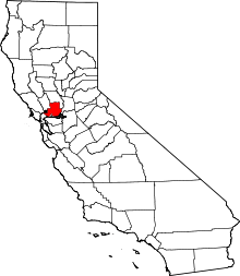 | |
| CDPs | ||
| Unincorporated communities | ||
| Ghost towns |
| |