Bindon Hill
| Bindon Hill | |
|---|---|
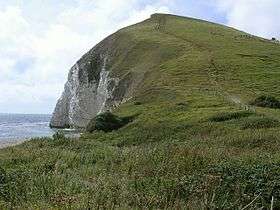 East end of Bindon Hill from Arish Mell gap. | |
| Highest point | |
| Elevation | 168 m (551 ft) [1] |
| Prominence | 94 m (308 ft) [1] |
| Parent peak | Lewesdon Hill |
| Listing | sub-HuMP |
| Geography | |
| Location | Dorset, England |
| Parent range | Purbeck Hills |
| OS grid | SY839802 |
| Topo map | OS Landranger 194 |

Bindon Hill is an extensive Iron Age earthwork enclosing a coastal hill area near Lulworth Cove in Dorset, England.
Location
The Hill is located about 19 kilometres west of Swanage, about six kilometres south west of Wareham, and about 17 kilometres south east of Dorchester.
Bindon Hill is only accessible when the Lulworth Ranges are open to the public. It can be reached by a short walk from West Lulworth, or alternatively via the South West Coast Path from Lulworth Cove. The ranges are owned by the Ministry of Defence (MoD) and is part of the Armoured Fighting Vehicles (AFV) Gunnery School. The ranges, which are more than 2,830 hectares (7,000 acres),[2] lies within an Area of Outstanding Natural Beauty and stretch along the Jurassic Coastline between Lulworth Cove and Kimmeridge. Visitors are advised to keep to official footpaths and abide to local site notices, because tanks and Armoured vehicles are used in this area. Safety warnings about explosives and unexploded shells are posted nearby by the MoD and there is a flashing warning lamp situated on the hill, which is illuminated when the ranges are in use.[3]
Hill fort

The main rampart and external ditch (univallate) run for over 2 km along an east-west ridge parallel to the coast, which lies about 750 m to the south. The ridge rises to 168 m and the cliffs are 30–120 m high. At the western end, an incomplete series of ramparts curve back to the cliffs of Lulworth Cove. At the eastern end, the main rampart reaches the cliffs on the north side of Mupe Bay. The total enclosed area is about 110 ha.
The enormous enclosed area, lack of evidence of settlement in the interior, and the impossibility of effectively defending such a large perimeter, all suggest it was primarily an enclosed pasture for domesticated animals, not a strategic tribal hill fort.
Geology
Bindon Hill lies above Fossil Forest and is part of the Jurassic Coast.
References
- 1 2 Database of British and Irish Hills at www.hill-bagging.co.uk. Accessed on 30 Mar 2013.
- ↑ "Public access to military areas". web page. Ministry of Defence. 12 December 2012. Retrieved 19 December 2012.
- ↑ "Safety and access restrictions: Lulworth ranges". Retrieved 2010-11-16.
Bibliography
- The Jurassic Coast Trust (2003). A Walk Through Time, the Official Guide to the Jurassic Coast. Coastal Publishing. ISBN 978-0-9544845-0-7.
- Barry Cunliffe (1974). Iron Age Communities in Britain. ISBN 978-0-7100-8725-6.
Coordinates: 50°37′20″N 2°14′05″W / 50.62217°N 2.23461°W