Billie Creek Covered Bridge
| Billie Creek Bridge | |
| National Register of Historic Places | |
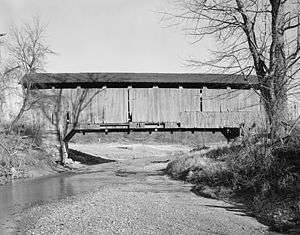
 Western portal and northern side | |
| Official name: Billie Creek Covered Bridge | |
| Named for: William's Creek | |
| Country | |
|---|---|
| State | |
| County | Parke |
| Township | Adams |
| Road | Old U.S.36 (Closed at various times of the year.) |
| City | Billie Creek Village |
| Crosses | William's Creek |
| Coordinates | 39°45′40.51″N 87°12′23.67″W / 39.7612528°N 87.2065750°WCoordinates: 39°45′40.51″N 87°12′23.67″W / 39.7612528°N 87.2065750°W |
| Length | 78 ft (24 m) 62ft +8ft overhangs on each end |
| Width | 15 ft (5 m) |
| Clearance | 12.5 ft (4 m) |
| Builder | Daniels, J.J. |
| Design | Burr arch truss bridge |
| Material | Wood |
| Built | 1895 Original Cost $820 |
| NBI Number | 6100086[1] |
| WGCB Number | #14-61-19 [2] |
| Added to NRHP | Dec 22, 1978 |
| NRHP Ref# | 78000384 [3] |
| MPS | Parke County Covered Bridges TR |
 Location of the Billie Creek Covered Bridge in Indiana
| |
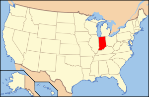 Location of Indiana in the United States
| |
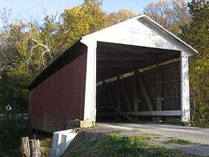
The Billie Creek Covered Bridge is a Burr Arch structure that was built by Joseph J. Daniels in 1895. J.L. Van Fossen supplied the sandstone that makes up the abutments cut from A.E. Fuel's nearby quarry.[2][4]
History
This bridge was built to replace the open wooden bridge that had been built by famed bridge builder J.A. Britton just 15 years earlier in 1880. It was built on what was then called the Pikes Peak Ocean to Ocean Highway, what would later become U.S. 36. Luckily it was saved because it was later bypassed when the road was rebuilt.[5]
It was added to the National Register of Historic Places in 1978.[3]
After being bypassed by the main highway it would become a tourist attraction when it became part of Billie Creek Village where it is still open to vehicular traffic and only closed at busy times of the year for traffic control.[2]
See also
- List of Registered Historic Places in Indiana
- Parke County Covered Bridges
- Parke County Covered Bridge Festival
References
- ↑ "Archived copy". Archived from the original on 2013-10-31. Retrieved 2009-08-07.
- 1 2 3 http://www.indianacrossings.org/bridgeLinks/14-61-19.html
- 1 2 National Park Service (2007-01-23). "National Register Information System". National Register of Historic Places. National Park Service.
- ↑ "Billie Creek Covered Bridge (#39)". Parke County Incorporated / Parke County Convention and Visitors Commission. Retrieved 2012-10-18.
- ↑ "Indiana State Historic Architectural and Archaeological Research Database (SHAARD)" (Searchable database). Department of Natural Resources, Division of Historic Preservation and Archaeology. Retrieved 2016-06-01. Note: This includes Charles Felkner (December 1977). "National Register of Historic Places Inventory Nomination Form: Parke County Covered Bridge Historic District" (PDF). Retrieved 2016-06-01., Site map, and Accompanying photographs.