Billerica, Massachusetts
| Billerica, Massachusetts | ||
|---|---|---|
| Town | ||
|
| ||
| ||
| Motto: America's Yankee Doodle Town[1] | ||
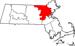
 Location in Middlesex County in Massachusetts | ||
 Billerica, Massachusetts Location in the United States | ||
| Coordinates: 42°33′30″N 71°16′10″W / 42.55833°N 71.26944°WCoordinates: 42°33′30″N 71°16′10″W / 42.55833°N 71.26944°W | ||
| Country | United States | |
| State | Massachusetts | |
| County | Middlesex | |
| Settled | 1652 | |
| Incorporated | 1655 | |
| Government | ||
| • Type | Representative town meeting | |
| Area | ||
| • Total | 26.4 sq mi (68.3 km2) | |
| • Land | 25.9 sq mi (67.1 km2) | |
| • Water | 0.5 sq mi (1.3 km2) | |
| Elevation | 250 ft (76 m) | |
| Population (2010) | ||
| • Total | 40,243 | |
| • Density | 1,500/sq mi (590/km2) | |
| Time zone | Eastern (UTC-5) | |
| • Summer (DST) | Eastern (UTC-4) | |
| ZIP code | 01821 (Billerica), 01862 (North Billerica) | |
| Area code(s) | 351 / 978 | |
| FIPS code | 25-05805 | |
| GNIS feature ID | 0618217 | |
| Website | www.town.billerica.ma.us | |
.jpg)

Billerica ![]() i/bɪlˈrɪkə/ is a town in Middlesex County, Massachusetts, United States. The population was 40,243 according to the 2010 census.[2] It borrows its name from the town of Billericay in Essex, England.
i/bɪlˈrɪkə/ is a town in Middlesex County, Massachusetts, United States. The population was 40,243 according to the 2010 census.[2] It borrows its name from the town of Billericay in Essex, England.
History
In the early 1630s, a Praying Indian village named Shawshin was at the current site of Billerica.[3]
In 1638, Massachusetts Bay Governor John Winthrop and Lt. Governor Thomas Dudley were granted land along the Concord River in the wilderness which was called Shawshin by the local Native Americans. (Today, Shawshin is commonly spelled Shawsheen; see Shawsheen River.) Most of the settlement was to take place under the supervision of Cambridge; however, financial difficulties in the colony prevented this from taking place, and the issue of settling Shawshin continued to be deferred. Finally, in 1652, roughly a dozen families from Cambridge and Charlestown Village, later Woburn, had begun to occupy Shawshin as well.[4]
Wishing to replace the foreign-sounding Shawshin with a name more familiar, the settlers chose the name Billerica, likely because some of the families living in the settlement came originally from the town of Billericay in Essex, England. The town was incorporated as Billerica in 1655, on the same day as neighboring Chelmsford and nearby Groton. The original plantation of Billerica was divided up into four towns, Billerica, Bedford, Wilmington, and Tewksbury, sometime during the colonial era. The oldest remaining homestead in the town is the Manning Manse, built in 1696, and later the residence of William Manning (1747–1814), the author of "The Key of Libberty," a critique of Federalist policies. (The unusual spelling of liberty is Manning's own.)[5] Other notable Revolutionary War era residents included Asa Pollard (1735–1775), the first soldier killed at the Battle of Bunker Hill, and Thomas Ditson (born 1741), who was tarred and feathered by the British in 1775 while on a visit to Boston. The song "Yankee Doodle" supposedly became a term of national pride instead of an insult because of this event.[6] The town now celebrates "Yankee Doodle Weekend" every September.
Geography

According to the United States Census Bureau, the town has a total area of 26.4 square miles (68 km2), of which 25.9 square miles (67 km2) are land and 0.5 square miles (1.3 km2) (1.90%) is water.
Billerica is located 20 miles (32 km) north-northwest of Boston along the Northwest Expressway (Massachusetts) portion of U.S. Route 3, positioning it as the border between the Boston Metro region to the south and the Greater Lowell region to the north. The town is also situated less than 3 miles from the Massachusetts Route 128/Interstate 95 High-Technology belt to the south and less than 2 miles from the Interstate 495 (Massachusetts) outer belt highway to the north.
Billerica has several small neighborhoods that form villages (or sections) of town. Those villages are East Billerica, North Billerica, Nutting Lake, Pinehurst, Rio Vista, River Pines, Riverdale, Riverside, and South Billerica.[7]
Billerica borders the following towns: Chelmsford, Lowell, Tewksbury, Wilmington, Burlington, Bedford, and Carlisle. The border with Lowell is at a point in the middle of the Concord River where Billerica, Chelmsford, Lowell and Tewksbury all meet.
Environment
The Shawsheen River and Concord River are the two major waterways within the town. Nuttings Lake offers a public beach and other recreational water activities including canoeing and sailing.
Demographics
| Historical population | ||
|---|---|---|
| Year | Pop. | ±% |
| 1850 | 1,646 | — |
| 1860 | 1,776 | +7.9% |
| 1870 | 1,833 | +3.2% |
| 1880 | 2,000 | +9.1% |
| 1890 | 2,380 | +19.0% |
| 1900 | 2,775 | +16.6% |
| 1910 | 2,789 | +0.5% |
| 1920 | 3,646 | +30.7% |
| 1930 | 5,880 | +61.3% |
| 1940 | 7,933 | +34.9% |
| 1950 | 11,101 | +39.9% |
| 1960 | 17,867 | +60.9% |
| 1970 | 31,648 | +77.1% |
| 1980 | 36,727 | +16.0% |
| 1990 | 37,609 | +2.4% |
| 2000 | 38,981 | +3.6% |
| 2010 | 40,243 | +3.2% |
| * = population estimate. Source: United States Census records and Population Estimates Program data.[8][9][10][11][12][13][14][15][16][17] | ||

As of the census[18] of 2000, there were 38,981 people, 12,919 households, and 10,244 families residing in the town. The population density was 1,505.9 people per square mile (581.3/km²). There were 13,071 housing units at an average density of 504.9 per square mile (194.9/km²). The racial makeup of the town was 94.68% White, 1.11% African American, 0.10% Native American, 2.76% Asian, 0.04% Pacific Islander, 0.33% from other races, and 0.99% from two or more races. Hispanic or Latino of any race were 1.54% of the population.
There were 12,919 households out of which 37.4% had children under the age of 18 living with them, 66.1% were married couples living together, 9.4% had a female householder with no husband present, and 20.7% were non-families. 16.4% of all households were made up of individuals and 5.3% had someone living alone who was 65 years of age or older. The average household size was 2.92 and the average family size was 3.30.
In the town the population was spread out with 25.7% under the age of 18, 7.3% from 18 to 24, 34.6% from 25 to 44, 24.0% from 45 to 64, and 8.4% who were 65 years of age or older. The median age was 36 years. For every 100 females there were 103.5 males. For every 100 females age 18 and over, there were 102.2 males.
As of the 2010 census, the median income for a household in the town was $87,073, and the median income for a family was $95,128. The per capita income for the town was $32,517. About 2.8% of families and 3.8% of the population were below the poverty line, including 4.5% of those under age 18 and 4.3% of those age 65 or over.
Billerica was a contender for CNN Money's "Best Places to Live" in 2009 but did not make the top 100 list for the nation.[19]
In 2016, Billerica was on the NeighborhoodScout's "America's Top 100 Safest Cities" list. [20]
Education
Public schools
Billerica Public Schools operate primary and secondary schools. The Billerica public school system consists of six elementary schools, two middle schools, and one high school.[21] In addition, the town is home to a regional technical high school. Shawsheen Valley Technical Highschool.[22]
The current superintendent of public schools is Tim Piwowar.
Elementary schools
- Ditson Elementary School (Cook Street; Pinehurst)
- Frederick J. Dutile Elementary School (Treble Cove Road; River Pines)
- S. G. Hajjar Elementary School (Rogers & Call Streets; North Billerica)
- John F. Kennedy Elementary School (Kimbrough Road & Carline Drive; East Billerica)
- Parker Elementary School (River Street; Billerica Village)
- Eugene C. Vining Elementary School (Lexington Road; Nuttings Lake)
Middle schools
- Orland S.Marshall Middle School (Floyd Street; Billerica Village)
- Cyril D. Locke Middle School (Allen & Baldwin Roads; Billerica)
High school
- Billerica Memorial High School (River Street; Billerica Village)
Vocational school
- Shawsheen Valley Technical High School (Cook Street; Pinehurst)
- Shawsheen Tech serves Billerica and four of its neighboring towns: Bedford, Burlington, Tewksbury, and Wilmington.
Parochial and private schools
There are no parochial or private schools in the town of Billerica. However, there are several in neighboring towns including:
Catholic schools
- Arlington Catholic High School, Arlington; grades 9–12
- St. Agnes School, Arlington; grades K–8
- Lowell Catholic High School, Lowell; grades 9–12
- Austin Preparatory School, Reading; grades 6–12
Sports and recreation
In celebrating Sports Illustrated's 50th anniversary, the magazine named Billerica one of the nation's top fifty towns for sports and recreation[23] and the "Sportstown for the Bay State."[24]
- The Country Club of Billerica, established in 1971, features an 18 hole golf course open to the public.[25]
- Rangeway Golf on Nashua Road features a driving range and a miniature golf course.
- The Boys and Girls Club of Greater Billerica includes a swimming pool, baseball and softball fields, a football field, tennis courts, and basketball courts.
- The Trampoline Park on 700 Boston Road, which opened in March 2014, features jumping activities such as 3D Dodgeball, Basketball Dunking Lanes, Kid Zone, Foam Pits, Gymnastics "tumble tracks", rock climbing wall, battle beam which is suspended over a foam pits, and also has a large main court. Altitude Billerica is the first trampoline park in Massachusetts to include a rock climbing wall and a battle beam.
- Dr. Robert J Calabrese Stadium, opened in 1972, Home of Billerica High's Football and Lacrosse Teams
Transportation

MBTA Commuter Rail provides service from Boston's North Station with the North Billerica station on its Lowell Line. The southern portions of the town are also geographically close to the Wilmington (MBTA station) and the Anderson Regional Transportation Center in Woburn. The Lowell Regional Transit Authority provides bus service in parts of Billerica. Route #3 (South Lowell) services the North Billerica MBTA station and the North Billerica Business Center. Route #13 (Billerica Via Edson) services Boston Road (Route 3A) from North Billerica to Pinehurst. Stops along the way include: The North Billerica MBTA Station, Pollard Street, High Street, Billerica Center and Town Hall, the Billerica Mall, and Towne Plaza, and a shopping center located in Riverdale. Route #14 (Burlington Mall/Lahey Clinic) services Route 3A until Billerica Center where it continues onto Concord Road and the Middlesex Turnpike.
The Middlesex Canal, which flowed through Billerica between 1795 and 1852, was used to transport goods between Lowell and Boston. Because of this key transportation corridor, Billerica earned the moniker "Gateway to Lowell."
In the 1840s, the Boston and Lowell Railroad's main line was built and passed through the town's villages of North Billerica and East Billerica. Stations were built in both locations and North Billerica Station is still an active Commuter Rail Station. Trains stopped taking passengers at East Billerica in 1965 and the station was remodeled and is now a private home.
Economy

- E Ink Corporation, a privately held manufacturer of electrophoretic displays (EPDs) that powers tablets such as the Amazon Kindle and Barnes & Noble Nook.
- Raytheon Company, a major American defense contractor and industrial corporation with core manufacturing concentrations in weapons and military and commercial electronics, has two large offices in Billerica, MA.[26]
- EMD Serono, Inc, the US biopharmaceutical division of Merck KGaA, Darmstadt, Germany, a global pharmaceutical and chemical group, is undergoing a $75-million expansion of their Billerica facility, naming it the EMD Serono Research & Development Institute.[27]
- GE Measurement & Control Solutions, a $5 billion energy technology unit of the General Electric Co. recently moved its headquarters to Billerica, MA[28]
- Cabot Corporation, a $3.3 billion specialty chemicals and performance materials company, has its primary Research and Development facility in Billerica, MA.[29]
- Avaya Inc, a privately held $8 billion global provider of business communications and collaboration systems, has its New England headquarters in Billerica, MA.[29]
- L3 Communications, is a $15 billion American company that supplies command and control, communications, intelligence, surveillance and reconnaissance (C3ISR) systems and products, avionics, ocean products, training devices and services, instrumentation, space, and navigation products. They have a Billerica office on Concord Road.[30]
- Pan Am Railways, New England's largest railroad, is headquartered in the North Billerica area of Billerica.[31][32]
- Merck KGaA, a German drug and chemicals company unrelated to Merck & Co., in March 2010 "said it plans to move the headquarters of its US chemicals business to Billerica after its acquisition of life sciences toolmaker Millipore Corp."[33]
- Pharmalucence, a biotech company which makes drugs for disease diagnosis has its corporate headquarters in Billerica.
- American Science & Engineering, based in Billerica, "said it received a $6.7 million order for its X-ray detection technology that will be used by the US government for counterterrorism missions."[34]
- Lantheus Medical Imaging Inc., the Billerica-based medical imaging company, "sealed a new purchasing deal with Ottawa-based MDS Nordion for a rare imaging isotope, molybdenum-99."[35]
- SeahorseBioscience, a labware products manufacturer, is also headquartered in the North Billerica area of Billerica.[36]
Government
Billerica is governed through a representative town meeting. In this system, the town government is made up of a legislative branch and an executive branch.
The town meeting is the legislative branch of the town and comprises approximately 240 meeting members who are elected from the town's 11 precincts and who vote democratically on town business at a bi-weekly town meeting that has two sessions a year. The first session begins in May and runs until business is concluded and the following session begins in October and similarly runs until business is concluded. The town charter states that "All powers of the town shall be vested in the representative town meeting, except as otherwise provided by law or by the charter." The town meeting also elects a moderator to regulate proceedings, decide questions of order and make public declarations of all votes. All town meeting members serve without compensation.
In addition to the town meeting, the town elects a board of five selectmen to serve as the executive head of the town. These selectmen deal with enforcing town laws, granting town licenses and the setting of town policy and are explicitly forbidden from becoming involved with day-to-day administration. To carry out that day-to-day administration the board of selectmen appoints a town manager. Alongside the board of selectmen the town elects the following: a school committee which appoints the superindendent and sets public school regulations, a town clerk to keep all town records and serve as custodian of the town seal, and a planning board which studies and prepares plans cocerning the resources, possibilities and needs of the town.
The town charter also explicitly spells out the formation of a Department of Public Works to manage all utility services in the town.
Billerica is a part of Massachusetts's 6th congressional district.[37]
The Middlesex House of Correction and Jail is located off Treble Cove Road. This jail is under the jurisdiction of the Middlesex County Sheriff's Office.[38]
Notable people
- Gary DiSarcina, former professional baseball player, AL All-Star (1995)[39]
- Tom Fitzgerald, former professional hockey player
- Tom Glavine, former professional baseball player, elected to the Baseball Hall of Fame (2014) [40]
- Dean Jenkins, former collegiate and professional hockey player[41]
- Charles Mears, businessman, entrepreneur
- Bob Miller, former professional hockey player
- Julius Sumner Miller. science teacher and popularizer
- Paul Miller, former professional hockey player[42]
- Azel W. Patten, Wisconsin politician and businessman[43]
- Asa Pollard, first man killed at the Battle of Bunker Hill, 1775[44][45][46][47]
- BJ Snowden, musician
- Robert Trant, attorney
Historic places

- Abraham Jaquith House
- Bennett Public Library
- Billerica Town Common District
- Billerica Mills Historic District
- Dutton–Holden Homestead
- Deacon Samuel Hill House
- Howe School
- Manning Manse
- Middlesex Canal
- Thomas Ditson Elementary School – Pinehurst is the original location of its namesake's home.
Sister city
Billerica is a sister city of Billericay, England, United Kingdom ![]() .
.
Footnotes
- ↑ Meagher, Kathy. "Yankee Doodle: The Man". Billerica Public Library. Retrieved 7 April 2014.
- ↑ "Profile of General Population and Housing Characteristics: 2010 Demographic Profile Data (DP-1): Billerica town, Middlesex County, Massachusetts". U.S. Census Bureau, American Factfinder. Archived from the original on September 11, 2013. Retrieved April 5, 2012.
- ↑ Hobson, Archie. Cambridge Gazeteer of the United States and Canada. (New York: Cambridge University Press, 1995) p. 62
- ↑ Hazen, Henry. History of Billerica. (Boston: A. Williams and Co., 1883) p. 3-15
- ↑ The Key of Libberty; Shewing the Causes Why a Free Government Has Always Failed, and a Remedy Against It...; With Notes and a Foreword By Samuel Eliot Morison; by William Manning (1922)
- ↑ The Billerica Colonial Minute Men; The Thomas Ditson story; retrieved on July 10, 2008
- ↑ Street Atlas of Metro Boston Arrow Publishing Company, 1998.
- ↑ "TOTAL POPULATION (P1), 2010 Census Summary File 1". American FactFinder, All County Subdivisions within Massachusetts. United States Census Bureau. 2010.
- ↑ "Massachusetts by Place and County Subdivision - GCT-T1. Population Estimates". United States Census Bureau. Retrieved July 12, 2011.
- ↑ "1990 Census of Population, General Population Characteristics: Massachusetts" (PDF). US Census Bureau. December 1990. Table 76: General Characteristics of Persons, Households, and Families: 1990. 1990 CP-1-23. Retrieved July 12, 2011.
- ↑ "1980 Census of the Population, Number of Inhabitants: Massachusetts" (PDF). US Census Bureau. December 1981. Table 4. Populations of County Subdivisions: 1960 to 1980. PC80-1-A23. Retrieved July 12, 2011.
- ↑ "1950 Census of Population" (PDF). Bureau of the Census. 1952. Section 6, Pages 21-10 and 21-11, Massachusetts Table 6. Population of Counties by Minor Civil Divisions: 1930 to 1950. Retrieved July 12, 2011.
- ↑ "1920 Census of Population" (PDF). Bureau of the Census. Number of Inhabitants, by Counties and Minor Civil Divisions. Pages 21-5 through 21-7. Massachusetts Table 2. Population of Counties by Minor Civil Divisions: 1920, 1910, and 1920. Retrieved July 12, 2011.
- ↑ "1890 Census of the Population" (PDF). Department of the Interior, Census Office. Pages 179 through 182. Massachusetts Table 5. Population of States and Territories by Minor Civil Divisions: 1880 and 1890. Retrieved July 12, 2011.
- ↑ "1870 Census of the Population" (PDF). Department of the Interior, Census Office. 1872. Pages 217 through 220. Table IX. Population of Minor Civil Divisions, &c. Massachusetts. Retrieved July 12, 2011.
- ↑ "1860 Census" (PDF). Department of the Interior, Census Office. 1864. Pages 220 through 226. State of Massachusetts Table No. 3. Populations of Cities, Towns, &c. Retrieved July 12, 2011.
- ↑ "1850 Census" (PDF). Department of the Interior, Census Office. 1854. Pages 338 through 393. Populations of Cities, Towns, &c. Retrieved July 12, 2011.
- ↑ "American FactFinder". United States Census Bureau. Archived from the original on 2013-09-11. Retrieved 2008-01-31.
- ↑ "Best Places to Live 2009". CNN.
- ↑ "Top 100 Safest cities to live in the USA - NeighborhoodScout". www.neighborhoodscout.com. Retrieved 2016-05-28.
- ↑ "Billerica Public Schools". Retrieved 2009-03-09.
- ↑ "Shawsheen Valley Technical High School". Retrieved 2009-03-09.
- ↑ Community Overview
- ↑ "Billerica honored as Sports Illustrated Sportstown for Bay State". CNN.
- ↑ Country Club of Billerica, MA – Massachusetts Golf Course
- ↑ Raytheon operations come to industrial park – Billerica, MA – Billerica Minuteman
- ↑ "EMD Serono plans to increase Billerica work force as it ups its US headcount – Boston.com". Archived from the original on June 8, 2015.
- ↑ Hot Seat interview with Brian Palmer, chief executive of GE Measurement and Control – Business – The Boston Globe
- 1 2 Research & Development – Cabot Corporation
- ↑ L-3 Communications
- ↑ Bellerica town, Massachusetts. U.S. Census Bureau. Retrieved on August 27, 2009.
- ↑ "Table of Contents Page." Pan Am Railways. Retrieved on August 27, 2009.
- ↑ Weisman, Robert (2010-07-09). "Merck will close lab in Kendall Sq". The Boston Globe.
- ↑ "$6.7m bomb screening deal lifts AS&E". The Boston Globe. 2010-06-29. Archived from the original on February 1, 2015.
- ↑ Lantheus inks purchasing deal with MDS Nordion for rare isotope | MassDevice – Medical Device Industry News
- ↑ "Company Overview of Seahorse Bioscience, Inc.". Bloomberg BusinessWeek. Retrieved 26 March 2013.
- ↑ "The Commonwealth of Massachusetts 2011 Congressional Districts" (PDF). Retrieved 9/8/2014. Check date values in:
|access-date=(help) - ↑ Archived December 5, 2010, at the Wayback Machine.
- ↑ Gary Disarcina Statistics and History – Baseball-Reference.com
- ↑ Tom Glavine Statistics and History – Baseball-Reference.com
- ↑ Dean Jenkins NHL Statistics | Hockey-Reference.com
- ↑ Paul Miller NHL Statistics | Hockey-Reference.com
- ↑ 'Wisconsin Blue Book 1872,' Biographical Sketch of Azel Wilder Patten, pg. 450
- ↑ Birthplace and Home of Asa Pollard – Billerica, MA – Massachusetts Historical Markers on Waymarking.com
- ↑ Archived October 3, 2011, at the Wayback Machine.
- ↑ "First Man Slain At Bunker Hill". Boston Daily Globe. 1904-06-19.
- ↑ The Dispatch - Google News Archive Search
Further reading
- Henry Allen Hazen, History of Billerica, Massachusetts, with a Genealogical Register. Boston: A. Williams and Co., 1883.
See also
External links
| Wikivoyage has a travel guide for Billerica. |
| Wikimedia Commons has media related to Billerica, Massachusetts. |