Bhatkal
| Bhatkal ಭಟ್ಕಳ | |
|---|---|
| Town | |
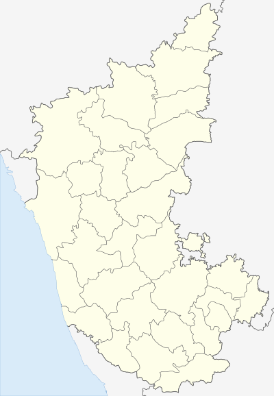 Bhatkal Location in Karnataka, India | |
| Coordinates: 13°58′01″N 74°34′01″E / 13.967°N 74.567°ECoordinates: 13°58′01″N 74°34′01″E / 13.967°N 74.567°E | |
| Country |
|
| State | Karnataka |
| District | Uttara Kannada |
| Government | |
| • Type | Town Municipal Council |
| Area | |
| • Total | 355.50 km2 (137.26 sq mi) |
| Elevation | 3 m (10 ft) |
| Population (2011) | |
| • Total | 149,338 (Taluk) |
| Languages | |
| • Official | Kannada |
| Time zone | IST (UTC+5:30) |
| PIN | 581 320 |
| Telephone code | +91-8385 |
| Vehicle registration | KA-47 |
Bhatkal also known as 'Batecala' in some Portuguese historical texts, is a port town in Uttara Kannada District of South Indian state of Karnataka. The town of Bhatkal lies on NH-66 running between Mumbai and Kochi and is one of the major railway stations along the Konkan Railway line running between Mumbai and Mangaluru. The closest airport is Mangaluru International Airport.The town is also called as Mini Dubai.
There is a high police presence in the city as it has a history of communal tensions. However the city is largely peaceful most of the time.
History
In the early ages Bhatkal belonged to followers of Jain and Hindu religion and later acquired more religions and cultures. According to Famous Moroccan traveler Ibn Battuta (1307-1377), "Bad-E-Qillah" (Bhatkal) was placed with Nawayath, Nakhuda Muslim & Jain communities, a town located on the shores of Arabian sea, with Sharavathi river few miles to its north. Bhatkal's location, although very strategic, was the main factor behind the country side's erratic history. Bhatkal witnessed the rise and fall of several dynasties and rulers. Bhatkal was a part of the Hoysala empire from 1291 to 1343 before falling into the hands of the Vijayanagara empire. After the disintegration of the latter, the much coveted town of Bhatkal was brought under the control of the Saluva (Jain) rulers of Hadwalli (a town on the State Highway towards Jog Falls). Numerous temples and basadis were constructed during the Saliva's reign. Vestiges of this period can be found in Mudbhatkal, where a few temples still stand as an old witness of that era. Chola emperors under Aditya I, his son Parantaka I and successor Sundara Chola also known as Parantaka Chola II initially invaded and conquered territories in the Kannada country between Gangavadi on the Mysore plateau and Bhatkal on the Sahyadri coast during 880-975 AD. As a sign of their victory in Kannada country, they built the Solesvara Temple in commemoration of their conquest. Inscriptions from successive kings from Parantaka Chola I to Kulothunga Chola III mention their generals as 'Lords of the Konkana' which included Bhatkal and of paying obeisance to Lord Solesvarar of Konkana.
The Portuguese also made their presence felt here in the beginning of the 16th century. Krishnadevaraya allowed them to build a fort in 1510.[1] From the Keladi rulers, Bhatkal was passed on to Hyder Ali and Tipu Sultan and later to the British Empire in 1799 after the death of Tipu Sultan.It is also said that the Nawayaths who constitute the majority of population in Bhatkal are known to be born form the Arabs who used to visit this land via sea-routes for trade had settled down with the Jain women and this is how the Nawayath community have come into existence. This can easily be identified through culture, their way of living and looks.
Geography
Bhatkal is located at 13°58′N 74°34′E / 13.97°N 74.57°E.[2] It has an average elevation of 3 metres (10 ft) above sea level.
Demographics
As of 2011 India census, Bhatkal Taluk had a population of approximately 149,338. Males constitute 50% of the population and females constitute 50%. Bhatkal has an average literacy rate of 83%, higher than the national average of 59.5%; with male literacy of 88% and female literacy of 78%. 14% of the population is under 6 years of age.
Economy
The local economy depends mostly on tourism and fishing.Bhatkal is also famous for imported goods market, mainly the Dubai Market or The Mirchi Gully
Politics
Bhatkal is represented in the Member of the Legislative Assembly (India). Mankal Vaidya, who was elected as the MLA from Bhatkal Constituency from independent candidates, was born in Bhatkal Taluk.[3]
External links
- Bhatkal Town Municipal Council
- Anjuman Institute of Technology and Management
- Famous News portal in Bhatkal
See also
References
- ↑ Sen, Sailendra (2013). A Textbook of Medieval Indian History. Primus Books. p. 109. ISBN 978-9-38060-734-4.
- ↑ Falling Rain Genomics, Inc - Bhatkal
- ↑ "Bhatkal Assembly Constituency Page - News, Details, Mandals, Parties Performance, Voting Trendz, Election Results,MLA, MP,MPTC, ZPTC Election Results". partyanalyst.com. Retrieved 2014-04-18.