Bewl Water
| Bewl Water | |
|---|---|
 | |
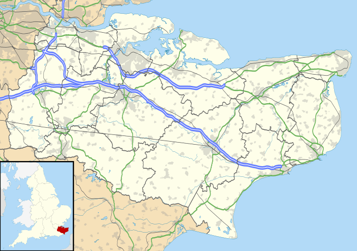
| Location | Kent/East Sussex |
| Coordinates | 51°04′12″N 0°23′42″E / 51.06997°N 0.39508°ECoordinates: 51°04′12″N 0°23′42″E / 51.06997°N 0.39508°E |
| Lake type | reservoir |
| Basin countries | United Kingdom |
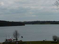
Bewl Water is a reservoir in the valley of the River Bewl (which is a tributary of the River Teise), straddling the boundary between Kent and East Sussex. It is about 2 miles south of Lamberhurst, Kent, England. The reservoir was part of a project to increase supplies of water in the area. It supplies not only Southern Water’s customers in the Medway towns, Thanet and Hastings, but is also used by other water companies in the area.
Work began to construct the reservoir in 1973 by damming and then flooding a valley. It was completed in 1975 having been filled with over 31,300 million litres of water. It is now the largest body of inland water in south east England.
In winter, when the flow in the River Medway exceeds 275 million litres per day, river water is pumped to storage in the reservoir. There is an outline plan to raise the water level by a further 3m to increase the yield by up to 30% to help with the growing water demand in south-east England. This will however put further demands on the River Medway to supply the additional water required with the potential for environmental degradation in the river and the eco-systems that it supports.
The reservoir in common with most large clean water lakes, is host to a large variety of wildlife.
Leisure use
Many recreational activities such as sailing and windsurfing at Bewl Valley Sailing Club [1] as well as rowing, trout fishing, Canoeing,[2][3] Kayaking[2][3] and walking take place on and around the reservoir (via a 12½ mile Round Reservoir Route for cyclist and walkers).[4]
There is also a passenger boat,[5] and a restaurant, conference facility and gift shop.
External links
- Bewl Water
- Bewl Water Outdoor Centre
- Bewl Canoe Club
- Bewl Canoe Club facebook page
- Bewl Valley Sailing Club
- Bewl Bridge Rowing Club
- Bewl Water Reservoir water level
References
- ↑ Bewl Water Outdoor Centre :: Bewl Water, Kent, UK :: Sailing, Windsurfing, Canoeing, Climbing and Teambuilding courses; Residential Trips for schools and other Groups:
- 1 2 http://www.bewlcanoeclub.co.uk
- 1 2 "Archived copy". Archived from the original on 10 August 2015. Retrieved 2015-07-31.
- ↑ http://www.bewlwater.co.uk/page.php?section=2&page=4
- ↑ http://www.bewlwater.co.uk/page.php?section=2&page=3