Benowa, Queensland
| Benowa Gold Coast, Queensland | |||||||||||||
|---|---|---|---|---|---|---|---|---|---|---|---|---|---|
| Population | 7,979 (2011 census)[1] | ||||||||||||
| Postcode(s) | 4217 | ||||||||||||
| Location |
| ||||||||||||
| LGA(s) | City of Gold Coast | ||||||||||||
| State electorate(s) | Surfers Paradise | ||||||||||||
| Federal Division(s) | Moncrieff | ||||||||||||
| |||||||||||||
Benowa is a suburb in Gold Coast, Queensland, Australia.[2] It is located 3 kilometres (1.9 mi) west of Surfers Paradise. At the 2011 Census, Benowa had a population of 7,979.[1]
History
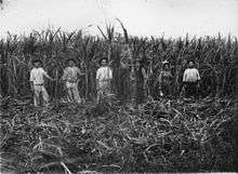
The name was originally derived from the Bundjalung word "Boonow", meaning bloodwood tree.[2] This word was later corrupted by European settlers in search of sugar cane growing on the shores of the Nerang River. The name was perpetualised in 1870 when a pioneer named Robert Muir used the name for his sugar plantation on the northern bank of the river.
The Bundall Provisional School opened on 21 September 1885 on the corner of Ashmore Road and Mediterranean Drive under head teacher Edwin Davies. In November 1900 it was renamed Benowa Provisional School. On 1 January 1909, it was relocated the corner of Ashmore Road and Carrara St and became Benowa State School. In 1965 it was relocated to its present site at Benowa Road.[3][4]
Geography
There are 3 distinct areas to Benowa. Established Benowa located on the northern side of Ashmore Road, Benowa Hills and Benowa Waters. Benowa is attracting a fair amount of attention from renovators with some of the original homes being built around the 1980s, due to its great proximity to Surfers Paradise, and Broadbeach and with so many great facilities within the area. Benowa is renowned for its canals with easy access to the Nerang River.
Demographics
In the 2011 census, Benowa recorded a population of 7,979 people, 52.1% female and 47.9% male.
The median age of the Benowa population was 42 years, 5 years above the national median of 37.
62.7% of people living in Benowa were born in Australia. The other top responses for country of birth were New Zealand 7%, England 5.9%, Japan 2%, South Africa 1.6%, Scotland 0.9%.
79% of people spoke only English at home; the next most common languages were 2.7% Japanese, 1.7% Mandarin, 1.4% Cantonese, 1% Croatian, 1% Korean.
Education
Benowa State Primary School was opened as a small rural school in 1885. The school continued as rural school until in the 1980s. Current enrolment is 890. School sports include Australian Rules football, touch football, netball, hockey and soccer. The school celebrates its 125th birthday in 2010.
Benowa State High School is known for its French immersion course, which started in 1985.[5]
Sport
Benowa is home to several sports clubs. The Surfers Paradise Australian Football Club are based at Sir Bruce Small Park and compete in the South East Queensland Australian Football League Division 1. The club also plays Cricket in the off season. The Surfers Paradise Baseball Club also play at Sir Bruce Small Park. The Benowa Bowls Club are based at Sir Bruce Small Park also.
Royal Pines Resort
The Royal Pines Resort is home to professional Golf tournaments such as the Australian PGA Championship and the Australian Ladies Masters. The resort also used to host a professional Tennis event named the Mondial Australian Women's Hardcourts on the WTA Tour. The event was moved to Brisbane in 2009. The Tennis facilities are still used by the Australian Fed Cup team to host Fed Cup ties and Bernard Tomic often trains on the courts in the off season.
References
- 1 2 Australian Bureau of Statistics (31 October 2012). "Benowa (State Suburb)". 2011 Census QuickStats. Retrieved 2013-10-16.
- 1 2 "Benowa (entry 46027)". Queensland Place Names. Queensland Government. Retrieved 16 April 2014.
- ↑ "Agency ID4840, Benowa State School". Queensland State Archives. Retrieved 16 April 2014.
- ↑ "School History". Benowa State School. Retrieved 15 April 2014.
- ↑ Benowa State High School Archived August 29, 2007, at the Wayback Machine.
External links
Coordinates: 28°01′S 153°24′E / 28.017°S 153.400°E