Beloit, Kansas
| Beloit, Kansas | |
|---|---|
| City | |
|
Mitchell County Courthouse (2014) | |
| Nickname(s): "The Heart of the Solomon Valley" | |
| Motto: "We're glad you're here, and we hope you stay for awhile [sic]."[1] | |
 Location within Mitchell County and Kansas | |
 KDOT map of Mitchell County (legend) | |
| Coordinates: 39°27′46″N 98°6′34″W / 39.46278°N 98.10944°WCoordinates: 39°27′46″N 98°6′34″W / 39.46278°N 98.10944°W | |
| Country | United States |
| State | Kansas |
| County | Mitchell |
| Platted | 1872 |
| Incorporated | 1872 |
| Government | |
| • Type | Mayor–Council |
| • Mayor | Tom Naasz |
| Area[2] | |
| • Total | 4.05 sq mi (10.49 km2) |
| • Land | 4.02 sq mi (10.41 km2) |
| • Water | 0.03 sq mi (0.08 km2) |
| Elevation | 1,385 ft (422 m) |
| Population (2010)[3] | |
| • Total | 3,835 |
| • Estimate (2012[4]) | 3,830 |
| • Density | 950/sq mi (370/km2) |
| Time zone | Central (CST) (UTC-6) |
| • Summer (DST) | CDT (UTC-5) |
| ZIP code | 67420 |
| Area code | 785 |
| FIPS code | 20-05775 [5] |
| GNIS feature ID | 0472339 [6] |
| Website | beloitks.org |

Beloit is a city and county seat of Mitchell County, Kansas, United States.[7] As of the 2010 census, the city population was 3,835.[8]
History
On permanent organization of the county in 1870, Beloit was selected as the county seat of Mitchell County, Kansas, and is located northeast of the center of the county on the Solomon River. The town site of Beloit was first settled by A.A. Bell in 1868 with the idea of improving the water power and for some time was known as Willow Springs.[9] Beloit is named after Beloit, Wisconsin.[10] Beloit sits at the junction of the Union Pacific and the Missouri Pacific Railroads.
Local legend has it that the local Indians advised Bell to locate the town at a certain bend of the Solomon river to protect the town from tornadoes. To this date, downtown Beloit has been hit with a tornado only once, in November 1922.
The town of Beloit was platted March 26, 1872, and the original description as found in the recorder's office covers all of Section 9, and the south half of the southeast quarter and south half of the southwest quarter of Section 4, Town 7 and Range 7 west. The proprietors of the town were T.F. Hersey, A.A. Bell, George Campbell, Alexander Campbell, C.H. Morrill, Edward Valentine, W.C. Ingram, Daniel Kepler and Vinton Whitehurst. The town grew very rapidly, and in July 1872, was incorporated as a city of the third class. On March 10, 1879, Gov. John P. St. John proclaimed Beloit a city of the second class.
Beloit was home to the Beloit Juvenile Correctional Facility of the Kansas Juvenile Justice Authority.[11]
On August 31, 2014, the city suffered a major hailstorm. The hail lasted for around 30 minutes and was the size of baseballs. The storm destroyed roofs, siding, windows, and caused heavy flooding. The storm was severe enough to be featured on the CBS Evening News.
Geography
According to the United States Census Bureau, the city has a total area of 4.05 square miles (10.49 km2), of which, 4.02 square miles (10.41 km2) is land and 0.03 square miles (0.08 km2) is water.[2]
Climate
The climate in this area is characterized by hot, humid summers and generally mild to cool winters. According to the Köppen Climate Classification system, Beloit has a humid subtropical climate, abbreviated "Cfa" on climate maps.[12]
Demographics
2010 census
| Historical population | |||
|---|---|---|---|
| Census | Pop. | %± | |
| 1880 | 1,835 | — | |
| 1890 | 2,455 | 33.8% | |
| 1900 | 2,359 | −3.9% | |
| 1910 | 3,082 | 30.6% | |
| 1920 | 3,315 | 7.6% | |
| 1930 | 3,502 | 5.6% | |
| 1940 | 3,765 | 7.5% | |
| 1950 | 4,085 | 8.5% | |
| 1960 | 3,837 | −6.1% | |
| 1970 | 4,121 | 7.4% | |
| 1980 | 4,367 | 6.0% | |
| 1990 | 4,066 | −6.9% | |
| 2000 | 4,019 | −1.2% | |
| 2010 | 3,835 | −4.6% | |
| Est. 2015 | 3,790 | [13] | −1.2% |
| U.S. Decennial Census | |||
As of the census[3] of 2010, there were 3,835 people, 1,647 households, and 964 families residing in the city. The population density was 954.0 inhabitants per square mile (368.3/km2). There were 1,842 housing units at an average density of 458.2 per square mile (176.9/km2). The racial makeup of the city was 98.1% White, 0.3% African American, 0.4% Native American, 0.2% Asian, 0.1% Pacific Islander, 0.2% from other races, and 0.8% from two or more races. Hispanic or Latino of any race were 1.0% of the population.
There were 1,647 households of which 25.6% had children under the age of 18 living with them, 48.3% were married couples living together, 7.7% had a female householder with no husband present, 2.6% had a male householder with no wife present, and 41.5% were non-families. 35.3% of all households were made up of individuals and 15% had someone living alone who was 65 years of age or older. The average household size was 2.18 and the average family size was 2.83.
The median age in the city was 42.8 years. 21.6% of residents were under the age of 18; 10% were between the ages of 18 and 24; 20.6% were from 25 to 44; 26.8% were from 45 to 64; and 21% were 65 years of age or older. The gender makeup of the city was 49.9% male and 50.1% female.
2000 census
As of the census[5] of 2000, there were 4,019 people, 1,623 households, and 994 families residing in the city. The population density was 1,012.2 people per square mile (390.9/km²). There were 1,851 housing units at an average density of 466.2 per square mile (180.0/km²). The racial makeup of the city was 96.94% White, 0.77% African American, 0.35% Native American, 0.37% Asian, 0.05% Pacific Islander, 0.17% from other races, and 1.34% from two or more races. Hispanic or Latino of any race were 1.07% of the population.
There were 1,623 households out of which 27.5% had children under the age of 18 living with them, 52.9% were married couples living together, 5.3% had a female householder with no husband present, and 38.7% were non-families. 34.4% of all households were made up of individuals and 17.2% had someone living alone who was 65 years of age or older. The average household size was 2.26 and the average family size was 2.93.
In the city the population was spread out with 24.3% under the age of 18, 10.9% from 18 to 24, 22.3% from 25 to 44, 21.2% from 45 to 64, and 21.3% who were 65 years of age or older. The median age was 40 years. For every 100 females there were 93.5 males. For every 100 females age 18 and over, there were 92.7 males.
The median income for a household in the city was $33,227, and the median income for a family was $43,030. Males had a median income of $26,099 versus $20,694 for females. The per capita income for the city was $17,713. About 5.5% of families and 8.9% of the population were below the poverty line, including 12.2% of those under age 18 and 7.5% of those age 65 or over.
Government
Local
Beloit has a Mayor/City Council form of government. Voters elect eight city council members, two from each of the City's four wards, to four-year terms. Also, the voters elect a Mayor. The Mayor and the 8 City Councilors form the City of Beloit Governing Body.[14]
The Beloit Governing Body meets in business session at 7:00 p.m. on the first and third Tuesdays of each month. Meetings take place in the Council Chambers at the Municipal Building. Cable channel 12 televises regular meetings.[14]
Districts
Beloit lies within Kansas's 1st congressional district, currently represented by Tim Huelskamp. For the purpose of representation in the Kansas Legislature, the city is located in the 36th Senate District, currently represented by Elaine Bowers, and the 107th House District, currently represented by Susan Concannon. On the local level, Beloit is in both the first, represented by Tom Claussen, and second, represented by Mike Cooper, Mitchell County Commissioner Districts. Beloit is mostly in Beloit Township, but the very far north side of the city is located in Plum Creek Township.
Education
Beloit is home to St. John's Catholic Grade School, St. John's Catholic High School (Beloit, Kansas), Beloit Elementary School, and Beloit Junior/Senior High School. Beloit is in USD 273. Beloit is also home to the North Central Kansas Technical College.
Notable people
- Sam Colson, Olympic gold medalist.[15]
- Scott Fulhage, professional football punter with the Atlanta Falcons and Cincinnati Bengals.
- Margaret H'Doubler, educator.
- Gene Keady, college and professional basketball coach.
- Waldo McBurney, former oldest living worker in the United States.
- Nancy Moritz, United States Circuit Judge for the United States Court of Appeals for the Tenth Circuit and former justice on the Kansas Supreme Court. She was born in Beloit and lived in nearby Tipton, Kansas until the age of 15.
- Mathew Pitsch, Republican member of the Arkansas House of Representatives from Fort Smith since 2015; former resident of Beloit.[16]
- Dean Sturgis, baseball player.
- Rodger Ward, professional race car driver. Two-time Indianapolis 500 winner.
See also
References
- ↑ welcome Archived November 10, 2012, at the Wayback Machine.
- 1 2 "US Gazetteer files 2010". United States Census Bureau. Archived from the original on 2012-07-14. Retrieved 2012-07-06.
- 1 2 "American FactFinder". United States Census Bureau. Retrieved 2012-07-06.
- ↑ "Population Estimates". United States Census Bureau. Archived from the original on 2013-06-17. Retrieved 2013-05-29.
- 1 2 "American FactFinder". United States Census Bureau. Archived from the original on 2013-09-11. Retrieved 2008-01-31.
- ↑ "US Board on Geographic Names". United States Geological Survey. 2007-10-25. Retrieved 2008-01-31.
- ↑ "Find a County". National Association of Counties. Archived from the original on 2011-05-31. Retrieved 2011-06-07.
- ↑ "2010 City Population and Housing Occupancy Status". U.S. Census Bureau. Archived from the original on July 21, 2011. Retrieved October 10, 2011.
- ↑ Blackmar, Frank Wilson (1912). Kansas: A Cyclopedia of State History, Embracing Events, Institutions, Industries, Counties, Cities, Towns, Prominent Persons, Etc. Standard Publishing Company. p. 171.
- ↑ Heim, Michael (2007). Exploring Kansas Highways. p. 78.
- ↑ Beloit Juvenile Correctional Facility Archived October 26, 2009, at the Wayback Machine.
- ↑ Climate Summary for Beloit, Kansas
- ↑ "Annual Estimates of the Resident Population for Incorporated Places: April 1, 2010 to July 1, 2015". Retrieved July 2, 2016.
- 1 2 Beloit Government
- ↑ "Sam Colson". Sports-Reference. Retrieved February 2016. Check date values in:
|access-date=(help) - ↑ "Mathew W. Pitsch". intelius.com. Retrieved April 9, 2015.
Further reading
- History of the State of Kansas; William G. Cutler; A.T. Andreas Publisher; 1883. (Online HTML eBook)
- Kansas : A Cyclopedia of State History, Embracing Events, Institutions, Industries, Counties, Cities, Towns, Prominent Persons, Etc; 3 Volumes; Frank W. Blackmar; Standard Publishing Co; 944 / 955 / 824 pages; 1912. (Volume1 - Download 54MB PDF eBook),(Volume2 - Download 53MB PDF eBook), (Volume3 - Download 33MB PDF eBook)
External links
| Wikimedia Commons has media related to Beloit, Kansas. |
- City
- Schools
- USD 273, local school district
- Maps
- Beloit City Map, KDOT
Municipalities and communities of Mitchell County, Kansas, United States | ||
|---|---|---|
| Cities | 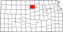 | |
| CDP | ||
| Unincorporated community | ||
| Townships |
| |
| Footnotes | ‡This populated place also has portions in an adjacent county or counties | |