Bela Palanka
| Bela Palanka Бела Паланка | ||
|---|---|---|
| Municipality and Town | ||
|
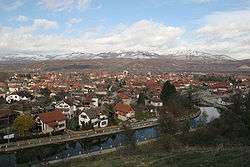
View from heights | ||
| ||
 Location of the municipality of Bela Palanka within Serbia | ||
| Coordinates: 43°13′N 22°19′E / 43.217°N 22.317°ECoordinates: 43°13′N 22°19′E / 43.217°N 22.317°E | ||
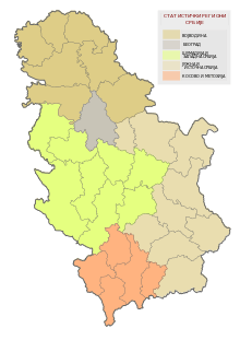
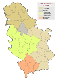
| Country |
| |
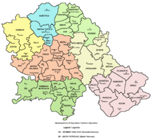
| District | Pirot | |
| Settlements | 46 | |
| Government | ||
| • Mayor |
Goran Miljkovic (DS) | |
| Area[1] | ||
| • Municipality | 551 km2 (213 sq mi) | |
| Population (2011 census)[2] | ||
| • Town | 8,112 | |
| • Municipality | 12,051 | |
| Time zone | CET (UTC+1) | |
| • Summer (DST) | CEST (UTC+2) | |
| Postal code | 18310 | |
| Area code | +381 18 | |
| Car plates | PI | |
| Website |
www | |

Bela Palanka (Serbian Cyrillic: Бела Паланка, pronounced [bɛ̂ːlaː pǎlaːŋka]) is a town and municipality located in the Pirot District of southeast Serbia. According to the 2011 census, the population of the town is 8,112, and thepopulation of the municipality is 12,051. In ancient times, the town was known as Remesiana. The name Bela Palanka means 'white town'.
Geography
Bela Palanka is a small town in the southeast of the country and is surrounded by countryside and mountains. The town is accessible from the nearby city of Niš by the Niš Express buses that run from Niš to Pirot, Babušnica, Dimitrovgrad, and Sofia.
Demographics
Ethnic groups in the municipality (2002 census):
- Serbs = 12,981
- Roma = 1,228
- Others
History
The town was originally settled by the Dacians and was known under the ancient name of Aiadava or Aeadaba. Thracians inhabited the area until their assimilation into contemporary ethnic groups in the area.
After the Romans conquered Moesia in 75 BC, the new castrum (imperial domain with estates) and municipium was known initially as Ulpianorum and then Remesiana[3] (Moesi) and stood along the Via Militaris between Naissus and Serdica.
Emperor Justinian had following strongholds in the district of Remesiana:
|
Brittura Subaras Lamponiana Stronges Dalmatas Primiana Phrerraria Topera Tomes Cuas Tzertzenutzas Stens Aeadaba Destreba Pretzouries Cumudeba Deurias Lutzolo Rhepordenes Spelonca Scumbro Briparo Tulcoburgo Longiana Lupophantana Dardapara Burdomina Grinciapana Graecus Drasimarca |
The patron saint of Romania, Nicetas of Remesiana, was a 4th-century bishop at Remesiana. Peter the Hermit was defeated by the Byzantines in the north and regrouped at an evacuated Bela Palanka, gathering the harvest before heading to Constantinople.[4]
Excavations include well-preserved castrum dating to 4th century and a hoard of 260 coins minted during the rule of Constantine I, Theodosius I, Tiberius Claudius Nero (3rd century AD).[5]
From 1929 to 1941, Bela Palanka was part of the Morava Banovina of the Kingdom of Yugoslavia.
-

By night
-

Fountain
-

Spring
-

Basilica Apse under excavation in Remesiana. Basilica is found under modern residential building.
-
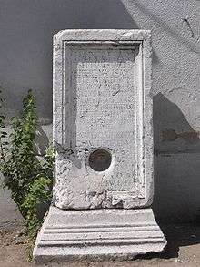
3rd century Septimius Severus monument in Bela Palanka.
-

Rajko Mitić Monument

See also
References
- ↑ "Municipalities of Serbia, 2006". Statistical Office of Serbia. Retrieved 2010-11-28.
- ↑ "2011 Census of Population, Households and Dwellings in the Republic of Serbia: Comparative Overview of the Number of Population in 1948, 1953, 1961, 1971, 1981, 1991, 2002 and 2011, Data by settlements" (PDF). Statistical Office of Republic Of Serbia, Belgrade. 2014. ISBN 978-86-6161-109-4. Retrieved 2014-06-27.
- ↑ http://www.roma-victrix.com/urbesetloca/urbesetloca_moesia.htm
- ↑ God's war: a new history of the Crusades-Christopher Tyerman 2006
- ↑ Ancient diseases: the elements of palaeopathology-Srboljub Živanović 1982
External links
| Wikimedia Commons has media related to Bela Palanka. |