Baxley, Georgia
| Baxley, Georgia | |
|---|---|
| City | |
|
City hall in Baxley | |
 Location in Appling County and the state of Georgia | |
| Coordinates: 31°46′31″N 82°20′51″W / 31.77528°N 82.34750°WCoordinates: 31°46′31″N 82°20′51″W / 31.77528°N 82.34750°W | |
| Country | United States |
| State | Georgia |
| County | Appling |
| Area | |
| • Total | 8.4 sq mi (21.7 km2) |
| • Land | 8.4 sq mi (21.7 km2) |
| • Water | 0 sq mi (0 km2) |
| Elevation | 203 ft (62 m) |
| Population (2010) | |
| • Total | 4,400 |
| • Density | 525/sq mi (202.8/km2) |
| Time zone | Eastern (EST) (UTC-5) |
| • Summer (DST) | EDT (UTC-4) |
| ZIP codes | 31513, 31515 |
| Area code(s) | 912 |
| FIPS code | 13-06016[1] |
| GNIS feature ID | 0331106[2] |
| Website |
www |

Baxley is a city in Appling County, Georgia, United States. As of the 2010 census, the city had a population of 4,400.[3] The city is the county seat of Appling County.[4] Baxley was first settled as a result of the Macon and Brunswick Railroad being built through Appling County in 1870. Originally, it was a railroad depot known as Station Number 7, but it soon was named Baxley (after one of the community's first settlers, Wilson Baxley of North Carolina).[5]
Geography
Baxley is located at 31°46′31″N 82°20′51″W / 31.77528°N 82.34750°W (31.775152, -82.347520).[6] Baxley is approximately 42 miles (68 km) east of Douglas, Georgia, and 47 miles (76 km) north of Waycross, Georgia.
According to the United States Census Bureau, the city has a total area of 8.4 square miles (21.7 km2), of which 0.012 square miles (0.03 km2), or 0.16%, is water.[7]
Demographics
| Historical population | |||
|---|---|---|---|
| Census | Pop. | %± | |
| 1880 | 110 | — | |
| 1890 | 337 | 206.4% | |
| 1900 | 488 | 44.8% | |
| 1910 | 831 | 70.3% | |
| 1920 | 1,142 | 37.4% | |
| 1930 | 2,122 | 85.8% | |
| 1940 | 2,916 | 37.4% | |
| 1950 | 3,409 | 16.9% | |
| 1960 | 4,268 | 25.2% | |
| 1970 | 3,503 | −17.9% | |
| 1980 | 3,586 | 2.4% | |
| 1990 | 3,841 | 7.1% | |
| 2000 | 4,150 | 8.0% | |
| 2010 | 4,400 | 6.0% | |
| Est. 2015 | 4,440 | [8] | 0.9% |
As of the 2010 United States Census, there were 4,400 people residing in the city. The racial makeup of the city was 51.7% White, 35.3% Black, 0.1% Native American, 1.3% Asian, 0.1% from some other race and 0.8% from two or more races. 10.6% were Hispanic or Latino of any race.
At the census[1] of 2000, there were 4,150 people, 1,567 households, and 1,048 families residing in the city. The population density was 580.7 people per square mile (224.1/km²). There were 1,866 housing units at an average density of 261.1 per square mile (100.8/km²). The racial makeup of the city was 57.28% White, 37.93% African American, 0.22% Native American, 0.60% Asian, 3.16% from other races, and 0.82% from two or more races. Hispanic or Latino of any race were 7.23% of the population.
There were 1,567 households out of which 33.2% had children under the age of 18 living with them, 43.3% were married couples living together, 18.5% had a female householder with no husband present, and 33.1% were non-families. 28.9% of all households were made up of individuals and 13.4% had someone living alone who was 65 years of age or older. The average household size was 2.56 and the average family size was 3.15.
In the city the population was spread out with 27.6% under the age of 18, 10.4% from 18 to 24, 26.7% from 25 to 44, 20.8% from 45 to 64, and 14.5% who were 65 years of age or older. The median age was 35 years. For every 100 females there were 91.1 males. For every 100 females age 18 and over, there were 84.9 males.
The median income for a household in the city was $24,441, and the median income for a family was $30,648. Males had a median income of $28,087 versus $16,250 for females. The per capita income for the city was $14,321. About 21.6% of families and 24.4% of the population were below the poverty line, including 31.0% of those under age 18 and 26.3% of those age 65 or over.
Economy
The Edwin I. Hatch Nuclear Power Plant is located north of the city along U.S. Route 1, on the banks of the Altamaha River. It is the area's largest employer.
International Forest Products Limited operates a sawmill employing over 50 people.
Education
Appling County students in K-12 grades are in the Appling County School District, which consists of four elementary schools (three include pre-school), a middle school and a high school.[10] The district has 210 full-time teachers and over 3,303 students.[11]
- Altamaha Elementary School
- Appling County Primary School
- Appling County Elementary School
- Fourth District Elementary School
- Appling County Middle School
- Appling County High School
Notable people
- Byron Buxton, Major League Baseball prospect, the second overall pick (drafted by the Minnesota Twins) in the 2012 MLB draft, winner of Baseball America's Minor League Player of the Year Award in 2013.
- Dexter Carter, running back for San Francisco 49ers and New York Jets from 1990 to 1996, born in Baxley and graduated from Appling County High School
- The Lacs, a country/rap music group, is from Baxley.
- Caroline Miller, Georgia's first Pulitzer Prize-winning novelist; she received the award for Lamb in His Bosom in 1934
- Janisse Ray, author of Ecology of a Cracker Childhood (1999) published by Milkweed Press, which is a memoir about growing up in Baxley. In the book she describes in vivid detail the ecosystem of the vanishing longleaf pine that once covered the area.
- Devonta Freeman, NFL Running Back for the Atlanta Falcons was a 4th round pick (103) in 2014, born in Baxley and went to Florida State University
Baxley in popular culture
Baxley was mentioned in Charlie Daniels' Open Letter to the Hollywood Bunch. It stated "Go down to Baxley, Georgia and hold an anti-war rally and see what the folks down there think about you."
References
- 1 2 "American FactFinder". United States Census Bureau. Archived from the original on 2013-09-11. Retrieved 2008-01-31.
- ↑ "US Board on Geographic Names". United States Geological Survey. 2007-10-25. Retrieved 2008-01-31.
- ↑ http://factfinder2.census.gov/faces/tableservices/jsf/pages/productview.xhtml?pid=DEC_10_SF1_GCTP2.ST13&prodType=table
- ↑ "Find a County". National Association of Counties. Archived from the original on 2012-07-12. Retrieved 2011-06-07.
- ↑ Georgia Info. Retrieved 2012-07-11.
- ↑ "US Gazetteer files: 2010, 2000, and 1990". United States Census Bureau. 2011-02-12. Retrieved 2011-04-23.
- ↑ "Geographic Identifiers: 2010 Demographic Profile Data (G001): Baxley city, Georgia". U.S. Census Bureau, American Factfinder. Retrieved May 6, 2013.
- ↑ "Annual Estimates of the Resident Population for Incorporated Places: April 1, 2010 to July 1, 2015". Retrieved July 2, 2016.
- ↑ "Census of Population and Housing". Census.gov. Archived from the original on May 11, 2015. Retrieved June 4, 2015.
- ↑ Georgia Board of Education, Retrieved July 8, 2010.
- ↑ Free District Report, Retrieved May 29, 2010.
External links
| Wikimedia Commons has media related to Baxley, Georgia. |
Municipalities and communities of Appling County, Georgia, United States | ||
|---|---|---|
| Cities | 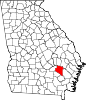 | |
| Town | ||