Battambang
| Battambang ក្រុងបាត់ដំបង Phra Tabong | |
|---|---|
| City | |
| ក្រុងបាត់ដំបង · City of Battambang | |
|
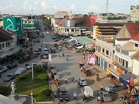
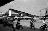
Road No. 3 near the central market | |
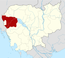
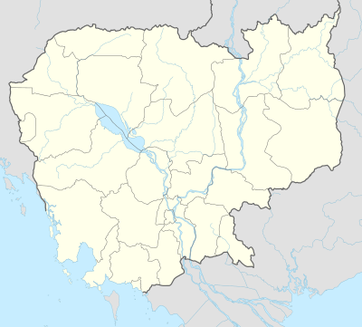 Battambang Location of Battambang, Cambodia | |
| Coordinates: 13°06′N 103°12′E / 13.100°N 103.200°E | |
| Country |
|
| Province | Battambang |
| Settled | 11th Century |
| Official | 1907 |
| Government | |
| • Type | City Municipality |
| Area | |
| • Total | 293 km2 (113 sq mi) |
| Elevation | 39 m (128 ft) |
| Population (2008)[1] | |
| • Total | 144,323 |
| • Rank | Ranked 3rd |
| • Density | 490/km2 (1,300/sq mi) |
| Time zone | Cambodia (UTC+7) |
| Website | City of Battambang |
Battambang (Khmer: ក្រុងបាត់ដំបង) or Krong Battambang (ក្រុងបាត់ដំបង, Battambang City) is the capital city of Battambang province in north western Cambodia.
Founded in the 11th century by the Khmer Empire, Battambang is the leading rice-producing province of the country. For nearly 100 years it was a major commercial hub and provincial capital of Siamese province of Inner Cambodia (1795-1907), though it was always populated by Khmer, with some ethnic Vietnamese, Lao, Thai and Chinese. Battambang remains the hub of Cambodia's northwest, connecting the region with Phnom Penh and Thailand.
The city is situated on the Sangkae River, a tranquil, small body of water that winds its way picturesquely through Battambang Province. As with much of Cambodia, French Colonial architecture is a notable aspect of the city, with some of the best-preserved examples in the country.
History
Battambang was established as an important trading city with around 2,500 residents in the 18th century. The population was centred along a single road parallel to the Sangkae River (Stung Sangkae). In 1795 Siam (modern-day Thailand) annexed much of north western Cambodia including the current provinces of Banteay Meanchey, Battambang, Oddar Meanchey, Pailin, and Siem Reap into the province of Inner Cambodia. The Siamese ruled Battambang as a provincial capital through the Thai-speaking Khmer Aphaiwong family,[2] a branch of the Khmer royal family, which governed for six generations until 1907 when the province was ceded to the French to be reunited with Cambodia as part of the French Indochina colony.
Following colonization by the French, an urban layout was developed which resulted in an enlarged French colonial town. This first attempt at modernization resulted in well-defined streets laid in a grid pattern, building of urban structures and three main streets parallel to the Sangkae River, and the linking of both banks by the construction of two bridges in 1917. Military and prison facilities were also erected. Nineteen years later, a second urban development plan was implemented with a newly constructed railway linking Battambang to Phnom Penh. The urban structures were extended to the west of the town creating urban hubs oriented around the railway station. The large residential villas and public buildings built during this period of French development significantly changed the landscape of the previously remote city. A subsequent third urban development plan for Battambang involved the north, east and south of the city. This vast undertaking, which required long-term planning to integrate all of the previous work, resulted in a modern provincial capital that was by far the most developed region of Cambodia outside of Phnom Penh.
Much later, more infrastructure and public facilities were built under the modernization program of the Cambodian government led by Prince Sihanouk. Several provincial departments, a court house and other public buildings were added on both sides of the river. Textile and garment factories were built by French and Chinese investors, the Battambang Airport was constructed, and the railway line was extended to the Thai border at Poipet. To serve the cultural needs of the population, numerous schools and a university were built as well as a sports centre, museum and an exhibition hall.
Climate
| ||||||||||||||||||||||||||||||||||||||||||||||||||||||||||||||||||||||||||||||||||||
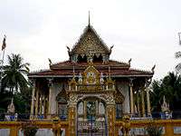
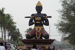
Attractions
Kamping Puoy Lake
Located between two mountains, named Phnom Kul or Phnom Ta Nget and Phnom Kamping Puoy, at Ta Nget village, Ta Kriem Commune is 35 kilometers (22 mi) from the provincial town. Kamping Puoy lake is 1,900 meters (6,230 ft) wide, 19 kilometers (12 mi) long and can load 110,000,000 cubic metres (3.8846×10⁹ cu ft). It is famous for its giant lotus flowers whose fiber is spun and weaved to make a new organic fabric. These activities employ more than 20 underprivileged women around the lake.

.jpg)
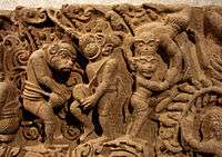
Baset Temple Was built during the reign of King Suryavarman I (1002–1050) and located on a hill at Baset village, Ta Pun commune 15 kilometers (9 mi) from the provincial town. Baset temple adapts the architecture of 11th century and built in 1036 and 1042. Next to the temple, there is a pond 20 meters (66 ft) long 12 meters (39 ft) wide and 10 meters (33 ft) deep. The pond never dries up even in the dry season.
Adapts the architecture of the 11th century and was built in 1027 during the reign of King Suryavarman I (1002–1050). It is located at Piem Ek commune 14 kilometers (9 mi) from the provincial town.
Prasat Banan
Adapts the architecture of the mid-11th century and the end of the 12th century; the temple was first built by King Dharanindravarman II (1050–1066) and was built finally built by the King Jayavarman VII (1181–1220). The temple is located on the top of approximately 400-meter-high (1,310 ft) mountain at Koh Tey 2 commune, Banan District 15 kilometers (9 mi) from the provincial town by the provincial Road No 155 parallel to Sangker River. In the valley, there is Ku Teuk and two main natural wells, namely: Bit Meas and Chhung or Chhung Achey.
Prasat Snung
Characterized by three separated stupas made of brick, located on a hill 30 meters (98 ft) long and 20 meters (66 ft) wide, in Snung pagoda’s area, Snung commune, Banan District 22 kilometers (14 mi) from the provincial town. According to the style at the gate, the temple is similar to other temples in 12th century. Behind the temple, there is another new temple being built.
Phnom Sampov
Is a natural resort located along the National Road No 57 (the former National Road No10) at Sam Puoy commune (the high land more than 100 meters (330 ft) high) and 12 kilometers (7 mi) from the provincial town of Battambang. On the top of Sam Puoy mountain, there is a temple and three natural wells, namely Pkar Slar, Lo Khuon and Ak Sopheak. Next to Sam Puoy mountain, there are some mountains, and natural sites like Phnom Trung Moan, Phnom Trung Tea and Phnom Neang Rum Say Sork. These mountains relate to the Cambodia folk legend of Reach Kol Neang Rum Say Sork.
Sek Sak Resort
A natural resort which has been popular since before the civil war, Sek Sak stretches along the river bank with plants, trees and bamboo stretching 500 meters (1,640 ft) in length. Tourists can also visit other attractive sites like Po Pus Pich Chen Da Dong Tong and Sa Ang speak, the pre-history site five kilometers (3.1 mi) to six kilometers (3.75 mi) away. Sek Sak located Treng commune, Rotanak Mondul District 50 kilometers (31 mi) from the provincial town of Battambang along the National Road No 57, the former National Road No 10.
Nory (Bamboo Train)
Is overseen by the tourist police and runs from just outside the city to a village that has a brick factory. See Norry for more information.
Battambang Circus (Phare Ponleu Selpak)
The shows include a range of circus disciplines including acrobatics, juggling, aerial work, clowning, tightrope walking and aqua-balance. It gives performances every Monday and Thursday evening. The shows are put on by students from the NGO arts school, Phare Ponleu Selpak that helps disadvantaged children and young people escape from situations connected with poverty such as begging or trafficking and to get an education, both in normal public school and in the arts.[4] It is probably Battambang's premier tourist attraction, and the performances are world class.
Transportation
The main means of reaching the city is via buses from Bangkok, Phnom Penh and Siem Reap. The airport is not much used, and the passenger rail service has not yet been restored.
There is also (except during the lowest water levels of the dry season) a daily boat connection between Battambang and Siem Reap via the Sangkae River. Since the buses are faster and cheaper, the scenic trip is nowadays used mainly by tourists and some locals who live along the river.
Twin towns – Sister cities
 Stockton, California, USA
 Kleinmachnow, Brandenburg, Germany
Notable people
- Kalyanee Mam - filmmaker
- Vann Nath - painter, artist, writer, and human rights activist
- Sopheap Pich - sculptor and artist
- Arn Chorn-Pond - human rights activist
See also
- Battambang (font): the name of the Cambodian font in Mac OS X.
References
- ↑ "Chapter 2: Spatial Distribution and Density of Population" (PDF). Statistics Japan.
- ↑ Goscha, Christopher E. (1999). Thailand and the Southeast Asian Networks of the Vietnamese Revolution, 1885-1954. Surrey, UK: Curzon Press, Nordic Institute of Asian Studies. p. 123. ISBN 0700706224. Retrieved 3 Dec 2013.
- ↑ "Weatherbase: Historical Weather for Batdambang, Cambodia". Weatherbase. 2011. Retrieved on November 24, 2011.
- ↑ "Phare Ponleu Selpak". Retrieved 14 January 2015.
Further reading
- Analyzing Development Issues Trainees, ADI Team, and Cooperation Committee for Cambodia. Labour Migration to Thailand and the Thai-Cambodian Border Recent Trends in Four Villages of Battambang Province. Small-scale research report. [Phnom Penh?]: Cooperation Committee for Cambodia, 2003.
- Catalla, Rebecca F. Crossing Borders, Crossing Norms Vulnerability and Coping in Battambang Province. SCVCS report, #5. Phnom Penh, Cambodia: UNICEF/AFSC, 2000. ISBN 0-910082-41-3
- Kassie, Alebachew, and Nguon Sokunthea. Credit and Landlessness Impact of Credit Access on Landlessness in Cheung Prey and Battambang Districts. Phnom Penh: Oxfam GB Cambodia Land Study Project, 2000.
- Mourer, Cécile, and Roland Mourer. The Prehistoric Industry of Laang Spean, Province of Battambang, Cambodia. Sydney: Australasian Medical Pub, 1970.
- Robinson, Court, Suphāng Čhanthawānit, and Lekha Nou. Rupture and Return Repatriation, Displacement, and Reintegration in Battambang Province, Cambodia. Bangkok: The Center, 1994. ISBN 974-631-130-1
- Grant Ross, Helen. Battambang = Pâtṭaṃpaṅ = Bad Dambaung = Le bâton perdu : histoire d'une ville. Phnom Penh, Cambodge: 3DGraphics Pub, 2003. ISBN 979-96974-4-1 in French and Khmer
- Tūc, Jhuaṅ. Battambang During the Time of the Lord Governor. Phnom Penh: Cedoreck, 1994.
- Vinary, Vonn. "All Our Livelihoods Are Dead" Landlessness and Aquatic Resources in Battambang Province. [Phnom Penh]: Oxfam GB Cambodia Land Study Project, 2000.
- Wallgren, Pia, and Ray Sano. Report on the Reconciliation Areas Based on in-Depth Interviews Conducted in Six Villages in Battambang, Banteay Meanchey and Siem Reap Provinces. Phnom Penh: UNDP/CARERE, 2000.
External links
| Wikimedia Commons has media related to Battambang. |
| Wikivoyage has a travel guide for Battambang. |
- Battambang - The Rice Bowl of Cambodia (Official Website of the Provincial Town Battambang on www.battambang-town.gov.kh) (Khmer) (English)
- Phnom Bannon Hill Temple
| Provincial capitals | ||
|---|---|---|
| Municipal cities | ||
| Other cities | ||
Coordinates: 13°06′N 103°12′E / 13.100°N 103.200°E