Batesburg-Leesville, South Carolina
| Batesburg-Leesville, South Carolina | |
|---|---|
| Town | |
| Nickname(s): B-L, The Twin Cities | |
 Location of Batesburg-Leesville within South Carolina. | |
| Coordinates: 33°55′N 81°33′W / 33.917°N 81.550°WCoordinates: 33°55′N 81°33′W / 33.917°N 81.550°W | |
| Country | United States |
| State | South Carolina |
| Counties | Lexington, Saluda |
| Government | |
| • Mayor | Rita Crapps |
| Area | |
| • Total | 7.4 sq mi (19.2 km2) |
| • Land | 7.3 sq mi (19 km2) |
| • Water | 0.1 sq mi (0.2 km2) |
| Elevation | 643 ft (196 m) |
| Population (2000) | |
| • Total | 5,517 |
| • Density | 752/sq mi (290.2/km2) |
| Time zone | EST (UTC-5) |
| • Summer (DST) | EDT (UTC-4) |
| ZIP codes | 29006, 29070 |
| Area code(s) | 803 |
| FIPS code | 45-04300[1] |
| GNIS feature ID | 1692657[2] |
| Website | http://www.batesburg-leesville.org |
Batesburg-Leesville is a town in Lexington and Saluda Counties, South Carolina. The population was 5,362 at the 2010 census.
History
The town of Batesburg-Leesville was formed in 1992 by the consolidation of the towns of Batesburg and Leesville. The last mayor of Batesburg and the first mayor of Batesburg-Leesville was Elza S. "Sandy" Spradley, Jr.
The D. D. D. Barr House, Batesburg Commercial Historic District, Simon Bouknight House, Cartledge House, Cedar Grove Lutheran Church, Church Street Historic District, Broadus Edwards House, Hampton Hendrix Office, Hartley House, Henry Franklin Hendrix House, Thomas Galbraith Herbert House, J.B. Holman House, A.C. Jones House, Leesville College Historic District, Crowell Mitchell House, McKendree Mitchell House, Mitchell-Shealy House, Old Batesburg Grade School, John Jacob Rawl House, Rawl-Couch House, Southern Railway Depot, and Rev. Frank Yarborough House are listed on the National Register of Historic Places.[3][4]
In February 1946, a black American soldier, Isaac Woodard, was attacked by the local police chief, Linwood Shull. The assault left Woodard blind. Shull was never punished. The attack was the subject of an Orson Welles radio commentary a few months later.[5]
Law and government
Batesburg-Leesville is served by a council-manager style government.
Mayor
Batesburg-Leesville's mayor is Rita Crapps.
Town Council
The town council comprises eight elected council persons representing single-member districts. The current council members are:
- District 1: Rachael Taylor
- District 2: Todd O'Dell
- District 3: Steve Cain
- District 4: Charles M. Simpkins (also mayor pro tem)
- District 5: Bob Penick
- District 6: Chip Spradley
- District 7: Meggie Ricard
- District 8: Jim Wiszowaty
Economy
Top employers
The top employer in Batesburg-Leesville is Lexington County School District Three with four different schools and a district office. The next is Union Switch and Signal, which has a 184,000-square-foot (17,100 m2) manufacturing facility.
Poultry industry
The town's economic dependence on poultry harvesting is apparent due to the presence of two large processing plants: Amick Farms and Columbia Farms. These assist in making Lexington County the top poultry producer in the state.
Poultry Festival
The South Carolina Poultry Festival (formerly the Ridge Poultry Festival) has been on the second Saturday in May since 1986. The festival features live music, food vendors, craft vendors, a carnival, a parade, and to conclude the event, a cake auction and fireworks show.
Future growth
On May 9, 2007, WalMart Stores, Inc, opened a new 180,000-square-foot (17,000 m2) Wal-Mart Supercenter near the middle of town, and a strip mall for smaller businesses. It created 375 new jobs, but the complex has been controversial. Local residents fear WalMart will draw off business from local ones. Others argue that when a WalMart moves into a small town, the associated economic benefits result in attracting new residents, who can also patronize local businesses.
Education
Public schools
The public school system in Batesburg-Leesville is administered by Lexington County School District Three, which consists of:
- Batesburg-Leesville Primary School (grades K-2)
- Batesburg-Leesville Elementary School (grades 3-5)
All sports teams associated with School District Three use a panther as their mascot. The Panthers' colors are purple and gold.
Private schools
W. Wyman King Academy and the Ridge Christian School are both private, nondenominational Christian schools accepting students in grades K-12.
Colleges and universities
University of South Carolina Aiken, University of South Carolina Columbia, and several Midlands Technical College campuses are within a roughly 30-45 minute drive from town.
In 2008, Midlands Technical College opened a new Batesburg-Leesville satellite campus around the site of the Old Haynes Auditorium in the Leesville side of town.
Media
Newspapers
Batesburg-Leesville is served weekly by The Twin-City News, which specifically focuses on local news, as well as that from immediately surrounding areas (mostly Gilbert and Monetta). It is usually devoid of national or world news.
The town is also served by The State newspaper, which is also circulated through most of the state of South Carolina.
In 2007, Lexington County Chronicle and The Dispatch-News began circulating at town stores and business to complement their subscribers in the area. The newspaper covers all county governments, state, national, and international news as it affects Lexington County residents.
Radio
Batesburg-Leesville has only one radio station transmitting from within its borders, WBLR 1430 AM. However, Batesburg-Leesville is in range of several radio stations broadcasting from the surrounding areas, including:
- WYFV 88.7 FM - Christian - Cayce, SC
- WMHK 89.7 FM - Christian - Columbia, SC
- WUSC 90.5 FM - University of South Carolina - Columbia, SC
- WLTR 91.3 FM - Classical/NPR - Columbia, SC
- WARQ 93.5 FM - New Rock - Columbia, SC
- WCOS 97.5 FM - Country - Columbia, SC
- WLXC 98.5 FM - R&B/Soul - Lexington, SC
- WWDM 101.3 FM - R&B/Soul - Columbia, SC
- WEKL 105.7 FM - Classic rock - Augusta, GA
- WNOK 104.7 FM - "Top 40" - Columbia, SC
- WTCB 106.7 FM - "Top 40" - Columbia, SC
Television
Over-the-air channels receivable in Batesburg-Leesville include:
- WJBF - Channel 6 - Augusta, GA
- WAGT - Channel 26 - Augusta, GA
- WRDW-TV - Channel 12 - Augusta, GA
- WOLO-TV - Channel 25 (ABC Affiliate) - Columbia, SC
- WFXG - Channel 54 - Augusta, GA
- WLTX - Channel 19 (CBS Affiliate) - Columbia, SC
- WACH - Channel 57 (Fox Affiliate) - Columbia, SC
- WIS-TV - Channel 10 (NBC Affiliate) - Columbia, SC
- WRLK-TV - Channel 35 - Columbia, SC
Alternatively, digital cable providers Time Warner Cable and Pond Branch Telecommunications collectively cover the majority of the greater Batesburg-Leesville area.
Geography
Batesburg-Leesville is located at 33°54′35″N 81°32′03″W / 33.909767°N 81.534296°W (33.909767, -81.534296).[6]
According to the United States Census Bureau, the town has a total area of 7.4 square miles (19.2 km2), of which 7.3 square miles (19.0 km2) is land and 0.1 square mile (0.2 km2) (1.21%) is covered by water.
Demographics
| Historical population | |||
|---|---|---|---|
| Census | Pop. | %± | |
| 1880 | 286 | — | |
| 1890 | 528 | 84.6% | |
| 1900 | 971 | 83.9% | |
| 1910 | 1,995 | 105.5% | |
| 1920 | 2,848 | 42.8% | |
| 1930 | 2,839 | −0.3% | |
| 1940 | 2,933 | 3.3% | |
| 1950 | 3,169 | 8.0% | |
| 1960 | 3,806 | 20.1% | |
| 1970 | 4,036 | 6.0% | |
| 1980 | 4,023 | −0.3% | |
| 1990 | 4,082 | 1.5% | |
| 2000 | 5,517 | 35.2% | |
| 2010 | 5,362 | −2.8% | |
| Est. 2015 | 5,441 | [7] | 1.5% |
As of the census[1] of 2000, there were 5,517 people, 2,167 households, and 1,482 families residing in the town. The population density was 751.4 people per square mile (290.2/km2). There were 2,446 housing units at an average density of 333.2 per square mile (128.7/km2). The racial makeup of the town was 52.82% White, 45.66% African American, 0.29% Native American, 0.20% Asian, 0.40% from other races, and 0.63% from two or more races. Hispanic or Latino of any race were 1.61% of the population.
There were 2,167 households out of which 31.2% had children under the age of 18 living with them, 42.0% were married couples living together, 22.2% had a female householder with no husband present, and 31.6% were non-families. 28.3% of all households were made up of individuals and 13.7% had someone living alone who was 65 years of age or older. The average household size was 2.50 and the average family size was 3.03.
In the town the population was spread out with 26.5% under the age of 18, 8.4% from 18 to 24, 25.2% from 25 to 44, 22.6% from 45 to 64, and 17.3% who were 65 years of age or older. The median age was 38 years. For every 100 females there were 83.3 males. For every 100 females age 18 and over, there were 76.5 males.
The median income for a household in the town was $32,865, and the median income for a family was $40,040. Males had a median income of $32,447 versus $22,196 for females. The per capita income for the town was $16,078. About 16.1% of families and 18.0% of the population were below the poverty line, including 25.9% of those under age 18 and 12.5% of those age 65 or over.
Notable people
Notable figures who were born in, lived in, or are otherwise associated with Batesburg-Leesville include:
Athletes
- Shaq Roland, South Carolina University Wide Receiver for South Carolina Gamecocks
- Dontrelle Inman, professional football player for San Diego Chargers
- Ed McDaniel, former professional football player for Minnesota Vikings
- Zackary Bowman, professional football player for the Chicago Bears.
- Maurice Simpkins, professional football player for the St. Louis Rams
Musicians
- Linda Martell, singer
Political
- Ryan Shealy, South Carolina politician
- George Bell Timmerman, served as governor of South Carolina from 1955 to 1959, leading the state during a period of growing racial strife. He served as lieutenant governor under both Strom Thurmond and Jimmy Byrnes, 1947-1955.
References
- 1 2 "American FactFinder". United States Census Bureau. Archived from the original on 2013-09-11. Retrieved 2008-01-31.
- ↑ "US Board on Geographic Names". United States Geological Survey. 2007-10-25. Retrieved 2008-01-31.
- ↑ National Park Service (2010-07-09). "National Register Information System". National Register of Historic Places. National Park Service.
- ↑ "National Register of Historic Places Listings". Weekly List of Actions Taken on Properties: 11/15/10 through 11/19/10. National Park Service. 2010-11-26.
- ↑ Poston, Ted (17 July 1946). "Ask US to Probe Negro Vet's Blinding by Carolina Cops". New York Post. Retrieved 15 March 2015.
- ↑ "US Gazetteer files: 2010, 2000, and 1990". United States Census Bureau. 2011-02-12. Retrieved 2011-04-23.
- ↑ "Annual Estimates of the Resident Population for Incorporated Places: April 1, 2010 to July 1, 2015". Retrieved July 12, 2016.
- ↑ "Census of Population and Housing". Census.gov. Archived from the original on May 11, 2015. Retrieved June 4, 2015.
External links
Municipalities and communities of Lexington County, South Carolina, United States | ||
|---|---|---|
| Cities | 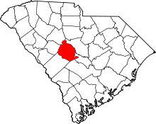 | |
| Towns | ||
| CDPs | ||
| Footnotes | ‡This populated place also has portions in an adjacent county or counties | |
Municipalities and communities of Saluda County, South Carolina, United States | ||
|---|---|---|
| Towns |  | |
| Ghost towns | ||
| Unincorporated community | ||
| Footnotes | ‡This populated place also has portions in an adjacent county or counties | |