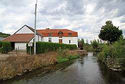
Bassenge
| Bassenge Bitsingen (Dutch) | ||
|---|---|---|
| Municipality | ||
 | ||
| ||
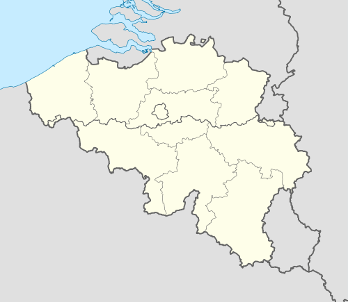 Bassenge Location in Belgium | ||
|
Location of Bassenge in Liège province  | ||
| Coordinates: 50°46′N 05°36′E / 50.767°N 5.600°ECoordinates: 50°46′N 05°36′E / 50.767°N 5.600°E | ||
| Country | Belgium | |
| Community | French Community | |
| Region | Wallonia | |
| Province | Liège | |
| Arrondissement | Liège | |
| Government | ||
| • Mayor | Josly Piette | |
| • Governing party/ies | CDH | |
| Area | ||
| • Total | 38.17 km2 (14.74 sq mi) | |
| Population (1 January 2016)[1] | ||
| • Total | 8,994 | |
| • Density | 240/km2 (610/sq mi) | |
| Postal codes | 4690 | |
| Area codes | 04 | |
| Website | www.bassenge.be | |

Bassenge is a Belgian municipality located in the Walloon province of Liège. On January 1, 2006, Bassenge had a total population of 8,335. The total area is 38.17 km² which gives a population density of 218 inhabitants per km².
The municipality is formed of Bassenge itself together with the villages of Boirs (Beurs), Eben-Emael, Glons (Glaaien), Roclenge-sur-Geer (Rukkelingen-aan-de-Jeker), and Wonck (Wonk).
Historic sites
Fort Eben-Emael was a major fortress intended to defend Belgium against attack from Germany. Built in the 1930s, it was swiftly captured by German forces in May 1940 during the Belgian Campaign of the Second World War.
Eben-Ezer Tower, also known as le musée du silex (the museum of flint) is a fantastical tower built of flint rubble in the 1960s by Robert Garcet and decorated with mystical and religious symbols.[2]
See also
References
- ↑ Population per municipality as of 1 January 2016 (XLS; 397 KB)
- ↑ "Tower of Eben-Ezer". Atlas Obscura. Retrieved 2015-06-28.
External links
-
 Media related to Bassenge at Wikimedia Commons
 |
Riemst (VLI) | | ||
| Tongeren (VLI) | |
Visé | ||
| ||||
| | ||||
| Juprelle, Oupeye |
Municipalities of the Province of Liège | ||
|---|---|---|
| Huy |  | |
| Liège | ||
| Verviers | ||
| Waremme | ||