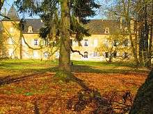
Basse-Rentgen
| Basse-Rentgen | ||
|---|---|---|
 | ||
| ||
 Basse-Rentgen | ||
|
Location within Grand Est region  Basse-Rentgen | ||
| Coordinates: 49°29′01″N 6°12′14″E / 49.4836°N 6.2039°ECoordinates: 49°29′01″N 6°12′14″E / 49.4836°N 6.2039°E | ||
| Country | France | |
| Region | Grand Est | |
| Department | Moselle | |
| Arrondissement | Thionville | |
| Canton | Yutz | |
| Intercommunality | Cattenom et environs | |
| Government | ||
| • Mayor (2008–2014) | Viviane Winterrath | |
| Area1 | 10.46 km2 (4.04 sq mi) | |
| Population (2009)2 | 360 | |
| • Density | 34/km2 (89/sq mi) | |
| Time zone | CET (UTC+1) | |
| • Summer (DST) | CEST (UTC+2) | |
| INSEE/Postal code | 57574 / 57570 | |
| Elevation |
209–267 m (686–876 ft) (avg. 200 m or 660 ft) | |
|
1 French Land Register data, which excludes lakes, ponds, glaciers > 1 km² (0.386 sq mi or 247 acres) and river estuaries. 2 Population without double counting: residents of multiple communes (e.g., students and military personnel) only counted once. | ||
.svg.png)
Basse-Rentgen is a commune in the Moselle department in Grand Est in northeastern France.
Population
| Historical population | ||
|---|---|---|
| Year | Pop. | ±% |
| 1793 | 456 | — |
| 1800 | 128 | −71.9% |
| 1806 | 139 | +8.6% |
| 1821 | 672 | +383.5% |
| 1836 | 487 | −27.5% |
| 1841 | 565 | +16.0% |
| 1861 | 534 | −5.5% |
| 1866 | 506 | −5.2% |
| 1872 | 450 | −11.1% |
| 1876 | 430 | −4.4% |
| 1881 | 424 | −1.4% |
| 1886 | 475 | +12.0% |
| 1891 | 475 | +0.0% |
| 1896 | 464 | −2.3% |
| 1901 | 388 | −16.4% |
| 1906 | 372 | −4.1% |
| 1911 | 393 | +5.6% |
| 1921 | 371 | −5.6% |
| 1931 | 355 | −4.3% |
| 1936 | 337 | −5.1% |
| 1946 | 304 | −9.8% |
| 1954 | 281 | −7.6% |
| 1962 | 285 | +1.4% |
| 1968 | 254 | −10.9% |
| 1975 | 230 | −9.4% |
| 1982 | 213 | −7.4% |
| 1990 | 289 | +35.7% |
| 1999 | 306 | +5.9% |
| 2006 | 329 | +7.5% |
| 2009 | 360 | +9.4% |
See also
References
This article is issued from Wikipedia - version of the 11/17/2016. The text is available under the Creative Commons Attribution/Share Alike but additional terms may apply for the media files.