Barriere, British Columbia
| Barriere | |
|---|---|
| District municipality | |
| District of Barriere[1] | |
 | |
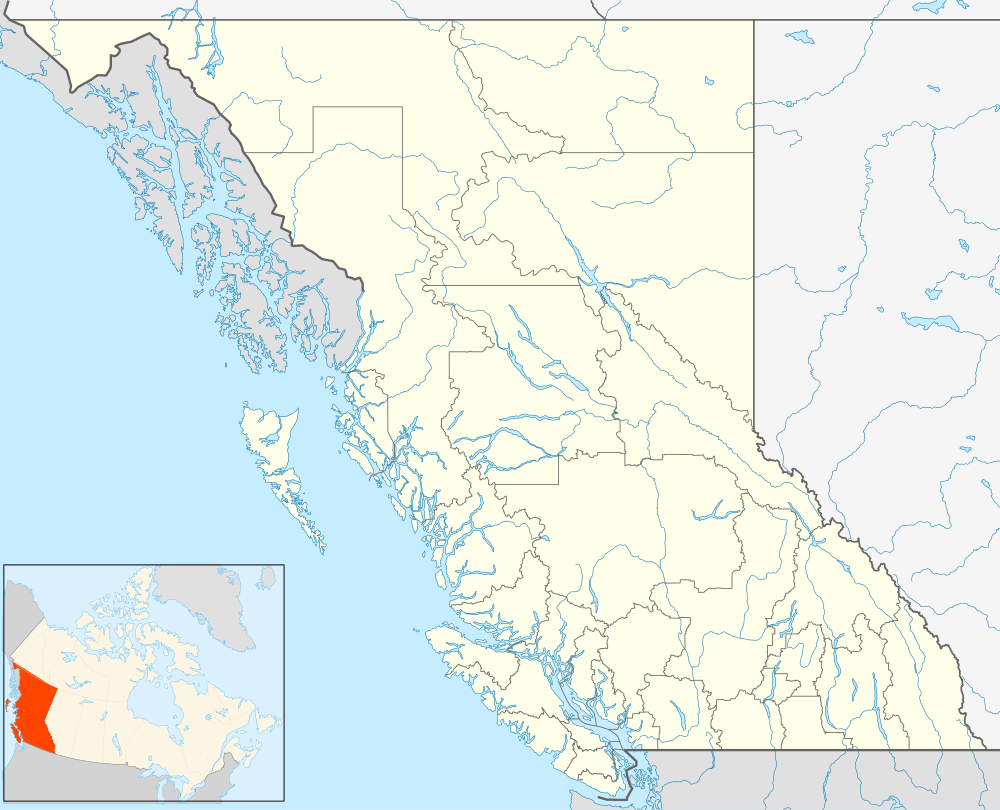 Barriere Location of Barriere in British Columbia | |
| Coordinates: 51°10′59″N 120°7′21″W / 51.18306°N 120.12250°W | |
| Country |
|
| Province |
|
| District | Thompson-Nicola District |
| Incorporated | December 2007 |
| Government | |
| • MP | Cathy McLeod (Conservative) |
| • MLA | Terry Lake (Liberal) |
| Area | |
| • Land | 10.77 km2 (4.16 sq mi) |
| Population (2011)[2] | |
| • Total | 1,773 |
| • Density | 164.7/km2 (427/sq mi) |
| Time zone | PST (UTC−8) |
| • Summer (DST) | PDT (UTC−7) |
| Area code(s) | 250 / 778 / 236 |
| Highways |
|
| Website | www.districtofbarriere.com |
Barriere is a district municipality in central British Columbia, Canada, located 66 kilometres (41 mi) north of the larger city of Kamloops on Highway 5. It is situated at the confluence of the Barrière River and North Thompson Rivers in the Central North Thompson Valley.
History
The community derives its name Barriere (originally and alternately, Barrière) from the rocks/nets placed in the water by first nations people to act as fish traps, forming a barrier to boat passage on the river. The descendants of those placing the fish-trap barriers are from the Simpcw/Secwepemc Nation,[3] who still reside in present-day Chu Chua, just north of Barriere.
Gold was discovered in the area as early as 1861, and was mined using the placer method. The August 12, 1861 edition of the British Colonist mentions "...one party of Frenchmen at a place above Kamloops called Barrier (sic). They are fluming the Thompson, and expect to take out $25 per day to the hand, it is also incorpurated (sic)."[4]
Depending upon where one resided, $25 could purchase an acre of land,[5] a saddle, or double-barreled shotgun.[6] To give some sense of proportion to these figures: Comparing $25 of daily productivity per hired hand to the price of a barrel of crude oil in 1861 ($0.49[7]), the gold production would yield roughly more than 1,200 barrels (190 m3) of oil per hand per day.
2003 fire

In 2003, a major forest fire swept through the area surrounding Barriere and destroyed both homes and industry, most notably the Louis Creek sawmill, a large local employer. The fire burned the mountain above Barriere called Armor Mountain, in the Louis Creek zone. It also burned across the North Thompson river from Barriere, to Bonaparte Lake. At one point up to 3,000 were forced to evacuate the area. On July 26, 2008 a wildfire dragon monument was erected in Louis Creek to commemorate the determination and compassion of those who fought the flames and those who aided in the rebuilding of the community.[8][9]
Climate
Barriere has a humid continental climate (Köppen climate classification Dfb) with cold winters and warm summers. Winters are cold and snowy with a January average of −6.5 °C (20 °F) and an average annual snowfall of 121 centimetres (48 in).[10] Summers are warm and dry with a July high of 27.9 °C (82.2 °F) although temperatures above 30 °C (86 °F) occur 27 days in a year.[10] The climate is dry, with an average annual precipitation is 486 millimetres (19 in).[10]
| Climate data for Barriere | |||||||||||||
|---|---|---|---|---|---|---|---|---|---|---|---|---|---|
| Month | Jan | Feb | Mar | Apr | May | Jun | Jul | Aug | Sep | Oct | Nov | Dec | Year |
| Record high °C (°F) | 14.0 (57.2) |
15.5 (59.9) |
24.0 (75.2) |
32.2 (90) |
38.0 (100.4) |
39.4 (102.9) |
41.1 (106) |
38.9 (102) |
34.5 (94.1) |
27.5 (81.5) |
21.7 (71.1) |
12.2 (54) |
41.1 (106) |
| Average high °C (°F) | −1.7 (28.9) |
2.4 (36.3) |
10.5 (50.9) |
15.9 (60.6) |
21.0 (69.8) |
24.6 (76.3) |
27.8 (82) |
27.0 (80.6) |
21.7 (71.1) |
12.2 (54) |
3.2 (37.8) |
−2.0 (28.4) |
13.6 (56.5) |
| Daily mean °C (°F) | −5.2 (22.6) |
−2.4 (27.7) |
3.6 (38.5) |
8.2 (46.8) |
13.0 (55.4) |
16.7 (62.1) |
19.2 (66.6) |
18.4 (65.1) |
13.3 (55.9) |
6.4 (43.5) |
−0.2 (31.6) |
−5.1 (22.8) |
7.2 (45) |
| Average low °C (°F) | −8.7 (16.3) |
−7.1 (19.2) |
−3.4 (25.9) |
0.5 (32.9) |
4.9 (40.8) |
8.8 (47.8) |
10.4 (50.7) |
9.7 (49.5) |
4.9 (40.8) |
0.6 (33.1) |
−3.5 (25.7) |
−8.1 (17.4) |
0.8 (33.4) |
| Record low °C (°F) | −42.8 (−45) |
−34.4 (−29.9) |
−29.4 (−20.9) |
−11.7 (10.9) |
−4.4 (24.1) |
−1.1 (30) |
0.6 (33.1) |
−2.2 (28) |
−7.0 (19.4) |
−20.0 (−4) |
−33.0 (−27.4) |
−39.4 (−38.9) |
−42.8 (−45) |
| Average precipitation mm (inches) | 41.0 (1.614) |
26.7 (1.051) |
26.4 (1.039) |
32.3 (1.272) |
44.8 (1.764) |
56.8 (2.236) |
50.9 (2.004) |
50.7 (1.996) |
35.8 (1.409) |
39.3 (1.547) |
53.8 (2.118) |
48.4 (1.906) |
506.9 (19.957) |
| Average rainfall mm (inches) | 13.2 (0.52) |
12.7 (0.5) |
22.0 (0.866) |
31.6 (1.244) |
44.7 (1.76) |
56.8 (2.236) |
50.9 (2.004) |
50.7 (1.996) |
35.8 (1.409) |
37.8 (1.488) |
33.4 (1.315) |
11.9 (0.469) |
401.4 (15.803) |
| Average snowfall cm (inches) | 27.8 (10.94) |
14.1 (5.55) |
4.4 (1.73) |
0.7 (0.28) |
0.1 (0.04) |
0.0 (0) |
0.0 (0) |
0.0 (0) |
0.0 (0) |
1.4 (0.55) |
20.4 (8.03) |
36.5 (14.37) |
105.5 (41.54) |
| Average precipitation days (≥ 0.2 mm) | 13.5 | 10.7 | 10.9 | 12.1 | 13.7 | 13.4 | 12.0 | 11.7 | 9.0 | 12.6 | 16.4 | 13.6 | 149.4 |
| Average rainy days (≥ 0.2 mm) | 5.8 | 5.9 | 9.4 | 11.9 | 13.7 | 13.4 | 12.0 | 11.7 | 9.0 | 12.4 | 10.7 | 4.1 | 120.0 |
| Average snowy days (≥ 0.2 cm) | 9.8 | 5.6 | 2.0 | 0.6 | 0.1 | 0.0 | 0.0 | 0.0 | 0.0 | 0.8 | 7.5 | 10.8 | 37.2 |
| Source: [11] | |||||||||||||
Infrastructure
The community voted to become an incorporated municipality in November 2007. Winning the election for the first mayor was Mr. Mike Fennell, a member of one of the founding families of the community.
The closest hospital in the region is the Royal Inland Hospital located to the south in Kamloops and to the north in Clearwater, British Columbia. One of the main reasons for the growing community's existence is its location on the Yellowhead Highway #5, which offers the only viable route in the interior to northern British Columbia, Jasper, and Edmonton. A Canadian National Railway line passes through the town as well.
Industry
Barriere is primarily driven by the forest industry, however the other industries which serve the town are tourism and agriculture, primarily alfalfa. Mining development is on the increase in the North Thompson Valley, and is predicted that many forestry workers will migrate from forest to mining as these new developments begin production. There are two industrial parks in the community. One is located in nearby Louis Creek and was the former site of Tolko Mill was destroyed in the 2003 fire. Barriere is just south of the newly discovered Harper Creek Copper deposit, considered to be the 8th largest in the world.
The primary employers in the town are Gilbert Smith Forest Products, with 75% of the town's residents being linked to forestry.[12] Many residents who live in Barriere commute to work in Kamloops, 45 minutes to the south. Currently there is a community effort to promote the development of a TV, film & new media technology industry in the area.
Barriere is the same latitude as the world famous Stonehenge. In October 2009 it was proposed by Coun. Virginia Smith, that the community erect a scaled-down replica of the 100-metre-wide (330 ft) Druidic temple.
Recreation

- North of the town centre is Chinook Cove Golf Course.
- Several lake resorts are a short driving distance from the community. East of the city is East Barriere Lake, South Barriere Lake as well as North Barriere Lake.
- The ski resort of Sun Peaks is approx a 1 hour drive from Barriere.
- There is a curling rink, library, post office and Royal Canadian Mounted Police station in the community.
- There are several community parks including ball fields.
- Community halls include the Fall Fair Hall and Lions Club Hall. Other larger facilities include the curling rink and seniors centre. At the Lions Club hall there is a program called 'Cadets'.
- A local community theatre group: Thompson Valley Players Society
- The North Thompson Museum
- Every Labour Day weekend the town hosts the North Thompson Fall Fair Rodeo. It is the community's biggest yearly event produced by hundreds of volunteers. About 10,000 people attend annually, over the three-day fair.
- Barriere & the North Thompson Fall Fair have the 3rd oldest Royalty Pageant program in British Columbia.
- Barriere Fall Fair and Rodeo features a large parade.
Schools
There are two schools in Barriere.
1. Barriere Elementary School
2. Barriere Secondary School
There used to be a primary school called Barriere Ridge Elementary, but it was shut down because of a lack of students. It is now a daycare and the City Hall. In 1967, the Secondary school was burnt down just before final exams and a new one was built. The graduating class of 1968 had to be bused to Kamloops Senior Secondary School while the new school was built.
Religion
There are six houses of worship within the town.[13]
- The Church of St Paul - a worshipping community of Anglicans, Uniteds and Lutherans
- Bethany Baptist Church - affiliated with the Fellowship of Evangelical Baptist Churches'. Located on the corner of Barriere Town Road, and Dixon Cr. Road, Barriere, BC.
- Christian Life Assembly - Member of Pentecostal Assemblies of Canada
- St. George's Roman Catholic Church
- Kingdom Hall of Jehovah's Witnesses
- Barriere Open Door Fellowship
Additionally, the First Nations community of Chu Chua is located 10 minutes north of Barriere on Dunn Lake Road.
Notable residents
- Plein Air painter Wayne Broomfield calls Barriere home for much of the year.
References
- ↑ "British Columbia Regional Districts, Municipalities, Corporate Name, Date of Incorporation and Postal Address" (XLS). British Columbia Ministry of Communities, Sport and Cultural Development. Archived from the original on July 13, 2014. Retrieved November 2, 2014.
- ↑ "Canada Census 2011 (Community profiles)". Retrieved 2013-05-10.
- ↑ "Simpcw First Nation | Barriere British Columbia". Barrierebc.info. 2010-10-23. Archived from the original on 2011-09-10. Retrieved 2011-09-17.
- ↑ "History of Barriere". Britishcolumbia.com. Archived from the original on 2011-09-27. Retrieved 2011-09-17.
- ↑ The history of Linn county, Iowa ... - Google Books. 2008-01-24. Retrieved 2011-09-17 – via Google Books.
- ↑ Confederate cavalryman, 1861-65 - Google Books. 2002-06-25. Retrieved 2011-09-17 – via Google Books.
- ↑ File:Oil Prices 1861 2007.svg
- ↑ "The Mclure-Barriere Fire August 2003" (PDF). Retrieved 2013-05-10.
- ↑ "Thompson-Nicola Regional District (McLure Wildfire 2003) map". Retrieved 27 June 2015.
- 1 2 3 Environment Canada—Canadian Climate Normals 1971–2000, accessed 23 August 2012
- ↑ "Calculation Information for 1981 to 2010 Canadian Normals Data". Environment Canada. Archived from the original on June 14, 2013. Retrieved July 9, 2013.
- ↑ "Barriere". NTValley. Retrieved 2011-09-17.
- ↑ "Barriere Churches". Barrierebc.com. Retrieved 2011-09-17.
External links
- Municipality website
- Local Weekly Newspaper The Star/Journal
- Christian Life Assembly website
- North Thompson Volunteer & Information Centre list of organizations in Barriere, BC
Coordinates: 51°10′49″N 120°07′34″W / 51.18028°N 120.12611°W
| Subdivisions |  | |
|---|---|---|
| Communities | ||
| Metro areas and agglomerations | ||
| District municipalities |
| |
| ||